Guilin FeiYu Electronic Technology Co., Ltd
Guilin FeiYu Electronic Technology Co., Ltd http://www.feiyudz.cn E-mail:[email protected] Page
8
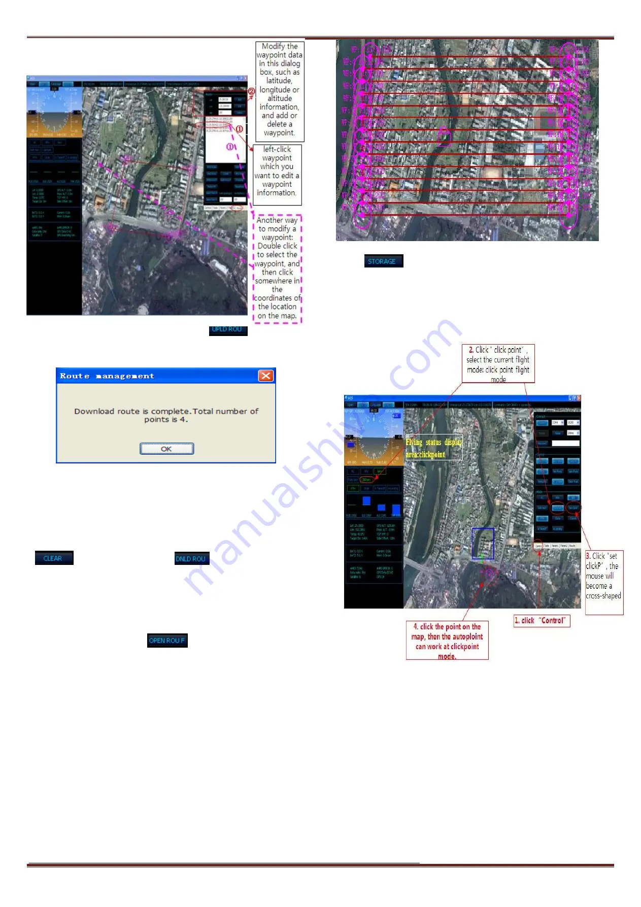
Fig11 Air Route Setting Interface
After you plan the route completely, please click “
” to upload the
route to the autopilot. After upload the route successfully, will pop up the
following Fig12 dialog box.
Fig12 The Dialog Box
Note:
Please don’t click any other buttons when the air route is in the
uploading or downloading status. The entire navigations point information
must be successfully loaded before you click anywhere else or the air route
transmission will be interrupted.
After uploading, you can clear the current waypoints via click the
“
” button. And then click “
”, download waypoints in
panda, check the waypoints are correct.
c)
Aerial photography route planning
First set the route direction horizontal or Longitudinal, Line Spacing,
Distance Buffer, altitude. Click “
”, modify the latitude and
longitude in edit box which pop-up, on the map will show the return point
icon. Click the button “Select Region”, then drag right mouse button to
select the area for aerial photography, as the following:
Fig13 Aerial photography route interface
Click “
”, save the route which is set into panda, otherwise
waypoints will be lost after power outage.
d)
Operation for the click point flig ht
Operation for the click point flight refer to as following Fig14:
Fig14 the click point flight interface
Note: We reserve the right to change this manual at any time! And the
newest edition will be shown on our website.
---END--


