


Ignis Operations Manual (DJI M600 Variant)
Drone Amplified
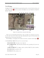
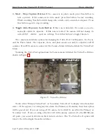
Touching the GPS satellite icon at the top of the screen will open the Map Recentering
Menu, shown in Figure 70. If you do not have any map overlays loaded, touching the GPS
satellite icon will directly open the Map Recentering Menu. Touch either “Drone”, “Home”
or “User” to recenter and rezoom the map on that. Touch the map or the menu button again
to close this menu.
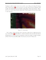
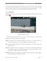
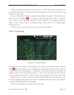
Figure 71: Overlays List
The “Overlays” button will open a list of all of the overlays that are displayable by the
app, shown in Figure 71. This includes a colorized elevation overlay and any georeferenced
pdf, kmz/kml, or csv files that have been imported. Touch the checkbox to toggle the display
of that overlay. Press the GPS satellite icon at the top to get out of this screen.
Last Updated March 12, 2020
Page 90


