background image


http://www.CompeGPS.com         http://Support.CompeGPS.com       22


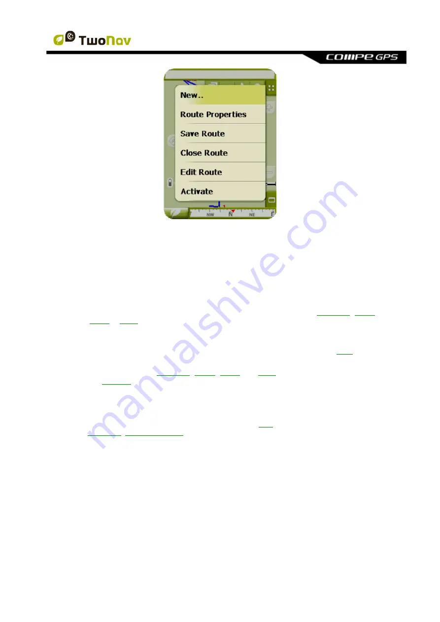
To open the Contextual Menu of any element (track, map, waypoint…), 

press on it for one 

second

. You may open contextual menus on the following settings of the user interface: 


Navigation window (map)

: Depending on the element on which you open the 

Contextual, you may enter different functions. There is a description of the available 
functions on the menu of each element on the specific sections for 

waypoints

routes

tracks

 or 

maps


Data fields

: When opening the Contextual on the data fields (on the data bar or the 

data pages) you will be able to modify the available fields, set an alarm or enter other 
functions that may change depending on the field (reset, countdown, etc.). (

+info


Lists

: The Contextual Menu may be opened to see the different actions to carry out on 

any given element (

waypoints

routes

tracks

 and 

maps

) by clicking on its name from 

the 

data lists

.  


3.5 

Shifting over lists  

TwoNav uses a system of lists on the various situations: 

data

 (tracks, waypoints, routes and 

maps), 

data fields

contextual menus

, etc. 

scroll

 system has been developed in order to facilitate the shifting through these lists, which 

allows for the movement around the different options by dragging the pen or finger upwards or 
downwards. 

If you execute a brief shift, the last displayed element will become the first on the list. 

If you execute a long shift, the list will keep scrolling down and it will stop at the end or by 
pressing on the screen. 


Summary of Contents for TwoNav Ultra 2.6

Page 1: ...device 9 3 2 Navigation window 10 3 2 1 Tool bar 13 3 2 2 Data bar 14 3 2 3 InfoCurrent and InfoNext 14 3 3 Menu 16 3 3 1 On road Off road 17 3 3 2 Navigate 17 3 3 3 Data Lists 17 3 3 3 1 Name filter 19 3 3 4 Discover 19 3 3 5 Status 20 3 3 6 Settings 21 3 4 Contextual menus 21 3 5 Shifting over lists 22 3 6 Using MicroSD slot 23 3 7 Activate sensors 23 4 Settings 24 4 1 On road Off road Selector ...

Page 2: ...cale bar 40 4 6 19 Pointer 41 4 6 20 Smoother 41 4 6 21 List menu 42 4 7 Vehicle 42 4 7 1 Vehicle configuration 43 4 7 2 Special stuff on Boat vehicle 43 4 8 Navigation 44 4 8 1 Available commands Onroad Offroad and Default Advanced 44 4 8 1 1 On Road 44 4 8 1 2 Off Road 44 4 8 2 Auto route 44 4 8 3 Speed limit 45 4 8 4 Ecocalculator 46 4 8 5 Tracklog 46 4 8 6 Next WPT 47 4 8 7 Tracks 47 4 8 8 Alt...

Page 3: ...nt waypoints routes tracks and maps 66 8 1 Waypoints 66 8 1 1 What is a waypoint 66 8 1 2 Supported formats 66 8 1 3 Waypoints list 67 8 1 4 Open and close 69 8 1 4 1 Open waypoints file 69 8 1 4 2 Close waypoints file 69 8 1 5 Create and edit 69 8 1 5 1 Create waypoints Active Waypoints File 69 8 1 5 1 1 Create a waypoint in the present position 70 8 1 5 1 2 Create a waypoint on the map 71 8 1 5 ...

Page 4: ... order of the waypoints in the route 84 8 2 5 2 5 Invert the route 84 8 2 5 2 6 Convert a route into a track 85 8 2 5 3 Save 85 8 2 5 3 1 Save route 85 8 2 5 3 2 Save route as 85 8 2 6 Search loaded route on screen 85 8 2 7 Properties 85 8 2 7 1 Properties of a route 85 8 2 7 2 Properties of a waypoint 86 8 2 8 Associated files images sounds texts 86 8 2 9 Route Graph 86 8 2 10 Activate a route na...

Page 5: ...Types of maps 103 8 4 2 1 Marine charts 104 8 4 3 Maps lists 104 8 4 4 Open and close 105 8 4 4 1 Automaps 105 8 4 4 2 Open map 105 8 4 4 3 Close map 105 8 4 5 Search a loaded map on screen 105 8 4 6 Properties 106 8 4 7 Multi Maps 106 8 4 8 Contextual menu of the map 106 9 Other functions 107 9 1 Simulation 107 9 2 Zoom to 108 9 3 Anchor here 109 9 4 Bluetooth 109 10 Geocaching 109 10 1 Compatibl...

Page 6: ...he bases of them should also be taken into account for journeys on foot Fitting the appliance correctly The appliance should be fitted in a place where it will not obstruct the vehicle driver s visibility of the road It should additionally be secured to ensure it cannot fall off easily and hinder driving Do not handle the appliance whilst driving The route planning should be completed before setti...

Page 7: ...answer the message within 30 minutes the system will turn off in order to avoid accidental discharges you may deactivate this function form Configuration System Autonomy Warning Avoid vibrations or rude movements on device while USB port is connected It may deform USB port being reparation out of warranty Do not re charge battery while driving a motorbike or any other vehicle which is causing vibr...

Page 8: ...Land PC software to manage them CompeGPS Land allows easily creating editing and transferring files to TwoNav becoming a necessary reference to have an advanced control over your outdoor trips info 2 5 Using the electronic compass TwoNav Ultra is fitted with a digital compass so you have accurate information available on the directions to follow even if you are stopped To be able to use the inform...

Page 9: ...our device and get to know the steps to follow for installing it 3 General description 3 1 The device 1 POWER button Short press Start Pause enter if inside menu Long press Power on Shutdown menu 2 PAGE button Short press Switch Map Datafields Menu pages back if inside menu Long press Tools for the present window 3 4 UP DOWN buttons In map Zoom In Datapages Switch datapages In menu Move selection ...

Page 10: ...l only be available if V map is available 1 Distance to next event Distance left to next event roundabout waypoint exit 2 Next manoeuvre When navigating On road the next event space will display a representation of the next manoeuvre to be done right turn left turn roundabout diversion etc 3 Tool Bar Its content can be customized from Tool bar manager 4 Show Hide tools 5 Mute ...

Page 11: ...stination 15 Menu button Goes to TwoNav Main menu 16 Status icons enters status window To indicate the present battery and GPS coverage level The page Status is entered by pressing on them 17 Speed limit of present road Indicates the legal speed limit of the road on which we are 18 Re centring after sliding the map Press the re centre button to focus on your present position after sliding over the...

Page 12: ...point has an associated file it can be reproduced clicking on its name info 29 Currently Recorded Track If the present track is being recorded we can see its trace marks behind us 30 Guide line waypoint direction track Joins your present position to the place you are heading for track or next waypoint 31 Next waypoint 32 Loaded Track 33 GOTO arrow Direction on which the next waypoint is When follo...

Page 13: ... get a broader view of the map When navigating a route or a track or just recording a track graph will also be available here and this button will have 3 states Data bar Graph bar Won t be displayed for boat mode Nothing 3 2 1 Tool bar Tool bar allows a quick access to some functions Available functions can be configured from menu settings display tool bar Tool bar manager allows to add functions ...

Page 14: ... when navigating a route or track it has an extra state which shows altitude profile Click on the button at the right side to switch between data bar and graph bar or to hide it Data bar can be configured from menu settings display Data bar Data field manager also allows to customize data pages which are accessed with the page button You can also change a concrete data field directly opening the c...

Page 15: ...ult Next street Signpost Some roads have information about signposts If this information is available for next manoeuvre e g highway exit InfoNext will show a reproduction of the real signpost you will see in the road InfoNext can be displayed in 3 states depending on the size of the text to show 1 One line If text is too big to fit in one line a little triangle at right will inform about availabi...

Page 16: ... Settings System Advanced with the user redirecting the function to any of the three proposed commands of TwoNav Main menu by default Data page Tool bar 3 3 Menu Most of the options of the program may be entered from the TwoNav Main menu The On road Off road mode selectors can be found in it as well as the access to the different sections of functions and a direct access to the map ...

Page 17: ...tures three basic ways of activating navigation towards a destination By means of the Navigate button By means of the waypoints routes and tracks lists By means of selection on map Check the section Select destination for further information 3 3 3 Data Lists By pressing on the data button on the main menu you will be able to manage the available files on your device This operation is carried out t...

Page 18: ...ill be displayed Press again on the name of the element to hide its contents Actions on the elements You can carry out diverse actions on each element When selecting an element click briefly on it the bottom buttons of the list will show the most important functions for this element see properties zoom on the element add waypoints etc Next you have a list of the elements you can find o Properties ...

Page 19: ...ed in the Data section check the section Waypoints Routes Tracks and Maps 3 3 3 1 Name filter Elements of a list can be filtered to only show files which contain a combination of characters Press button to enter a character combination to filter If a waypoints file is opened when filter is applied its content will also be filtered This means that waypoints which don t contain that character combin...

Page 20: ...ivated Data pages info 3 3 5 Status The Status allows you to know the general status of the TwoNav by displaying fields such as battery level reception and position of satellites luminosity of the screen sound volume or the recording of a track There are two ways of entering the Status page From Main Menu Status From the map with the icons located on the bottom left Once in the Status page you may...

Page 21: ...info Brightness percentage of luminosity displayed by the screen info Audio set the general audio and the volume of each audible element individually info Triplog by keeping the record button pressed the present track will be saved Data fields and recorded tracks are synchronized so if you press pause you pause both counters chronometer distance mean speed and track recording until record is press...

Page 22: ...r enter other functions that may change depending on the field reset countdown etc info Lists The Contextual Menu may be opened to see the different actions to carry out on any given element waypoints routes tracks and maps by clicking on its name from the data lists 3 5 Shifting over lists TwoNav uses a system of lists on the various situations data tracks waypoints routes and maps data fields co...

Page 23: ...der and save your maps in it they will not be shown in TwoNav s maps list You can modify TwoNav s folders configuration to search for maps in other folders Just go to Settings System Folders and add a new maps folder or modify an existing one For example you can choose MicroSD card root so any map in SD card will be read no matter in which folder it is 3 7 Activate sensors After mounting sensor fo...

Page 24: ...ities of the program also change in various aspects which are generally explained in this section and are detailed in other sections of this manual You may change the TwoNav navigation mode by pressing on the tabs on the top of the Main menu Off road The areas where open air activities are carried out do not usually have usable information for the automatic calculation of the route and therefore c...

Page 25: ... pages is different to better fit the needs of each use A change in one mode will not affect the other so you can configure a specific set of data fields for On Road and another one for Off Road Tool bar You can also configure a specific set of tools for each mode Menu Availability and order of some functions will change Check Navigation options sections 4 2 2D 3D 3D TwoNav offers three visualizin...

Page 26: ...ng to enter 3D an available CDEM in the area will be sought and it will open automatically In On road mode you will have to load the CDEM manually 3 Vectorial maps won t be displayed in 3D mode 4 3 Data fields TwoNav contains a multitude of data on your navigation that may be of great interest in your outings speed height distances This data is basically found in two spaces 1 Data bar The data bar...

Page 27: ...ber of fields in a more clear way Press the button to enter them TwoNav contains three pages of data that are displayed in order 1 Data page 8 data fields 2 Compass page a special field with an illustration of the compass and 6 data fields 3 Graph page It contains a special field with an altitude profile If you are navigating a route or a track it will be shown with current position ...

Page 28: ...t for On Road or Off Road Changes made in one mode will not affect the other 4 3 1 Selection of the data fields You can select data fields in two ways Change just one field By opening the contextual menu in any field long click and selecting Change this field This will let you choose directly the data to display in that field Data field manager From Main Menu Settings Display Data fields Check the...

Page 29: ... total odometer 1 and 2 6 Countdown You may define the value from which units of distance and time will keep being subtracted according to field until reaching 0 7 Compass calibration Direct access to the digital compass calibration 8 Barometer calibration Direct access to the digital barometer calibration 4 4 Record the track You may choose if you want to keep saving your present trip in a track ...

Page 30: ...ints to which navigate Your home a restaurant you like a spectacular park you have visited your children s school may become part of your favourites list You may enter to set up your Favourites from the main menu The Favourites list is not set by default so you have to set it up yourself introducing the elements to make up this list Therefore the first time you enter Favourites you will find the f...

Page 31: ...order to establish the favourite point using your coordinates Your Favourites will be displayed on the map and in the favourites list with the icon The point established as Home will be represented by the icon Once a Favourite point is created you will be able to Edit the characteristics of your Favourite by means of the tool Add or delete Favourites from your list by means of the tools Make this ...

Page 32: ...road mode and Automaps is not on it will mean that the new On road route won t be properly calculated and the Off road mode will still be displayed on the screen in spite of having the most suitable map for each navigation mode Automap possibilities Auto open maps Opens the most suitable map for each situation Auto open on line maps Opens the most suitable on line map only visible in connected dev...

Page 33: ...nd the pointer will rotate to show your present course The map won t rotate and the North will always be upwards You may modify this option from the button bar on the navigation window or from the display menu 4 6 4 2D 3D If you want to change between 2D to 3D or vice versa you only have to alternate both modes at Menu Settings Display information about 3D mode ...

Page 34: ...ghtness of the TwoNav screen may dazzle you TwoNav contains a night mode that reduces the brightness of the screen and displays a user interface of darker tones By activating the At night and tunnels option TwoNav changes to night mode automatically at night or when inside a tunnel The option At night makes it automatic but only for night and not for tunnels If automatic is off you will be able to...

Page 35: ...es to adapt it to your preferences 4 6 9 Themes You can select different color combinations according to your preferences 4 6 10 Labels Next parameters can be configured Font size for all labels Labels of elements like waypoints or POI will have this size Font color for new WPTs Default waypoint property for next waypoints that will be created Waypoints which were created previously will keep thei...

Page 36: ...s Once inside the editor take the following steps 1 Press on the Type pull down menu to choose the section to be set 2 Select the space you wish to edit bar page compass o graph 3 You may delete data by pressing on the left check mark and add other data by pressing on them See a list of these variables and their meaning in Appendix 1 4 On the compass and graph pages a squared icon on the side show...

Page 37: ...move pages to de default ones using the or symbols at top right of the data field manager window Just press to remove currently selected data page Follow next steps to add a new page 1 Press 2 Enter a name for new page 3 Select a template for new data page 4 Choose data fields for it You can find a list of the available fields in appendix 1 4 6 13 Tool bar Tool bar can be customized to show the be...

Page 38: ...on with default name and icon in one click Mark and edit WPT Creates a waypoint in current GPS position and access to properties so you can customize it New waypoint Create a waypoint choosing where to place it and customizing it properties Mute Window zoom draw an area on map to zoom to it Full screen Most of user interface elements will be hidden to get a wider view of the map Zoom 100 zoom will...

Page 39: ... tracks waypoints etc to habilitate the visualizing mode 3D 3D real Besides remaining subjacent and supply the ground altitude data the 3D relieves may be seen with the following options Draw landscapes on the 2D view It will be seen if a CDEM is loaded although it will take position in the lowest layer so any other loaded map will be displayed on top Relief colour selector the user is able to sel...

Page 40: ... the sky and the map that distinguishes them more clearly Sea level When the height is under the sea level 3D mode can also represent the situation by fixing the current value of the sea level CDEM elevation map required By default the level of the sea is set at 0 meters 4 6 16 Active POIs By means of the active POIs list you will be able to choose the POIs categories that the map is to show All t...

Page 41: ...els o Real distance meters o Expected distance in time minutes TwoNav will calculate the estimated distance to be covered in that time at current speed o Infinite Note These properties depend on the selected vehicle Variable ring you may add more rings around your position You have to define the radium of the inner ring and the number of successive rings which will be equidistant from the first in...

Page 42: ...d on V map 4 6 21 List menu You may choose between two display modes of the submenus Button menu This is the traditional mode If there are more options than the screen can display the next button will appear in order to enter it List Menu The options will be displayed on a continuous list To move the list UP and DOWN keep the finger or the stylus on the list and drag 4 7 Vehicle Choose your transp...

Page 43: ...sed This value will determine the depth alarms 4 7 2 Special stuff on Boat vehicle Since marine navigation has special needs comparing to terrestrial navigation when Boat vehicle is selected some special changes in addition to normal changes related to vehicle will take place Specific Data fields in Data bar and Data pages Specific main menu specially changing Navigate section Specific tool bar Ma...

Page 44: ... road navigation mode can be adjusted so the automatic calculation of your routes is done according to your preferences Fast Short The first option will calculate the estimated time of arrival bearing in mind the speed of each road and will suggest the navigation which takes shorter The second option will suggest a navigation based on distance choosing the shortest way although it may not be the f...

Page 45: ...nd it is recalculated adapting it to the present position 4 8 3 Speed limit This section gives you options related to the speed alerts and traffic radars and can be set according to your preferences Set a speed limit the speed limit of each particular road will be considered by default but you can set a fixed speed limit disregards the limit of each road Speed alert If you wish TwoNav to let you k...

Page 46: ...ing TwoNav may automatically record the track of your departure and save it in the TwoNavData folder Set up according to your needs or preferences Recording interval Choose the type of recording and interval you wish for the track to be generated for your navigation o By time The point of each track will be recorder every X seconds o By distance The point of each track will be recorder every X met...

Page 47: ...r 10 of the radius of any WPT Same as the previous but if any waypoint is very near 10 of its radius it will be validated and the next one will be activated Only buttons bar Never will automatically change to next waypoint only manually with NextWPT and PreviousWPT buttons at buttons bar Also from this options section a default radius can be assigned for route waypoints which will be taken when th...

Page 48: ...he other tracks The active one has a different on screen display which can be personalized by the user Usually the active track has a notable thickness and it is related to a different colour to make it different from the rest This parameters can be configured at settings navigation tracks there you will be able to change the navigating track colour as well as double line s thickness opacity and c...

Page 49: ...brate the barometric altimeter using the GPS position along time see following point If after some time you select Barometric altimeter the introduced calibration will be saved with the automatic option but it won t be updated with the new GPS measurements Automatic recommended the barometric altitude will be used but the barometer will be automatically calibrated using the altitude data from the ...

Page 50: ...ate is calculated using Tanaka s formula 4 9 System 4 9 1 Audio You can manage beep sound configurations selecting Status Audio At this section you can enable or disable each sound alarm Mute general activation or deactivation of beep sounds Voice Due the fact that TwoNav Ultra has no voice indicator voice alarm advices will be displayed as beeps More at Audible information Alarm specific navigati...

Reviews: