


AvMap - 15
Farmnavigator
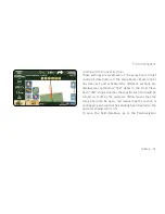
the fields’ database.
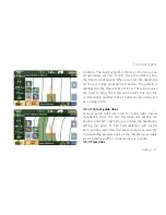
3.4 Positioning obstacles / soil samples
You can record the positions of soil samples or obstacles,
like trees or holes.
To save a position, go as near as you can to the relevant
object and click the obstacle button (with the orange
cone icon). The positions of obstacles and soil samples
are now saved in the fields’ database and are shown on
the map with an orange cone icon and a progressive
number.
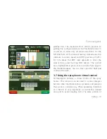
3.5 Setting the Guide lines
Once you have created the field, you can go on with your
work using the Assisted-Driving function (a.k.a parallel
guidance).
The recording of field perimeter and the reference line
can be done in one step.
Summary of Contents for G6 Farmnavigator
Page 1: ...Corresponding to Software Version 2 5 xx FARM NAVIGATION User Manual ...
Page 31: ......
Page 32: ...www farmnavigator com ...


