- 1 -
PORTABLE
NAVIGATION
DEVICE
HPS9308
Need More Help?
DO NOT RETURN THIS
PRODUCT TO THE STORE
Please visit online help at
http://www.venturer.com
User Manual
Страница 1: ... 1 PORTABLE NAVIGATION DEVICE HPS9308 Need More Help DO NOT RETURN THIS PRODUCT TO THE STORE Please visit online help at http www venturer com User Manual ...
Страница 2: ... we recommend that you operate this Navigator before beginning your journey The driver s attention should be on the road Plan your route before departure and pull over if you need to change route parameters This Navigator has a built in optional Safety Mode that will prevent you from using the screen functions if your car is in motion Unless a passenger will be the only one to operate this Navigat...
Страница 3: ...ocated on the lower right rear of the Navigator All screen buttons and controls are designed so that you can operate them with your fingertips or stylus When using this Navigator you do not need to double tap or tap and hold the touch screen as these functions cannot be used reliably in a moving vehicle A single tap triggers most of the screen controls The only exceptions are drag and drop for mov...
Страница 4: ...21 6 3 7 Selected Map Point Cursor 22 6 3 8 Marked Map Points Pin 23 6 3 9 Visible POIs Point of Interest 24 6 3 10 Elements of the Action Route 26 6 3 10 1 The Start Point Via Points and the Destination 26 6 3 10 2 AnimatedTurnGuidance 26 6 3 10 3 The Active Leg of the Route 26 6 3 10 4 InactiveLegsoftheRoute 27 6 3 10 5 Roads in the Route Excluded by your References 27 6 4 GPS Data Screen 28 6 4...
Страница 5: ...oute Tab 53 6 7 3 1 Recalculate 53 6 7 3 2 Delete 54 6 7 3 3 Itinerary 55 6 7 3 4 Fly Over 57 6 7 3 5 Edit 57 6 7 3 6 Info 58 6 7 4 MainButton 58 7 Settings 59 7 1 General Settings 59 7 1 1 Safety Mode 59 7 1 2 Set Favorite Destinations 60 7 1 3 Automatic Night Colors 60 7 1 4 Alerts 61 7 1 4 1 Warn When Speeding 61 7 1 5 Route Recalculation 62 7 1 5 1 Automatic 62 7 1 5 2 Ask First 63 7 1 5 3 Dis...
Страница 6: ...uteSensitivityand Recalculation Delay 76 7 6 4 2 U turn Penalty 77 7 6 4 3 Cross Border Planning 77 7 6 4 4 CarpoolLanes 77 7 6 4 5 Keep Position on Road Lock on Road 77 7 6 5 User Data Management 77 7 6 5 1 Backup Data 78 7 6 5 2 Restore Data 78 7 6 5 3 Remove Pins 78 7 6 5 4 Clear Data 78 7 6 5 5 Reset Advanced Settings 78 8 Find 79 8 1 Find GO Main Menu 79 8 2 Selection by Tapping the Map 79 8 ...
Страница 7: ...ach the device to your dashboard WARNING NOTICE TO DRIVERS IN CALIFORNIA AND MINNESOTA State law prohibits drivers in California and Minnesota from using suction mounts on their windshields while operating motor vehicles Venturer does not take any responsibility for any fines penalties or damages that may be incurred as a result of disregarding this notice See California Vehicle Code Section 26708...
Страница 8: ... 8 Mount the Bracket to the Windshield mounting bracket 1 2 suction release 3 4b 5To windshield 4a 6 ...
Страница 9: ...ven your vehicle The included car plug is for use with this Navigator only Do not use it with other equipment Make sure the Navigator is fastened securely to prevent it from falling or flying through the air in the event of an accident When the inside of the cigarette lighter socket is dirty with ashes or dust the plug section may become hot due to poor contact Be sure to clean the cigarette light...
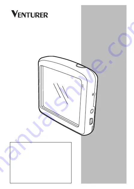
Страница 10: ...tions can be accessed using the touch screen The hardware buttons are as follows 1 2 3 4 5 6 7 8 9 1 Speaker 2 Map Card 3 Touch Screen Displays the local map Tap the screen with the stylus to select menu commands or enter information 4 Button Press and hold for 2 seconds to turn the Navigator on or off 5 Charger Indicator 6 Reset Button Press to reset the Navigator 7 Headphone Jack 8 Mini USB for ...
Страница 11: ...the track log will not be saved and navigation will stop 5 1 1 Turn On the Navigator Press the button and hold for 2 seconds to turn on the Navigator Select Navigation After reading press the Accept button 5 1 2 Zoom In and Out Press the button and hold for 2 seconds to turn on the Navigator Zoom will change the scale of the map in both 2D and 3D map modes This function is explained in detail 6 5 ...
Страница 12: ...e slider the left most position means the minimum value while the right most position represents the maximum value This control can be operated in two ways Either drag the handle to move the slider to its new position or tap the slider where you want the handle to appear handle jumps there immediately As with the list selectors there is no need to confirm your selection As soon as you leave the sc...
Страница 13: ...n it is inevitable In these cases a full screen keyboard pops up that can be easily operated with your fingertips You can choose between a separate ABC and numeric keypad or a QWERTY type keyboard that contain both letters and numbers This Navigator will remember your last choice and offer it the next time you need to enter data The alphabetic keyboards in this Navigator do not contain special cha...
Страница 14: ...s of the standard QWERTY keyboard To switch to the QWERTY type keyboard press the Keys button until the appropriate keyboard appears The special keys described in the previous section are also available here 5 2 5 3 The Numeric Keyboard The numeric keyboard only contains numbers only on large buttons The special keys you find on the other keyboards except Space are available here as well Although ...
Страница 15: ...e program Screens are also accessible from each other to reduce the number of actions needed to initiate a function or change a setting Most parts of the program are directly accessible from here by using the buttons described below 6 7 Press to open FIND GO menu 8 Press to open MAP screen 9 Press to open COCKPIT screen 10 Displays battery status indicator 1 Displays current position 2 Displays cu...
Страница 16: ... screen They are similar in look and in possible controls but are optimized for different uses The map they display is common The elements of the map are described here For the controls and special functions of the two map screens see 6 5 The current version of this Navigator is primarily intended for land navigation That is why maps in this Navigator look similar to paper roadmaps when using dayt...
Страница 17: ... will come later in this manual NOTE 3D view is only useful for navigation As you zoom out the view angle will automatically be raised Finally 2D view will be reached When you zoom back in 3D view will gradually return NOTE Using the Advanced settings you can force Map mode to always start in 2D North up view and or Cockpit mode to always start in 3D Track up view 7 6 1 2 You can still rotate and ...
Страница 18: ...bottom of the Map screen or use the semi transparent screen icons 6 5 2 on both Map and Cockpit screens NOTE If you need to zoom out briefly to locate your position on the map use the Overview mode instead of zooming out and back in The Overview mode is a 2D North up view that can be started by tapping the compass button on the right see 6 5 8 NOTE ThisNavigatorhasaspecialSmart Zoom function for n...
Страница 19: ...tints for large objects to keep the average brightness of the screen low with carefully selected colors to still keep you informed about all the necessary information on the screen TIP There are several day and night color schemes included with this Navigator To select the one that suits your needs the best make your selection in Settings 7 2 1 To further enhance the effect of the night color sche...
Страница 20: ...fers to their importance so it will not be difficult to tell a highway from a small street Streets and roads have names or numbers for identification Of course this information can be displayed on the map This Navigator uses two different ways to show street labels The conventional way is the same as a roadmap it displays the name of the street aligned with the street The alternative is a kind of ...
Страница 21: ... Other Objects To help orientate you the map also contains objects that have no other navigating function other than to help you recognize your location on the map These are surface waters large buildings forests etc TIP These objects are normally displayed using textured polygons that are natural to the eye You may wish to switch the textured 6 3 6 Current Position and Lock on Road When your GPS ...
Страница 22: ...orted by the GPS receiver When the GPS position is lost the arrow turns grey but the journey continues on the recommended route for a short period of time with the speed last detected before the GPS position was lost When the next route event is reached or after 40 seconds the arrow stops and remains gray until GPS reception returns This way short tunnels can be crossed without losing the position...
Страница 23: ...blue arrow When you select another point by tapping the map or using the Find menu 8 3 the new Cursor is shown on the display with the red dot and the radiating red circles 6 3 8 Marked Map Points Pin The Cursor can be marked with a pin Pins are shown as being stuck in the map A pin is visible at all zoom levels and remains in its position until you unpin it or delete all pins in advanced setting ...
Страница 24: ...h thousands of built in POIs and you can create your own POI database as well Having all of them displayed on the map would make the map too crowded To avoid this this Navigator lets you select which POIs to show and which ones to hide 6 7 2 4 using their categories and subcategories Icons on the map represent POIs For a built in POI it is the icon of the subcategory of the actual POI For points y...
Страница 25: ... disable Lock to Position 6 5 4 This will restore street names and POI icons immediately Now tap Follow to reactive Lock to Position TIP Tap the map on or near a POI item to see the list of the names of the nearest POIs in a popup list if it is enabled 6 7 2 5 To see the details of a particular POI in the list tap the blue i icon on the right If you have too may POIs nearby this list may not be co...
Страница 26: ...rn Guidance Animated arrows represent all route events other than the above mentioned special points These arrows shown the direction you need to travel to continue your journey 6 3 10 3 The Active Leg of the Route The active leg is the section of the route you are currently driving If you have not added any additional points the whole route will be the active leg When additionas points are presen...
Страница 27: ...eter settings 7 4 4 sometimes they are impossible to avoid If so this Navigator will display those segments of the route with an alternate color The line of the route is displayed on the driving side of the road for two way and on the axis in case of one way streets When the map is zoomed in and the line is wide enough small arrows show the direction of the route This can be useful if you preview ...
Страница 28: ...all satellite dish icon on the Main Menu Map or Cockpit screen to open this window The GPS Data screen is a collection of information received from the GPS device and it also serves as the entry point to the following screens Time Sync ...
Страница 29: ...acy NOTE Accuracy can be affected by several factors the GPS cannot take into account Use this accuracy information only as estimation There are two icons on the left to show the status of the GPS connection and the quality of reception 6 4 2 GPS Connection Indicator In the middle to the left there is a lamp similar to the ones used for switches This one has more colors and represents more values ...
Страница 30: ... 6 4 4 Time Synchronization In the top right corner of the screen you have another button that leads to a new screen where you can synchronize the clock of your PNA to the accurate time provided by the connected GPS Turn on the Auto Correction switch to let this Navigator frequently check and correct the PNA time with the GPS time Below that button you will see the current values of the GPS and th...
Страница 31: ...re just cruising speed current street you are driving on speed limit for the current street and additional route data if you are navigating e g next street in your route distance to travel type of the next route event This screen is typically used in 3D Track up mode you can make this Navigator always open the Cockpit screen like that see 7 6 1 2 There are several controls that function in a simil...
Страница 32: ...rn Opens GPS Data screen Opens settings Enables disables muting Opens Track Log screen Opens Cursor menu Opens Route Information screen Opens Route Information screen N A N A N A Cockpit screen contents On Map screen only when a route is active Contents differ when a route is active Only appears when a route is active Only appears when a route is active and the next turn is near Follow simulation ...
Страница 33: ...re only displayed if Zoom Tilt is enabled in the Quick menu 6 7 2 2 Zoom out shows a larger part on the map while Zoom in shows a smaller part of the map in more detail The automatic Smart Zoom function will do the necessary zoomingforyouwhennavigating zooms out if the next turn is at a distance to let you see far ahead and zooms in when approaching a turn to give you a better view of the upcoming...
Страница 34: ...tap the Follow button 6 5 4 to return the tilt control to Smart Zoom You can also set this Navigator to do this automatically after a few seconds 6 5 4 Follow Mode Lock to GPS Position and Heading No 6 This semi transparent icon is displayed if the GPS position is available and the map has been moved It also appears when you scale or tilt the map while Smart Zoom is enabled Normally this Navigator...
Страница 35: ...is set in Advanced settings 7 6 3 3 6 5 6 Map Scale No 8 The scale indicator is only available on the Map screen In 2D map view it represents the scale of the map In 3D view it is the scale of the nearest part of the map only You can use it in both 2D and 3D modes to scale the map Drag and pull it to the right to zoom in or left to zoom out 6 5 7 Menu No 9 This button opens the Menu with the Find ...
Страница 36: ...ive you a better look of where you are on the map You can change the zoom level at any time This will not cause the Follow button to appear but when entering Overview mode later the default zoom level will be restored The arrow representing your position will be fixed in the middle of the screen When you move the map in Overview mode the Follow button will appear and when pushed it will move the m...
Страница 37: ...ull but there is sufficient reserve capacity When the inside of the battery is red the battery needs recharging 6 5 11 Sound Muting No 13 By tapping this button you can quickly mute all sounds of the PNA This will not modify the volume level and the enabled or disabled status of the voice guidance or the key sounds all to be set on the Sound Settings screen 7 3 It just mutes the sound output When ...
Страница 38: ...he selected point on the map marked by a red dot and radiating red circles around it or the current GPS position when it is available and Follow to Position is enabled When you tap the screen to place the Cursor the Cursor menu pops up automatically to give you the list of possible functions you can use the Cursor for At the same time Popup Info street name house number and the list of POIs nearby...
Страница 39: ...is Navigator to cross this location before the destination of the route This is the way to build a multi point route in reverse order when you wish to insert a stopover go to A but first get some fuel at B or want to influence the direction of the route This menu point works only if a route is already active Remove Via Removes the via point near or at the Cursor The route will be recalculated imme...
Страница 40: ...you can do so by tapping Add POI in the bottom left corner 6 5 15 Travel and Route data No 17 The contents of these three fields are different when cruising without an active route or navigating following an active route While cruising the fields show the present speed the current speed limit and the time of day While navigating a route these fields show the estimated time needed to reach the dest...
Страница 41: ... of the road or street A bullet symbol will appear next to the name of towns to help you tell them apart from street names 6 5 18 Approaching Next Turn No 20 This bar is only visible when approaching the next route event It appears on the screen to visualize the distance when you get closer than 300 meters 1000 feet to the next turn and it remains visible till you reach the turn This field is disp...
Страница 42: ...two ways tapping the Info button in the Route menu 6 7 3 6 or tapping one of the Route Data fields on the Cockpit screen 6 6 1 Route Data Displayed for Destination and Via Points In the top section of the screen you see information about the current route These fields are continuously updated while this screen is open When you open the screen all fields contain information on reaching your final d...
Страница 43: ... route may be different from the previous one When the data corresponding to the entire route is displayed in the fields below the line is colored the same way as the route line shown on the map When you see data that belongs to a via point the route is colored only up to that via point The rest of the line remains grey 6 6 1 2 Distance Left This value can also be displayed in one of the Route dat...
Страница 44: ...ey Some of them turn red and show a graphical symbol in case warnings are attached to the planned route These are warnings so icons always show information for the whole route even if the data fields display values from your current position to a via point only Click on any of the icons to show its description A few samples of the available icons 6 6 1 4 Time Left This is an estimated value that c...
Страница 45: ...he Route Parameters setting The recommended route contains areas only accessible to pedestrians The recommended route contains unpaved roads The recommended route contains roads that require a permit or permission to enter Information any other piece of relevant but not categorized information Tap the icon to see the content Next page displayed when more than 5 warnings apply for the recommended r...
Страница 46: ...le options 6 7 2 1 3D Map When the green light is on the map shows a perspective view When the green light is off the map is displayed in a NOTE When you reach 2D view by tilting the map Smart Zoom will tilt the map as you press the Follow button or it disappears after the time out set in Advanced settings expires Use the 3D Map toggle to permanently switch to 2D view conventional top down view Th...
Страница 47: ... this option turns off the Automatic Night Colors feature You need to re enable it at the General settings screen 7 1 to have the colors change automatically again 6 7 2 4 Manage POI Points of Interest Here you can set all the parameters of POIs that you have created and the visibility of the built in POIs that come with the map If the map is zoomed out so that the view angle is automatically rais...
Страница 48: ...ed In order to avoid that you can decide which POI groups to show and which ones to hide on the map This Navigator has a multi level POI category system You can set the visibility of the top two levels All levels below that will be shown or hidden according to their respective category i e you can set the visibility of Gas Stations in the Services category but all brands listed under that will eit...
Страница 49: ... by their distance from the Cursor When the My POI Groups are displayed you have the following options Show Hide Similarly to built in POIs you have the possibility to show or hide all POIs of the selected category on the map Groups with a tick mark are displayed all other groups are hidden New You can create a new My POI group by tapping this button You need to select an icon a name and the maxim...
Страница 50: ...s show the current page number and the number of pages When the list of My POIs is displayed you have the following options Search You can shorten the list of matching POI items by filtering Just like in Find enter a few letters of the desired POI name When the number of matching items can fit in one page this Navigator will automatically display the list If you tap Done any time before this happe...
Страница 51: ...ll your track logs When it comes up it shows a list of all track logs already saved The original name of a track log is the date and time when it was recorded You can change their name to something more meaningful if you wish Each track log has a color shown to the left of its name when the track log is visible on the map If the track is not visible an underscore character is shown here Tapping th...
Страница 52: ...l be saved until you stop the recording or exit this Navigator A red icon 6 5 12 is shown on the map screens to let you know that a recording is in progress Tapping that icon opens this Track Log screen Stop Recording If recording is in progress this buttons stops it Info This button opens a screen that shows the track log details and lets you Change the name of the track log Rename button Change ...
Страница 53: ...is possibility is typically used when automatic off route recalculation is disabled However you may consider using it when you travel on a road parallel to that recommended by the route In this case this Navigator may not recalculate the route for some time but you can force recalculation here This is also the button you will most frequently use when the window appears automatically provided that ...
Страница 54: ...ic streets or turns When you use this feature this Navigator will keep on excluding the same part of the map from later routes until you manually delete the route 6 7 3 2 or restart this Navigator Cancel This option returns directly to the map screen without recalculating the active route If you choose this option when manual route recalculation is configured in 7 1 5 navigation stops and will be ...
Страница 55: ...rmation available including pictograms of the needed action and distance of the event from the previous list item Theliteraryisliveandconstantly updated when navigating a route The list item coming next in navigation is the highlighted one until you highlight another one by tapping it After that the highlight remains on the item you have selected Detailed Instructions This is the list displayed wh...
Страница 56: ...ill help you identify route events in the list Avoid Tap this button to show a list of possibilities for modifying the route They let you recalculate the route avoiding the highlighted event and sometimes also some of the subsequent ones important in the route it is likely that this Navigator will replace the turn with several easier ones to get to the same street Road When you exclude a road this...
Страница 57: ... has no navigation function it merely provides a quick view of the route It will present a simulation of the route showing what you will see later when navigating Lifelike Simulation Tap the Fly Over button In this mode the simulation is run at normal speed using the speed limit of the streets and roads in the route and voice instructions are also played This mode is mainly useful for demonstratin...
Страница 58: ...Main menu screen described in 6 1 Optimize You can optimize the order in which you will drive through the via points if there is no specific order you would like to keep When tapping this button this Navigator reorders the list instantly to save you time and fuel Optimization is for via points only Your starting point and destination remain in their positions of course Up and Down Using these butt...
Страница 59: ... from the map screens by using the battery icon 6 5 10 while some of its sub screens are accessible from other parts of the program Settings 7 7 1 General Settings These are the basic settings of this Navigator 7 1 1 Safety Mode Safety Mode will disable the touch screen above 10 km h 6 mph to keep your attention on the road When you disable Safety Mode this Navigator will warn you ...
Страница 60: ...hown here as a street address a latitude longitude position or both NOTE If you tap either of your favorite destinations in the Find menu 8 3 5 before defining it this Navigator will offer to take you to this screen to set it up 7 1 3 Automatic Night Colors Usingtheautomaticnightmode this Navigator will change between the day and night color schemes a few minutes before sunrise and a few minutes a...
Страница 61: ...lect whether you want to specify the tolerance as a Fixed value offset to the speed limit or as a Percentage The slider will change depending on which mode you have chosen Both positive and negative values can be given in either offset or percentage mode Alternative Speed Limit If the speed limit of the current roadsegmentequalsorisabove this limit the speed warning will use the alternative tolera...
Страница 62: ...km h 5 120 km h 126km h 120km h 5 160 km h 168km h 160km h 5 7 1 5 Route Recalculation Once a route is planned this setting will tell this Navigator what to do when you deviate from that route 7 1 5 1 Automatic The route will be recalculated automatically a few seconds after you go astray Alternative Speeding Tolerance If the speed limit of the current road reaches the value set at Alternative spe...
Страница 63: ...rst This Navigator can also ask your preference each time you leave the planned route The route will not be recalculated until you make your choice from the menu that automatically appears from the list and recalculate the route without it If you have only one target left the label of the button will be Delete Route and it will end navigation Bypass if you have deviated from the original route bec...
Страница 64: ...on the map when driving Based on the current zoom and tilt levels street names are displayed either aligned with the street or NOTE You can only disable street names and POI icons if this Navigator follows your position As soon as you move the map and the Lock to Position 6 5 4 is disabled street names and icons become visible again Tap Follow to re enable Lock to Position and have the labels and ...
Страница 65: ...ndem with the Mute button 6 5 11 on the map screens Switching one of them 7 3 2 Voice Guidance Volume Switch Theswitchontheleftcanturnon or mute this Navigator s audible guidance When turned on the slider on the right will adjust the loudness of voice prompts In its leftmost position the voice guidance is suppressed in its rightmost position the master volume applies NOTE The Mute function 6 5 11 ...
Страница 66: ...ers of a street name to have a short list of matches on the screen 7 3 4 Dynamic Volume When driving at high speed the noise in the car may be too loud to clearly understand the voice guidance messages and perceive the key sounds Using Dynamic Volume you can instruct this Navigator to increase the volume to its highest level when your speed exceeds a certain minimum and macimum speed determined by...
Страница 67: ...e you the optimal result independent of the slider 7 4 2 1 Fast Choosing Fast will result in the quickest possible route given that you can travel at or near the speed limits on all included roads This is usually preferred for fast and normal cars 7 4 2 2 Short Choosing Short will result in a route that has the smallest total distance of all possible routes between the given points This is usually...
Страница 68: ... to be considered or excluded from the route if possible 7 4 4 1 Unpaved Roads Unpaved roads are excluded by default as they can be in a bad condition and you usually cannot reach the speed limit on them 7 4 4 2 Highways When driving a slow car or towing another vehicle you may prefer not to take highways 7 4 4 3 Ferries The accessibility of temporary ferries is not necessarily included in the map...
Страница 69: ...ers prefer to replace them with a few normal left and or right turns in the next few junctions so it is disabled by default Turning back on dual roadways is not considered a u turn 7 4 4 5 Permit Needed To use some roads or enter some areas you may need a special permit or permission from the owners These roads are excluded from your routes by default Use this switch if your vehicle is authorized ...
Страница 70: ... any of these to hear a sample voice prompt Tap OK when you have selected the new spoken language 7 5 4 Set Date and Time Format You can set the date and time format displayed by this Navigator Various international formats are available 7 5 3 Navigators You can set the distance Navigators to be used by the program This Navigator may not support all of the listed Navigators in some voice guidance ...
Страница 71: ...elements or how it presents the screens 7 6 1 1 2D in Map Mode and North up Orientation NOTE You will still have the possibility to rotate and tilt the map but the map will return to 2D mode whenever Map mode is started The normal use of the Map mode is to browse the map and look for different places on it It is usually done in a top down view having north towards the top of the map By default thi...
Страница 72: ...If you turn this switch on this Navigator will also zoom in to the selected point The zoom level in this case depends on the type of object you have searched for For example in the case of a city search the zoom level will show you the whole city or at least a significant part of it around its center Selecting POI an intersection or an exact address will give you a closer look with only a few stre...
Страница 73: ...ightness You can set the backlight level separately for both day and night modes thus enhancing the effect of the night color scheme The values are between 0 and 99 where zero means there is no backlight at all and 99 represents the maximum backlight value 7 6 3 Smart Zoom Smart Zoom is more than just a usual automatic zoom While Navigating a Route When approaching a turn it will zoom in and raise...
Страница 74: ...tion icon see in 6 5 8 Overview modes You can change the zoom level manually at any time the Follow button will not be displayed but when you enter the Overview mode again the zoom level will be reset to this value You can also move the map in Overview mode Then the Follow button will appear and when pushed it will move the map to have your current position in the middle again NOTE When this autom...
Страница 75: ...osition and also re enables Smart Zoom You can make this Navigator push the Follow button for you automatically after a few seconds of inactivity This functionality and the related parameters below apply to the Cockpit screen only The Map screen will wait for your action Restore Lock to Position Turn this switch on if you want this Navigator to return to your current GPS position after you have mo...
Страница 76: ...alculated GPSpositionislikely Although this Navigator employs a sophisticated Follow on Road system that will mostly suppress these position errors by aligning your position to the recommended route and the road network of the map sometimes the errors are too large to correct To reduce the effect of large errors you can increase the recalculation tolerance two ways Off Route Sensitivity This is a ...
Страница 77: ...es NOTE By turning off Lock on Road you also turn off the GPS position error searching The position shown on the map will be subject to all position errors and position fluctuations 7 6 5 User Data Management Everything that was saved pins My POIs Favorites track logs etc or modified Settings Historylists sincethisNavigator was manufactured is stored in a user database located in the RAM of the PN...
Страница 78: ...e Data If you have accidentally deleted things or you have created a number of temporary items and you do not wish to delete them one by one you can tap this button to restore the state 7 6 5 3 Remove Pins Normally pins can be deleted one by one Since they are shown at all zoom levels and you may end up having too many of them this button lets you delete all of them together This Navigator will wa...
Страница 79: ... and start navigation 8 1 Find GO Main Menu As just mentioned the fastest way to find your destination and start navigating is to tap Find GO in the Main Menu 6 1 This will put you on the Find screen and as soon as you pick a destination this Navigator will immediately show the Cockpit screen and start navigation This means that if you plan your route to one of your favorite destinations you only ...
Страница 80: ...tersection or an exact address can all be done in the Find Address module If you know at least a part of the address this is the quickest way to find the location The following illustration shows the structure of the address search module There are five levels Country State City Street and Address The list of recent cities and states is the entry point of the module The red rectangles are the exit...
Страница 81: ...ry you are currently in just start Find Address and read the first line of the list This function leads to a reliable result only if If you find that the list of recently used cities contains cities you will not visit in the near future you can choose to empty the list by the Clear button in the bottom left corner Selecting a New City to Search In If you are looking for a city or town or state you...
Страница 82: ...r You can accomplish this by using an alphabetic input screen either an ABC or QWERTY type You only need to enter the first few letters as the program only searches among the cities that exit in the given state or country If the name of the city is of more than one word the searched pattern can be any or a combination of those You can search for multiple partial words by inserting space characters...
Страница 83: ...tate tap Other City then Change State from the list of recently used cities then select the appropriate state Should you wish to search for an address in the whole country just tap Change state at the beginning of the list When the state is selected you need to select a city by entering a part of its name or zipcode then select from the list of available matching items as described before 1 11 ...
Страница 84: ...name you are looking for TIP If you are looking for an intersection choose the street that has a rare or unusual name first This way you need to enter fewer letters to get the list of results You may also choose the shorter of the two streets first This way it will be faster to choose the second one from the list of crossing streets after the first street has been selected You can search for both ...
Страница 85: ...he map of your region Ask your local dealer for details TIP If you do not know the house number just press done and the midpoint of the street will be used as the selected location Selecting a House Number from Several Street If you are uncertain which of the resulting streets contain the house number you are looking for tap Search In All and proceed to the House Number Input screen without select...
Страница 86: ...sed Find before or saved map points as POIs marked points with a pin or picked and used points of the map before they all appear in the History list This list is ordered by the time the points were last used The most recently used locations are always at the beginning of the list TIP If you will need a location later but you do not want to save it as POI just mark it with a pin and remember its co...
Страница 87: ...outh This tells this Navigator whether the point is the Northern or the Southern hemisphere Use the button to change the hemisphere Enter numbers for the latitude Use the decimal point if the degrees minutes or seconds are not integers Use the button the label depends on the current cursor position inside the latitude to start entering minutes after degrees or seconds after minutes When finished t...
Страница 88: ...lways look at the current reference point shown in the green field above the POI category buttons and confirm that it matches what you want To change the reference tap the Change ref button in the top right corner Once you tap the Change ref button you are presented with these choices Address You can specify an address to be searched around or a city to search in The center of this city will be us...
Страница 89: ...or tap it again to see the list of subgroups Using the same action you can move deeper into subgroups Search from all the POIs of That Level Tapping the Search button will bring up a text input screen to let you narrow the list of POIs If you tap Search in the list of subgroups you will only search in the group you are already in See all POIs of the Current Group in a List Tapping the all button o...
Страница 90: ...the very first screen of POI search and get a list of the nearest POIs Use the Next button in the bottom right corner to turn the page if you cannot see the desired place on the first page of the list 8 3 5 Find a Favorites Location If you have already set up your favorite destinations in General settings 7 1 2 you can select either of them by simply tapping the button with the name on it Using th...
Страница 91: ... yellow when using night colors arrow shows my location but I cannot see the route green or red line and no voice instructions are announced It is likely that you have no active route Check the upper left corner of the Cockpit screen if you can see the indication for the next turn or not If this field is blank you have no route planned so you need to create one first It is a common mistake to find...
Страница 92: ...lable from both map screens is just a quick silencer that cancels the sound output Voice guidance and key sounds need to be enabled and volume must be set at the Sound Settings screen I enabled the speed warning as soon as I bought the product but I have just been fined for speeding because Venturer GPS Navigation failed to warn me For an accurate speed warning the actual speed limits of each stre...
Страница 93: ...ess of its current error based on the number of satellites it can receive a signal from and their position in the sky This information is shown in Venturer GPS Navigation on the GPS Data screen Use it as a general reference only Note that several other factors affect the real accuracy some of which the GPS is incapable of estimating e g signal delay in the ionosphere reflecting objects near the GP...
Страница 94: ... should also be aware that the elevation value is generally less accurate by at least a factor of 2 than the horizontal position See also 2D 3D GPS Reception ETA Estimated Time of Arrival A frequently used expression in navigation It represents the time when you will reach your destination based upon calculations using the remaining part of the route and available information of the roads used Thi...
Страница 95: ... of important points saved in a database together with their name category and subcategories e g Service Fuel Autogas address phone and fax number and other important information Use the versatile search system in Venturer GPS Navigation to find the appropriate POI near you your destination or any other given location on the map You can also have your favorite places saved as My POI in Venturer GP...
Страница 96: ...ntation when the map is rotated to always look in the direction you are headed See also North up and Map Orientation Via Point Routes in Venturer GPS Navigation can have several as many as you want different destinations to reach in a specific order All these points except the final destination are called via points as the route goes via through them The destinations can be seen in the Route Infor...
Страница 97: ...on of the Agreement between the User and the Licensor 2 3 Present Agreement shall by no means entitle persons who unlawfully acquire use install on a computer install in a vehicle or utilize in any manner whatsoever the software product 2 4 The end user license agreement between the Parties shall be concluded with terms set forth in present Agreement 2 5 The time of conclusion of present Agreement...
Страница 98: ...ntation rights from the Database Owner in order to utilize and give into further utilization the map database as set forth in present Agreement 5 4 In conclusion and execution of present Agreement the Database Owner is represented by Licensor in relations to the User 5 5 By concluding present Agreement Licensor shall withhold all rights vested in the software product except for those that the User...
Страница 99: ...the software product and the technical limitations the Licensor does not warrant for the software product being completely error free and the Licensor is not bound by any contractual obligation by which the software product obtained by the User should be completely error free 8 2 The Licensor does not warrant that the software product is suitable for any purpose defined either by the Licensor or t...
Страница 100: ...on even by way of publicity to the expense of the person under breach 9 1 4 claim the return of the increase of assets due to the breach 9 1 5 claim ceasing the breaching situation the restitution of the state before the breach to the expense of the person in breach and may claim the destruction of instruments and materials used for the breach and that of the objects created by the breach 9 1 6 cl...