6-36
6 SPECIAL MODE (Menu Mode)
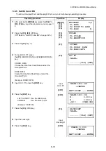
6.6.7 Select a File
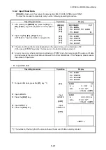
To set the coordinates to be used for the Occupied Point and Backsight Point, carry out the following
operating procedure.
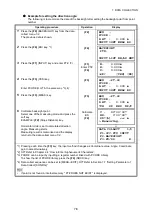
6.6.8 Initialize ROAD data
To initialize the data, carry out the following operating procedure.
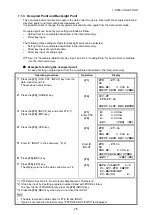
11
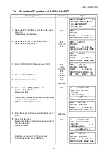
Press the
{F3}
(NEZ) key.
The coordinate data is shown.
{F3}
12
Press the
{F4}
(NEXT) key to set next layout point.
{F4}
*1) If not selecting offset, press the
{ENT}
key.
Operating procedure
Operation
Display
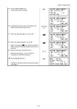
1
After pressing the
{MENU}
key, press the
{F4}
(P
↓
),
{F2}
,
{F4}
key to get the programs menu on page 2/
2.
{MENU}
{F4}
{F2}
{F4}
2
Press the
{F3}
,
{F2}
key.
(
Refer to “Select a file” on page 6-26.)
{F3}
{F2}
3
Press the
{F3}
key.
4
Enter the name of the file being used (or select it
from the list).
5
Press the
{ENT}
key.
{F3}
Select a file
{ENT}
Operating procedure
Operation
Display
1
After pressing the
{MENU}
key, press the
{F4}
(P
↓
),
{F2}
,
{F4}
key to get the programs menu on page 2/
2.
{MENU}
{F4}
{F2}
{F4}
2
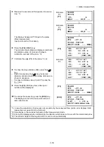
Press the
{F3}
,
{F3}
key.
(
Refer to “Initialize ROAD data” on page 6-26.)
{F3}
{F3}
3
When the
{F4}
(YES) key is pressed, all ROAD
DATA with the exception of the coordinate data file
is erased.
Press the
{F4}
key.
{F4}
N * 70.000 m
E : 50.000 m
MODE ANG NP/P NEXT
PROGRAMS 2/2
F1:AREA
F2:POINT TO LINE
F3:ROAD P
↓
SETOUT
F1:OCC&BS
F2:SETOUT ROAD
F3:SELECT A FILE
SELECT A FILE
FN:__________
INPUT LIST --- ENTER
PROGRAMS 2/2
F1:AREA
F2:POINT TO LINE
F3:ROAD P
↓
INITIALIZE DATA
ERASE ROAD DATA
>OK ? [NO][YES]


