Warning: Minimum Safe Depth, Width and
Height
Depending on cartography vendor, the
[Minimum safe depth]
,
[Minimum safe width]
, and
[Minimum safe height]
settings that
you specify for your vessel will be used during automatic route
generation. These settings will ensure that automatic routes
are not generated in areas that are unsuitable for your vessel.
Minimum safe settings are user-defined calculations. As these
calculations are outside of Raymarine’s control, Raymarine
will not be held liable for any damage, physical or otherwise,
resulting from the use of the automatic route generation
feature or the
[Minimum safe depth]
,
[Minimum safe width]
or
[Minimum safe height]
settings.
Autoroute - compatible cartography vendors
The Autoroute feature is compatible with the following cartography vendor
features.
• Navionics® Autorouting.
• Navionics® Dock-to-dock
• C-MAP® Easy Routing
Differences between automatic route generation functions
There are important differences between the way different vendors handle
automatic route generation.
Depth clearances (Tidal height)
• Navionics® Autorouting and Dock-to-dock avoids shallow areas based
on the user defined
[Minimum safe depth]
setting plus an additional
Navionics® safety margin. it assumes the lowest tide level, normally
Lowest Astronomical Tide (LAT). The tide can be lower than LAT due to
atmospheric effects such as high air pressure, wind direction, etc.
• C-MAP® Easy Routing assumes that there will be some tide. The user must
apply their own safety margin as appropriate to current conditions. Route
legs that cross areas shallower than the user defined
[Minimum safe depth]
setting are marked with hazard waypoint symbols, it is critical that these
legs are checked to ensure that there is sufficient tide to avoid the hazard.
Width & Height clearances
• Navionics® Autorouting and Dock-to-dock does not use the user defined
[Minimum safe width]
or
[Minimum safe height]
settings when generating
routes. Objects with width / height constraints are marked with hazard
waypoint symbols, it is critical that these legs are checked to ensure that
there is sufficient clearance to avoid the hazard.
• C-MAP® Easy Routing uses the user defined
[Minimum safe width]
and
[Minimum safe height]
settings to determine if sufficient clearance is
available. The user must apply their own safety margin as appropriate to
current conditions. The Height datum must be checked, as it could be
Mean High Water Springs (MHWS) or Highest Astronomical Tide (HAT). In
both cases the tide can be higher than the datum due to atmospheric
effects such as high air pressure, wind direction, etc.
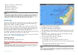
Reviewing an automatically generated route
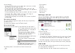
Before following any route you must ensure that it is safe to do so.
Upon Route completion:
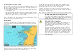
1. Range in on each route leg and waypoint that make up the Route.
2. Check either side of the route leg and around the waypoint for any
possible obstructions.
Obstructions can be charted objects or restricted areas. Routes
generated automatically should use the caution waypoint symbol in
areas where there are possible obstructions.
3. Where obstructions exist move the necessary waypoints so that the
waypoint and route leg is no longer obstructed.
Route management
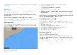
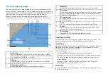
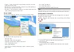
Routes are managed using the routes and tracks menu.
The
[Routes & Tracks]
menu can be accessed from the Homescreen and
from the Chart app:
[Homescreen > Routes & Tracks]
, or
[Chart app > Menu
> Routes & Tracks ]
.
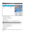
When the routes and tracks menu is opened the routes menu is displayed by
default.
59

