


Rev #
23
Version 7.10
December
2019
5.1.6.3
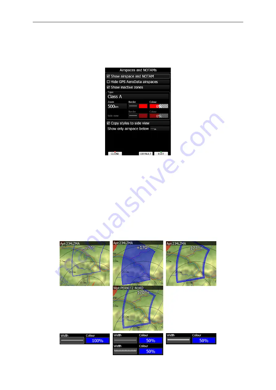
Airspace and NOTAMs
I
n this dialogue you can define the airspace map
p
resentation. Check the
Show airspace
item to enable airspace displays
with
in navigational pages. If this item is unchecked no
airspace will be displayed.
If you don’t want to see GPS AeroData airpaces select
Hide GPS AeroData airspaces.
If
the
Show inactive zones
option is
checked,
then airspace zones with proximity warning
switched off will be shown. Use
Show only airspace below
to eliminate airspace which is
going to be too high for the day. For example, if the forecasted cloud base is to be 1500
m
,
set this value to 1600
m and your screen will be much more readable.
In the
Type
panel
you can specify how each airspace type is displayed. You should define each type of
airspace zone separately. First choose an airspace type from the list.
The
Zoom
value
defines to which zoom level this type will
be visible. The
Colour
and
Width
items spe
cify
how selected airspace zone will be drawn.
You can also modify
the
transparency of the
selected type. Turn th
e
ZOOM selector knob
to change
the transparency
v
alue.
0
% means
completely transparent and only the airspace zone outline will be shown.
10
0% means
completely solid
(not recommended).
The i
mage below shows example
s
of combinations of
Width and Colour property and rendering of
the
airspace zone.
Содержание LX80 Series
Страница 7: ...Rev 23 Version 7 10 December 2019 Page 7 of 224 11 Revision History 222 ...
Страница 223: ......


