


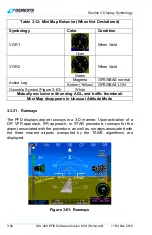


Section 3 Display Symbology
3-34
IDU-450 EFIS Software Version 8.0H (Rotorcraft)
1
st
Ed Nov 2018
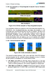
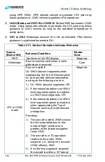
the autopilot is vertically coupled to the selected vertical navigation source.
Otherwise, the selected vertical navigation source is white.
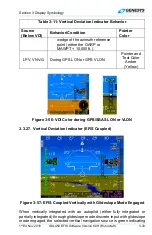
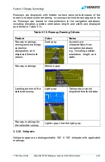
3.3.28. Highway in the Sky/Skyway
Coupled
Uncoupled
Figure 3-58: Highway in the Sky
When not decluttered, the PFD displays the active navigation route or
manual OBS course in 3-D with a series of skyway boxes, which overly the
flight plan route at a desired altitude and provide lateral and vertical
guidance. See Section 7 IFR Procedures for details.
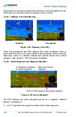
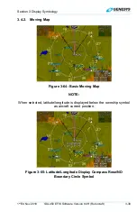
3.3.29. Active Waypoint and Waypoint Identifier
Figure 3-59: Active Waypoint
The PFD displays the active waypoint symbol as a magenta “tethered
balloon” consisting of:
1) an “X” depicted at the ground location of the active waypoint;
ETE or ETA based on along track distance
Distance to active
waypoint
Instantaneous bearing
to active waypoint