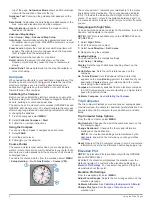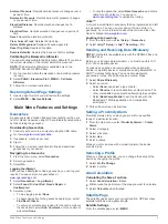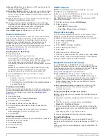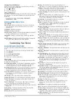
background image

3

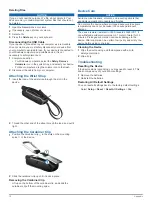
Replace the battery cover, and turn the D-ring clockwise.

4

Hold  .

5

Select 

Setup

 > 

System

 > 

AA Battery Type

.

6

Select 

Alkaline

Lithium

Traditional NiMH

, or 

Precharged 

NiMH

.

Turning On the Device

Hold  .

Acquiring Satellite Signals

It may take 30 to 60 seconds to acquire satellite signals.

1

Go outdoors to an open area.

2

If necessary, turn on the device.

3

Wait while the device searches for satellites.
A question mark flashes while the device determines your 

location.

4

Select   to open the status page.

 shows the GPS/GLONASS signal strength.

When the bars are green, the device has acquired satellite 

signals.

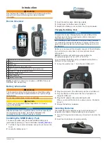
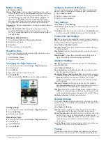
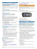
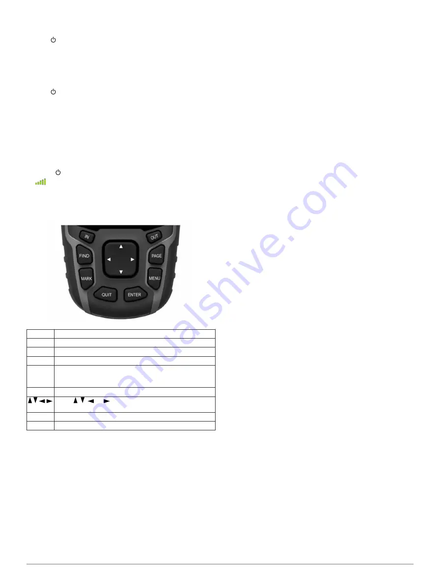
Keys

FIND

Select to open the search menu.

MARK

Select to save your current location as a waypoint.

QUIT

Select to cancel or return to the previous menu or page.

ENTER

Select to select options and acknowledge messages.

MENU

Select to open the options menu for the page that is 
currently open. Select twice to open the main menu (from 
any page).

PAGE

Select to scroll through the main pages.


Select  ,  ,  , or   to select menu options and move the 
map cursor.

IN

Select to zoom in on the map.

OUT

Select to zoom out on the map.

Waypoints, Routes, and Tracks

Waypoints

Waypoints are locations you record and store in the device.

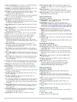
Creating a Waypoint

You can save your current location as a waypoint.

1

Select 

MARK

.

2

If necessary, select a field to make changes to the waypoint.

3

Select 

Done

.

Projecting a Waypoint

You can create a new location by projecting the distance and 

bearing from a marked location to a new location.

1

From the main menu, select 

Waypoint Manager

.

2

Select a waypoint.

3

Select 

MENU

 > 

Project Waypoint

.

4

Enter the bearing, and select 

Done

.

5

Select a unit of measure.

6

Enter the distance, and select 

Done

.

7

Select 

Save

.

Navigating to a Waypoint

1

From the main menu, select 

FIND

 > 

Waypoints

.

2

Select a waypoint.

3

Select 

Go

.

Editing a Waypoint

Before you can edit a waypoint, you must create a waypoint.

1

Select 

Waypoint Manager

.

2

Select a waypoint.

3

Select an item to edit, such as the name.

4

Enter the new information, and select 

Go

.

Deleting a Waypoint

1

Select 

Waypoint Manager

.

2

Select a waypoint.

3

Select 

MENU

 > 

Delete

.

Routes

A route is a sequence of waypoints or locations that leads you 

to your final destination.

Creating a Route

1

Select 

Route Planner

 > 

Create Route

 > 

Select First Point

.

2

Select a category.

3

Select the first point in the route.

4

Select 

Use

.

5

Select 

Select Next Point

 to add additional points to the 

route.

6

Select 

QUIT

 to save the route.

Editing the Name of a Route

1

Select 

Route Planner

.

2

Select a route.

3

Select 

Change Name

.

4

Enter the new name.

Editing a Route

1

Select 

Route Planner

.

2

Select a route.

3

Select 

Edit Route

.

4

Select a point.

5

Select an option:
• To view the point on the map, select 

Review

.

• To change the order of the points on the route, select 

Move Up

 or 

Move Down

.

• To insert an additional point on the route, select 

Insert

.

The additional point is inserted before the point you are 

editing.

• To remove the point from the route, select 

Remove

.

6

Select 

QUIT

 to save the route.

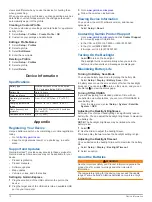
Viewing a Route on the Map

1

Select 

Route Planner

.

2

Select a route.

2

Waypoints, Routes, and Tracks 

Содержание GPSMAP 64

Страница 1: ...GPSMAP 64 Owner s Manual February 2014 190 01702 00_0B Printed in Taiwan...

Страница 2: ...stered in the USA and other countries ANT BaseCamp chirp Garmin Connect Garmin Express HomePort and tempe are trademarks of Garmin Ltd or its subsidiaries These trademarks may not be used without the...

Страница 3: ...Satellite Settings 5 Garmin Adventures 6 Sending Files to BaseCamp 6 Creating an Adventure 6 Starting an Adventure 6 VIRB Remote 6 Waypoint Averaging 6 Bluetooth Connected Features 6 Pairing a Smartph...

Страница 4: ...Cleaning the Device 12 Troubleshooting 12 Resetting the Device 12 Restoring All Default Settings 12 Index 13 ii Table of Contents...

Страница 5: ...y pack observing polarity 4 Gently press the battery pack into place 5 Replace the battery cover and turn the D ring clockwise Charging the Battery Pack NOTICE To prevent corrosion thoroughly dry the...

Страница 6: ...nd bearing from a marked location to a new location 1 From the main menu select Waypoint Manager 2 Select a waypoint 3 Select MENU Project Waypoint 4 Enter the bearing and select Done 5 Select a unit...

Страница 7: ...ting a Saved Track Before you can navigate a saved track you must save a track 1 Select FIND Tracks 2 Select a saved track 3 Select Go Purchasing Additional Maps 1 Go to your device product page at ww...

Страница 8: ...line leading to the destination The course deviation indicator CDI provides the indication of drift right or left from the course The scale refers to the distance between dots on the course deviation...

Страница 9: ...r about the cache itself select Add Comment enter a comment and select Done To rate the geocache select Rate Geocache and enter a rating for each category You can go to www opencaching com to upload y...

Страница 10: ...venture Before you can start an adventure you must send an adventure from BaseCamp to your device 1 Select Adventures 2 Select an adventure 3 Select Start VIRB Remote NOTE The VIRB Remote feature is a...

Страница 11: ...ving based on the compass Course The direction from your starting location to a destination Course can be viewed as a planned or set route You must be navigating for this data to appear Current Lap Th...

Страница 12: ...be navigating for this data to appear Velocity Made Good The speed at which you are closing on a destination along a route You must be navigating for this data to appear Vertical Dist to Dest The elev...

Страница 13: ...NOTE You should not change the position format or the map datum coordinate system unless you are using a map or chart that specifies a different position format Select Setup Position Format Position F...

Страница 14: ...n screen instructions Viewing Device Information You can view the unit ID software version and license agreement Select Setup About Contacting Garmin Product Support Go to www garmin com support and c...

Страница 15: ...ports these file types Files from BaseCamp or HomePort Go to www garmin com trip _ planning GPX track files GPX geocache files Go to www garmin com geocache GGZ geocache files Go to www garmin com geo...

Страница 16: ...the carabiner clip in the slots on the mounting spine of the device 2 Slide the carabiner clip up until it locks in place Removing the Carabiner Clip Lift up on the bottom of the carabiner clip and s...
Страница 17: ...on 3 purchasing 3 settings 3 4 updating 10 zoom 4 marine alarms setup 9 settings 9 measuring distances 3 memory card 11 microSD card See memory card N navigating 4 navigation 4 stopping 3 notification...

Страница 18: ...0800 4412 454 44 2380 662 915 35 1214 447 460 386 4 27 92 500 0861 GARMIN 427 646 27 0 11 251 9999 34 93 275 44 97 49 0 180 6 427646 20 ct Anruf a d deutschen Festnetz Mobilfunk max 60 ct Anruf 46 774...

Отзывы: