background image

A

B

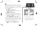
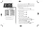
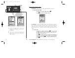
To insert a new waypoint before the selected route waypoint:

1. Highlight the ‘Insert?’ option and press 

T

.

2. Enter the name of the new waypoint using the 

R

keypad, or press

O

to select the new waypoint from the nearest list, waypoint list, or

map display.

3. Press 

T

to finish.

To remove the selected route waypoint:

1. Highlight the ‘Remove?’ option and press 

T

.

To change the selected route waypoint:

1. Highlight the ‘Change?’ option and press 

T

.

2. Enter the name of the new waypoint using the 

R

keypad, or press

O

to select the new waypoint from the nearest list, waypoint list, or

map display.

3. Press 

T

to finish.

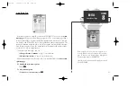
The 

route edit options page

features five more functions. These functions

may be selected by highlighting the desired function and pressing 

T

:

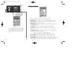
• Activate Route?—

activates the route you are editing and begins navigation.

• Invert Route?—

activates the route you are editing in reverse order and begins

navigation.

• Center On Vessel?—

redraws route edit map with your vessel in the center of the

display.

• Center On First Wpt?—

redraws route edit map with the first route waypoint in

the center of the display.

• Deactivate Route?—

stops navigation of the route currently selected.

To exit the route edit mode and return to the route list page, press the 

Q

key.

50

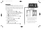
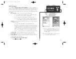
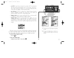
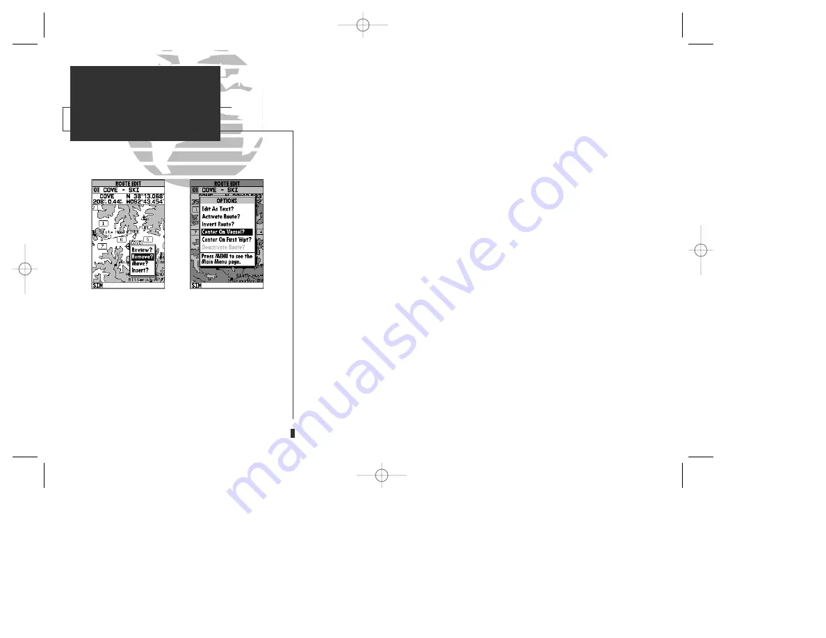
A.

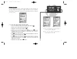
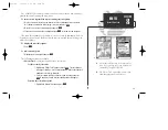
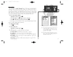
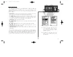
To remove a route waypoint, highlight the way-
point on the map, press EDIT/ENTER, and select
the remove option from the pop-up window.

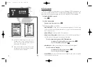
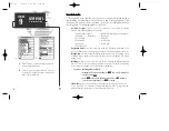
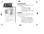
B.

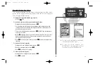
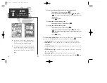
The route edit options page lets you activate,
invert or deactivate the route you are editing. The
‘Center On Vessel’ and ‘Center On First Wpt’
options redraw the map to display the desired
option.

SECTION

8

ROUTES

Editing Routes

Route Editing Options

gps 130  7/23/98 9:22 AM  Page 50

Содержание GPSMAP 130

Страница 1: ...GPSMAP TM 130 OWNER S MANUAL AND REFERENCE gps 130 7 23 98 9 20 AM Page 1...

Страница 2: ...gps 130 7 23 98 9 20 AM Page 2...

Страница 3: ...in any form or by any means electronic or manual including photocopying and recording for any purpose without the express written permission of GARMIN Information in this document is subject to change...

Страница 4: ...a particular installation If this equipment does cause harmful interference the user is encouraged to try to correct the interference by relocating the equipment or connecting the equipment to a diff...

Страница 5: ...beacon receiver for better than 10 meter accuracy Waterproof dry nitrogen filled case for use in exposed locations Advanced Navigating and Plotting 250 alphanumeric waypoints with selectable icons an...

Страница 6: ...use The warranties and remedies contained herein are exclusive and in lieu of all other warranties expressed or implied including any liability arising under warranty of merchantability or fitness fo...

Страница 7: ...with the unit This part will provide you with a basic working knowledge necessary to use the unit to it s fullest poten tial Part Two is divided into sections that provide detailed references to the...

Страница 8: ...cludes the following items If any parts are missing please see your GARMIN dealer immediately Standard Package GPSMAP 130 Unit External Antenna and 30 cable Power Data Cable Mounting Bracket Owner s M...

Страница 9: ...33 Viewing the main menu page and selecting submenus Section 6 Waypoints 34 42 Creating using and editing waypoints Section 7 GOTO MOB TracBack Functions 43 46 Going to a destination and using GOTO op...

Страница 10: ...aphically from the map Displays context sensitive options window Press MENU twice to display main menu page Activates highlighted fields and confirms menu options and data entry Turns the unit on and...

Страница 11: ...on your vessel according to the instructions in Appendix A To turn the GPSMAP 130 on 1 Press and hold the P key until the power tone sounds The welcome page will appear while the unit conducts a self...

Страница 12: ...the left hand side of the status bar A signal strength bar will also appear for each satellite in view with the appropriate satellite number under each bar The progress of satellite acquisition is sh...

Страница 13: ...ome page will appear while the unit conducts a self test 2 Once the self test is complete press the T key to acknowledge the mariner s warning The satellite status page will appear and the receiver wi...

Страница 14: ...option and press T 3 Press the T key to confirm the simulator warning Once the simulator has been started the status field at the top of the page will display a Simulating Navigation status and you r...

Страница 15: ...the com pass tape show your current course and speed over ground along with a resettable trip odometer and altitude display Your current latitude and longitude along with a 12 24 hour clock appear at...

Страница 16: ...mbol page 7 Use the R keypad to highlight the ANCHOR symbol 8 Press T to confirm the symbol 9 Press T again to confirm the DONE prompt and save the waypoint The waypoint is now stored in memory Note t...

Страница 17: ...the range and bearing to a position and perform various waypoint and route functions The data window located at the top of the page provides a user selectable display of various navigation data includ...

Страница 18: ...t the top of the page showing the bearing and distance from your boat to the cursor along with the lat lon of the cursor 4 Press the Q key to remove the cursor and recenter your boat on the map displa...

Страница 19: ...ed tour route the second method which will automatically place our vessel at the first route way point This will also give us an idea of how the O key is used throughout the GPSMAP 130 system to provi...

Страница 20: ...only presentation of the surrounding shoreline Because the usable range of the built in database is only valid to 64 nm scale we no longer have full cartog raphy available Keep in mind that whenever...

Страница 21: ...N 35 02 129 W 076 26 106 use the data window to verify the cursor position 2 Press the T key to capture the cursor position 3 Use the R key to highlight the waypoint symbol field 4 Press T to access t...

Страница 22: ...nearby waypoints on screen The moving arrow below the highway always points to the destination waypoint relative to the direction you re moving The line down the center of the highway represents your...

Страница 23: ...tal distance or the width of the base of the highway display The default CDI graph ic highway setting is 1 4 nm but can be set for a 1 2 1 2 or 4 nm range To change the CDI scale highway display 1 Pre...

Страница 24: ...it ing and copying functions you ll use most often like inverting and deactivating the active route Let s go ahead and deactivate the active route To deactivate the active route and stop navigation 1...

Страница 25: ...ack log page allows you to specify whether to record a track plot and define how it is recorded It also provides both an indicator of the total memory used and the individual functions to clear the tr...

Страница 26: ...he P key for about 3 seconds until the screen is blank Thank you for choosing the GARMIN GPSMAP 130 navigation system We hope that it will be a useful tool for you wherever you travel 16 GETTING START...

Страница 27: ...w indicator will not be highlighted The sky view shows a bird s eye view of the position of each satellite relative to the receiver s last known position The outer circle represents the horizon track...

Страница 28: ...geometry have been acquired and a 2 dimensional position fix latitude and longitude is being calculated 2D Differential Navigation will appear when you are receiving DGPS corrections in 2D mode 3D Nav...

Страница 29: ...rth Up SkyView allows you to select between a north up or track up sky view display Setup Simulator allows you to define speed course and position values while in simulator mode See the Getting Starte...

Страница 30: ...m of the page indicates posi tion fix status and is described in detail on page 18 The units of measure for speed distance position and altitude are all user selectable through the navigation setup op...

Страница 31: ...ce travelled ALT altitude VDC DC voltage To change a data field 1 Highlight the Change Data Fields option and press T 2 Move the field highlight to the field you want to change and press T 3 Select th...

Страница 32: ...estination waypoint Whenever the cursor is active an additional data window will appear below to indicate the position range and bearing to the cursor or a selected waypoint or navaid Each data field...

Страница 33: ...t icon attempts to go off the display the zoom level may need to be adjusted to keep cartography on screen Whenever the R keypad is pressed the GPSMAP 130 will enter cursor mode In cursor mode The cur...

Страница 34: ...view a selected position directly from the map display To select an on screen waypoint or navaid with the cursor 1 Use the R keypad to move the cursor to the desired waypoint or navaid if there are se...

Страница 35: ...a G chart cartridge cartography will be displayed using the data with the best resolution When the selected zoom range exceeds the resolution of the chart in use by up to two settings overzoom cartogr...

Страница 36: ...The default setting is on Measure BRG DIS allows you to measure the bearing and distance between any two points on the map display To measure the BRG DIS between two points 1 Highlight the Measure BR...

Страница 37: ...Use the R keypad to select the desired map item and press T A popup window will appear with the current settings displayed 2 Use the R keypad to highlight the scale you want to change 3 Press T to ch...

Страница 38: ...data window 3 Press T to confirm the calibration offset The next option available from the map configuration page is the set map colors option which allows you to define the fill color grayscale of th...

Страница 39: ...SOG speed over ground COG course over ground ETE estimated time enroute ETA estimated time of arrival XTK crosstrack error VMG velocity made good TRN turn angle to wpt WPT active wpt name To change a...

Страница 40: ...MG to your destination The middle section of the screen provides visual guidance to the waypoint on a graphic highway display The line down the center of the highway represents your desired track whil...

Страница 41: ...y Five settings are available from 1 4 to 4 nm with a default setting of 1 4 nm To change the highway perspective CDI scale 1 Press the up or down arrow of the Z key to select the desired setting Navi...

Страница 42: ...oints in the active route will be displayed Active Waypoint only the active waypoint will be displayed No Waypoints no waypoints will be displayed To configure the highway display 1 Highlight the Conf...

Страница 43: ...ice The 11 submenus are divided into categories by function To select a submenu from the main menu page 1 Highlight the submenu you want to view and press T For specific instructions on using a submen...

Страница 44: ...your present position To mark your present position 1 Press the M key The mark position page will appear with a default three digit name for the new waypoint 2 To accept the waypoint with the default...

Страница 45: ...r the Use NAVAID Posn option and press T 4 To accept the waypoint with the default name symbol and comment the date and time of creation press T to confirm the Done prompt 5 To enter a different name...

Страница 46: ...be created by manually entering a position s coordinates or referencing a stored waypoint through the Create Waypoint submenu option on the main menu page To create a new waypoint by manually enterin...

Страница 47: ...ess O to select the waypoint from the nearest list waypoint list or map display Leave the reference field blank to use your present position 5 Press T to begin entry of the bearing from your reference...

Страница 48: ...r the selected waypoint To change the waypoint symbol 1 Highlight the waypoint symbol field and press T 2 Use the R keypad to select the desired symbol and press T to confirm To change the position co...

Страница 49: ...r the cursor arrow 4 Use the R keypad to move the cursor arrow to the desired position The cursor s coor dinates along with the distance and bearing from the waypoint s position will be dis played at...

Страница 50: ...s of safety in emergency situations To scroll through and review the nearest waypoint list 1 Highlight the Nearest Waypoints option and press T 2 Use the R keypad to scroll through the list in either...

Страница 51: ...r map display 4 Press T to confirm The distance field will now be highlighted 5 Press T to begin entry of the proximity radius 6 Use the R keypad to enter a distance value to 99 99 units and press T T...

Страница 52: ...e waypoint list 1 Highlight the Waypoints option from the main menu page and press T 2 Use the R keypad to scroll through the list in the desired direction 3 Press T to review the highlighted waypoint...

Страница 53: ...med MAP at the navaid or map position To activate a GOTO from the map display 1 Press the G key twice 2 To select an existing user waypoint highlight the waypoint on screen and press T 3 To select a n...

Страница 54: ...from a list of the nine nearest waypoints to your present position To select a nearest waypoint as a GOTO destination 1 Highlight the Show Nearest Waypoints option and press T 2 Select the desired wa...

Страница 55: ...track log automatically stored in the receiver s memory which will eliminate the need to store waypoints along the way TracBack routes are created by reduc ing your track log into a route of up to 30...

Страница 56: ...nterval is set to the Time option the route may not follow your exact path keep the interval set to resolution for best performance If the receiver is turned off or satellite coverage is lost during y...

Страница 57: ...oint or navaid to the route use the arrow pointer to highlight the desired waypoint on screen and press T 6 To add a new waypoint to the route use the arrow pointer to select the desired map position...

Страница 58: ...s T To remove a route waypoint 1 Highlight the Remove option and press T To move a route waypoint 1 Highlight the Move option and press T 2 Move the cursor to the new map position and press T To inser...

Страница 59: ...e route edit options 1 Press O To select a menu option 1 Highlight the desired option and press T The following options are available Edit As Text allows you to modify a route by text entry To edit a...

Страница 60: ...and pressing T Activate Route activates the route you are editing and begins navigation Invert Route activates the route you are editing in reverse order and begins navigation Center On Vessel redraws...

Страница 61: ...ilable from the route options page To display the route options 1 Press O To select a menu option 1 Highlight the desired option and press T The following options are available from the route list pag...

Страница 62: ...nal To copy a route 1 Highlight the Copy Route option and press T The selected route will appear as the copy from route and the first open storage route will appear as the copy to route 2 Press T to c...

Страница 63: ...e to waypoint first From the active route page you can Change the route comment see page 51 for instructions Edit the route on map see pages 48 49 for instructions Additional functions for the active...

Страница 64: ...define the data displayed in the distance and ETE fields four data options are available DIS distance to active wpt DTK desired track ETE estimated time enroute ETA estimated time of arrival Restore...

Страница 65: ...val Resolution records track plot based upon a user defined variance from your course over ground The resolution option is the default setting and is recommended for the most efficient use of memory a...

Страница 66: ...display Press T to con firm the waypoint 4 Move the field highlight to the second waypoint field and follow the steps above to select the destination waypoint 5 Enter a speed for your trip in the spe...

Страница 67: ...e page will now display the planning information for the route leg selected or the cumulative values for the entire route The route planning mode will also let you plan cumulative totals for multiple...

Страница 68: ...n menu page provide access to the various system navigation alarm and interface settings of the GPSMAP 130 The system setup submenu is used to select the operating mode date and time for mats tone pre...

Страница 69: ...for the GPSMAP 130 s screen backlighting Six settings are available No Timeout the backlight will stay on until it is turned off 15 seconds default setting 30 seconds and 1 2 or 4 minutes Keeping the...

Страница 70: ...ridges Depth contours can be displayed in feet meters or fathoms The default setting is feet Heading lets you select what reference is used in calculating heading information You can select to referen...

Страница 71: ...ur current track and speed and adjust the receiver s response time automatically The on setting allows you to manually enter a response time up to 240 seconds Selecting a higher setting may be desirab...

Страница 72: ...rival alarm will sound Auto An arrival alarm will sound one minute before the destination based upon your current speed and course over ground On An arrival alarm will sound at the alarm distance spec...

Страница 73: ...table NMEA output RTCM In No Out allows DGPS beacon receiver input with no output capabilities NMEA In No Out allows input from a NMEA compatible external device such as a Yeoman Plotter with no outpu...

Страница 74: ...ill be 304 0 kHz with a bit rate of 100 bps or the last DGPS frequency bit rate selected To tune a DGPS frequency 1 Select the RTCM In NMEA Out format from the options page 2 Highlight the beacon rece...

Страница 75: ...130 is on a confirmation tone will sound when the cartridge has been properly installed and accepted 4 Close the cover If you insert a G chart cartridge and get a card format not recognized message t...

Страница 76: ...ar see page 26 Whenever you zoom past the usable range of the current electronic chart the range field will display Ovr Zm or No Map These warnings indicate that although you may still have cartograph...

Страница 77: ...dings caused by excessive heeling Most marine VHF and loran antennas will not seriously degrade the GPS antenna s reception Never paint the antenna or clean it with harsh solvents The GARMIN antenna s...

Страница 78: ...enough to support the unit and protect it from excessive vibration and shock For flush mounting make sure the flat panel is between 0 08 and 0 52 2 to 13 2mm thick to use the cam lobe built into the...

Страница 79: ...bracket downward until the panel is pinched tightly between the unit s flange and bracket lobe 5 Tighten knobs and connect the power data and antenna cables WARNING The temperature range for the GPSM...

Страница 80: ...PWPL GPBOD Proprietary sentences PGRME estimated error PGRMM map datum PGRMZ altitude PSLIB beacon rec control input DGPS corrections are accepted in RTCM 104 v 2 0 format through the NMEA In BROWN ha...

Страница 81: ...pprox 5 minutes Search the sky Update Rate 1 second continuous Position Accuracy 1 5 meters 3 16 ft 15 meters 49 ft RMS Velocity Accuracy 0 1 knot RMS steady state 90 knots max Dynamics Performs to sp...

Страница 82: ...raded beyond 500 meters due to poor satellite geometry or data quality You should check other navigational sources to verify the position indicated Max Calibration Is 5000mt 16 400 ft You have exceede...

Страница 83: ...do not use the unit and take it to an authorized dealer for repair Route Already Exists The route number you are trying to copy to is already used Route Does Not Exist The route number you are trying...

Страница 84: ...land Austria Austria Bellevue IGN Efate and Erromango Islands Bermuda 1957 Bermuda 1957 Bermuda Islands Bogata Observ Bogata Obsrvatry Colombia Campo Inchspe Campo Inchauspe Argentina Canton Ast 66 Ca...

Страница 85: ...ohnston Island Johnston Island Kandawala Kandawala Sri Lanka Kandawala Sri Lanka Kerguelen Islnd Kerguelen Island Kertau 1948 West Malaysia Singapore L C 5 Astro Cayman Brac Island Liberia 1964 Liberi...

Страница 86: ...63 S Chile Puerto Rico Puerto Rico Virgin Isl Qatar National Qatar National Qatar Qornoq Qornoq South Greenland Reunion Reunion Mascarene Island Rome 1940 Rome 1940 Sardinia Isl RT 90 Sweden Santo Dos...

Страница 87: ...y of your arrival at a destination Estimated Time Enroute ETE The time remaining to your destination at your present speed Grid A coordinate system that projects the earth on a flat surface using squa...

Страница 88: ...surface to measure position in specific zones Velocity Made Good VMG The speed you are travelling in the direction of the desti nation Waypoint A specific location saved in the receiver s memory 78 N...

Страница 89: ...5 to W157 5 11 W157 5 to W142 5 10 W142 5 to W127 5 9 W127 5 to W112 5 8 W112 5 to W097 5 7 W097 5 to W082 5 6 W082 5 to W067 5 5 W067 5 to W052 5 4 W052 5 to W037 5 3 W037 5 to W022 5 2 W022 5 to W0...

Страница 90: ...Error 77 Cursor Mode 23 24 Cursor Movement 8 24 D Data Field Entry 10 Data Window 47 Date Time Formats 59 Datums 74 76 Definitions 77 78 Desired Track DTK 77 Depth Contours 60 Depth Units 60 Dilution...

Страница 91: ...time 59 79 Operation Setup 58 59 Overzoom Mode 25 P Packing List vi Page Sequence 5 Physical Specifications 72 Point to Point Planning 56 Position Page 20 21 Position Format 60 Velocity Filters 61 Pow...

Страница 92: ...Resolution 55 Track Recording 55 Trip Odometer 20 21 Turn TRN 32 77 U Units of Measure 60 UTC time 59 82 UTM UPS Coordinates 82 V Velocity Filter 61 Velocity Made Good VMG 32 78 W Waypoints 34 42 Act...

Страница 93: ...gps 130 7 23 98 9 23 AM Page 83...

Страница 94: ...MIN International 1200 E 151st Street Olathe KS 66062 USA GARMIN Europe LTD Unit 5 The Quadrangle Abbey Park Industrial Estate Romsey SO51 9AQ UK Part Number 190 00106 00 Rev B gps 130 7 23 98 9 23 AM...

Отзывы: