


Garmin GI 275 Pilot's Guide
190-02246-01 Rev. A
175
Additional Features
System Overview
Flight Instruments
EIS
Navigation
Hazar
d A
voidance
Autopilot
Additional F
eatur
es
Appendices
Index
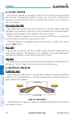
SECTION 7 ADDITIONAL FEATURES
7.1 OVERVIEW
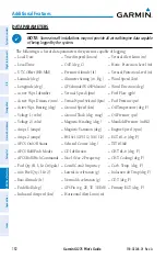
Additional features of the GI 275 Multi-Function Instrument (MFI) include the following:
• SafeTaxi
®
• Radar Altimeter (Optional)
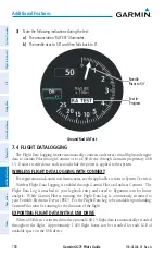
• Flight Data Logging
• D2
™
Pilot Watch Connectivity (Optional)
• Synthetic Vision Technology (Optional)
SafeTaxi
®
diagrams provide detailed taxiway, runway, and ramp information at more than
1,000 airports in the United States.
The optional Radar Altimeter feature on the MFI displays the height above terrain in real-
time, directly below the aircraft by using compatible hardware.
The Flight Data Logging feature automatically connects and stores critical flight and engine
data to Garmin Pilot through Connext or to a USB device through Garmin's proprietary GSB
15. Approximately 1,000 flight hours can be recorded for each 1GB of available space.
The optional D2
™
Pilot Watch can connect to the MFI using a Bluetooth Low Energy (BLE)
network. This connection establishes a real-time data transfer of flight information from the
aircraft to the D2
™
Pilot Watch.
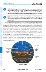
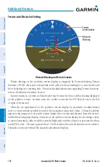
The optional Synthetic Vision Technology (SVT
™
) depicts a forward-looking attitude display
of the terrain and traffic immediately in front of the aircraft on the 'ADI' Page.
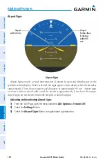
7.2 SAFETAXI
®
WARNING:
Do not use SafeTaxi
®
information as the primary method of flight
guidance during ground operations. SafeTaxi
®
does not have NOTAM or ATIS
information regarding the current active runway, condition, or complete information
about the position of hold lines.
NOTE:
With the availability of SafeTaxi
®
, it is still advisable to carry another source
of charts on board the aircraft.
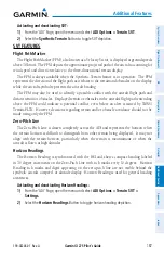
SafeTaxi
®
is an enhanced feature that provides greater map detail when viewing airports at
close range on the 'HSI Map' or 'Map' Page. Map options are configurable. When SafeTaxi
is enabled, the map reveals taxiways with identifying letters/numbers, airport Hot Spots, and
airport landmarks including ramps, buildings, control towers, and other prominent features.
SafeTaxi
®
features default to being viewed at or less than 1 nm and can be configured out to 5
nm. Resolution is greater at lower map ranges. When the aircraft’s current position is within
the SafeTaxi
®
view, the airplane symbol on the airport provides enhanced position awareness.
Содержание GI 275
Страница 1: ...GI 275 Pilot s Guide ...
Страница 2: ......
Страница 4: ......
Страница 12: ...Garmin GI 275 Pilot s Guide 190 02246 01 Rev A Warnings Cautions Notes Blank Page ...
Страница 14: ...Garmin GI 275 Pilot s Guide 190 02246 01 Rev A Software License Agreement Blank Page ...
Страница 16: ...Garmin GI 275 Pilot s Guide 190 02246 01 Rev A Record of Revisions Blank Page ...
Страница 22: ...Garmin GI 275 Pilot s Guide 190 02246 01 Rev A vi Table of Contents Blank Page ...
Страница 249: ......


