• To use a very fast scroll speed, select
Ultrascroll
.
The Ultrascroll option quickly scrolls new sonar data, but
with a reduced image quality. For most situations, the Fast
option provides a good balance between a quickly
scrolling image and targets that are less distorted.
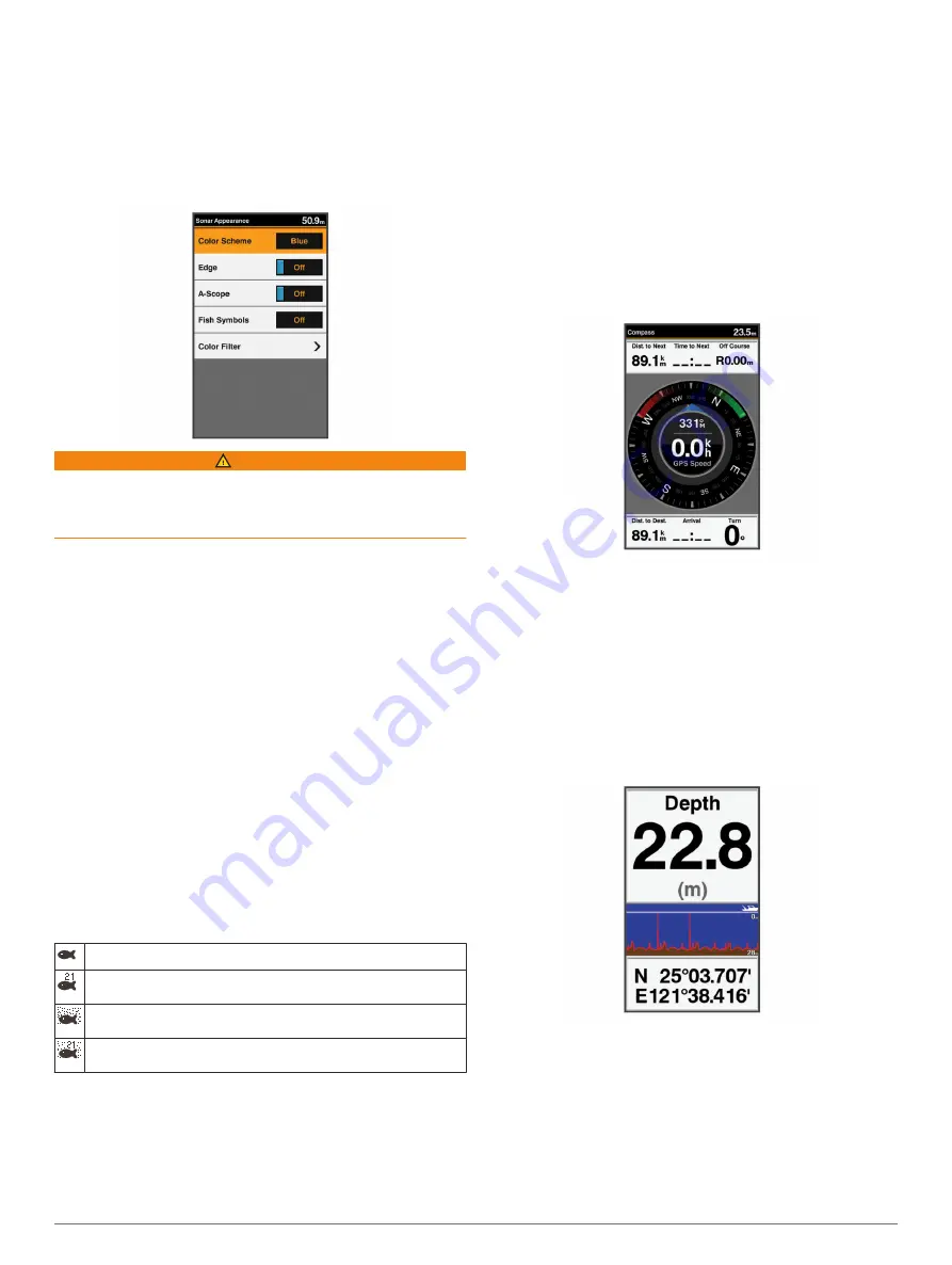
Sonar Appearance Settings
From a sonar view, select
MENU
>
Sonar Setup
>
Appearance
.
WARNING
Information is for reference only. Disabling warnings for
underwater hazards can result in death, personal injury, or
property damage. You are responsible for the safe and prudent
operation of your vessel.
Color Scheme
: Sets the color scheme.
Edge
: Highlights the strongest signal from the bottom to help
define the hardness or softness of the signal.
A-Scope
: Displays a vertical flasher along the right side of the
screen that shows instantaneously the range to targets along
a scale.
Fish Symbols
: Sets how the sonar interprets suspended
targets.
Color Filter
: Sets which colors are removed from the screen.
Turning On the A-Scope
NOTE:
This feature is not available in all sonar views.
The a-scope is a vertical flasher along the right side of the full-
screen sonar view. This feature expands the most recently
received sonar data so that it is easier to see. It can also be
helpful for detecting fish that are close to the bottom.
From a sonar view, select
MENU
>
Sonar Setup
>
Appearance
>
A-Scope
.
Configuring the Appearance of Suspended Targets
NOTE:
Configuring the appearance of suspended targets on
one screen applies that setting to all screens.
NOTE:
This feature is not available on all sonar views.
Shows suspended targets as symbols.
Shows suspended targets as symbols with target depth
information.
Shows suspended targets as symbols with background sonar
information.
Shows suspended targets as symbols with background sonar
information and target depth information.
1
From a sonar screen, select
MENU
>
Sonar Setup
>
Appearance
>
Fish Symbols
.
2
Select an option.
Overlay Numbers
From a chart, 3D chart view, or a combinations screen, select
MENU
>
Chart Setup
>
Overlay Numbers
>
Show
.
Edit Layout
: Sets the layout of the data overlay, or data fields.
You can select the data to be shown within each data field.
Navigation Inset
: Shows the navigation inset when the vessel
is navigating to a destination.
Navigation Inset Setup
: Allows you to configure the navigation
inset to show Route Leg Details, and to control when the
inset appears before a turn or destination.
Compass Tape
: Shows the compass tape data bar when the
vessel is navigating to a destination.
Compass
The compass uses GPS course over ground (COG) to guide
you to your destination, and does not account for other factors
that can affect your destination, such as currents and tides.
Select
Navigation Info
>
Compass
.
Depth and Water Temperature Graphs
If you are using a depth-capable transducer, or are receiving
water depth information over NMEA
®
0183, you can view a
graphic log of depth readings over time. If you are using a
temperature-capable transducer, or are receiving water
temperature information over NMEA 0183, you can view a
graphic log of temperature readings over time.
The graphs scroll to the left as information is received.
Before you can view the depth data graph page or temperature
graph page, you must add the page to your home screen
(
). Select Depth Data
Graph or Temperature Data Graph.
Waypoints and Marks
Waypoints are locations you record and store in the device that
allow you to navigate back to a location. Waypoints display on
the screen as a blue flag, and include the waypoint name and
symbol.
Marks are locations you record without navigation information.
Marks display on the screen as a dot with a symbol, and are
hidden in the Waypoints and Marks list by default. When you
Waypoints and Marks
7
Содержание FF 650 GPS
Страница 1: ...FF 650 GPS Owner s Manual ...
Страница 23: ......


