Copyright © 2022 DJI All Rights Reserved.
30
3.5 Checkpoint Setup
In topographic surveying missions, checkpoints can be used to verify the point cloud accuracy. The
output result from the L1 is 3D point cloud data in LAS format. Unlike the 3D models obtained with
visual cameras, the point cloud contains no structural information, so its checkpoints differ from those
in visible light surveying. If you use normal photogrammetry markers and mark the checkpoints in RGB
mode, there will be an extra error due to the colorization. Please note the GCP management feature
is not supported for L1 data in Terra.
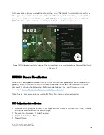
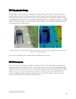
Figure: Example of normal photogrammetry checkpoints – not recommended for LiDAR as you cannot tell the
center of it in reflectivity mode
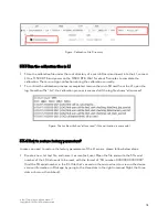
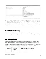
Two types of checkpoints are recommended for LiDAR, as shown below:
3.5.1 3D Checkpoints
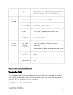
L1 point clouds can be displayed in reflectivity mode. Therefore, if the checkpoints are marked with
significant differences in reflectivity, they can be clearly recognized in the point cloud model. Highly
reflective paints are recommended to be used for checkpoint markings. The checkpoint size should be
greater than 1m x 1m. When measuring the checkpoint in DJI Terra, you can use the RGB display
mode to roughly locate the checkpoint and then switch to reflectivity display mode to accurately
measure the coordinate of the center of the checkpoint.

