Copyright © 2022 DJI All Rights Reserved.
19
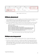
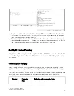
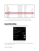
Copy the .txt text file to the root directory of the microSD card, insert the microSD card into the
L1 that needs to be calibrated, install the L1 onto the M300 RTK and power on the aircraft, wait
about 5 minutes to complete the calibration.
Record a set of point cloud data, remove the microSD card from the L1. Connect it to a computer
and check the .txt format log file. If it displays all succeeded, the reset is successful. Users can also
check whether the time parameter of the .CLI file is restored to the factory time.
3.4 Flight Mission Planning
A flight mission of the survey area can be pre-planned with the DJI Pilot App to enable automatic data
capture of a polygon area or a strip area. Detailed parameter recommendations for typical scenarios
are as below:
3.4.1 Topographic Surveying
This is a typical scenario of LiDAR to generate topographic maps, contour lines, etc. It may also be
applicable to forest inventory monitoring by measuring the tree heights and density of the canopy.
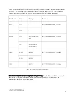
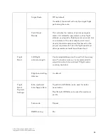
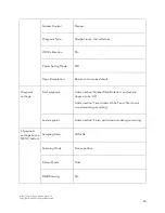
Create a "Mapping Mission". You can import the KML file of the target area or manually draw the area
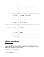
on the map. The recommended parameter settings for topographic surveying are as follows:
Category
Parameter
Name
Explanation and recommended value

