


Rev 6 – Feb 2022
Page 18 of 44
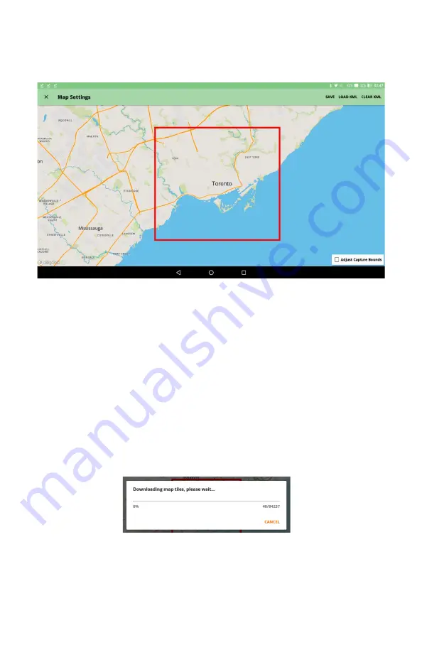
Map Settings
The Hexcorder Pro uses Openmaps.org for mapping purposes. A Wi-Fi internet connection prior to
the survey is necessary for this function to work. Map data can be saved (cached) on the tablet for
later use in the field when Wi-Fi is not available.
•
Turn on Wi-Fi on the tablet by pulling down the dropdown menu from the top of the
screen and toggling the Wi-Fi icon to “On”.
•
Connect to a local Wi-Fi network
•
Select the “Adjust Capture Bounds” box and use pinch-zoom and drag to move and
shape the red box to fit your survey area. (see above screenshot)
•
Load KML/Clear KML – Using the buttons in the top right corner of the Map Settings
screen, create your own google KML map files from previous survey data and place the
file on the tablet memory. Then, select the “Load KML” button and navigate to the
KML file you want to load. It will be loaded as a visible line of waypoints on the map,
which can give a guiding route during the survey.
•
Use pinch zoom until the desired map region is included inside the red box. Press the
“SAVE” button in the top right corner and this section of the map will be cached in
memory.
Later, when the tablet does not have internet access, this map section will still be available to view in
the map survey widget.
•
When surveying out of Wi-Fi range, turn off Wi-Fi to save battery.


