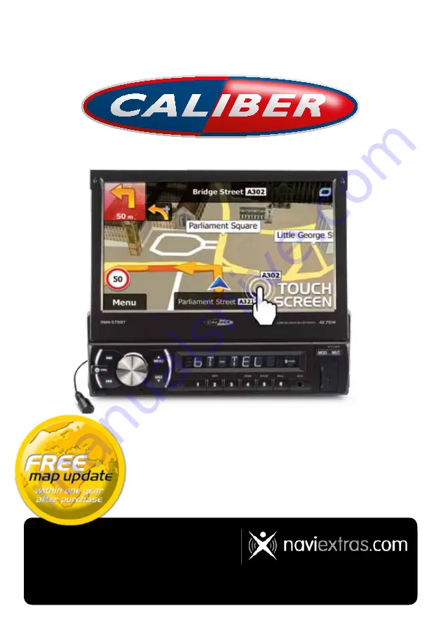
background image

RMN 575BT

NavigatioN MaNual

GB • F • D • NL

NavigatioN map update

After the first connection with the GPS satellite, you have 

one year to update the maps for 

free!

How does it work

Go to: 

www.naviextras.com

 - Click “Downloads” and  

download the program “

Naviextras toolbox

”. After installing it 

on your computer, just follow the instructions in the program.

Note: 

you need a cardreader (for SD) and a 

Navi

extras


user 

profile

 to update your device.You can create a profile on the 

website, simply go to 

www.naviextras.com

 and click  

“Create a user profile”.

Содержание RMN 575BT

Страница 1: ...it work Go to www naviextras com Click Downloads and download the program Naviextras Toolbox After installing it on your computer just follow the instructions in the program Note you need a cardreade...

Страница 2: ...RMN 575BT Navigation Manual ENGLISH User Manual Navigation software for the Caliber RMN575BT UK English...

Страница 3: ...s your navigator Start using Caliber RMN575BT right away This document is the detailed description of the navigation software You can easily discover Caliber while you are using it however we still re...

Страница 4: ...21 2 3 6 Checking the details of the current position Where Am I 23 3 On road navigation 25 3 1 Selecting the destination of a route 25 3 1 1 Entering an address or a part of the address 25 3 1 1 1 E...

Страница 5: ...ives for an existing route 57 3 4 8 Changing the vehicle used in route planning 58 3 4 9 Changing the road types used in route planning 59 3 5 Saving a location as a Favourite destination 60 3 5 1 Edi...

Страница 6: ...nd Warnings 82 6 3 2 Customise Quick menu 84 6 3 3 Driving time management 84 6 3 4 Traffic settings 85 6 3 5 Route settings 85 6 3 6 User profiles 89 6 3 7 Map settings 90 6 3 8 Visual guidance setti...

Страница 7: ...ersonal information If you change your mind later you can enable or disable the log collection in Settings page 94 It is important that you look at the display only when it is safe to do so If you are...

Страница 8: ...ect usage information and GPS logs that may be used for improving the application and the quality and coverage of maps Tap to allow the anonymous statistics or disable this function Later you can turn...

Страница 9: ...or enter a coordinate Tap to display the route parameters and the route in its full length on the map You can also perform route related actions such as editing or cancelling your route setting a star...

Страница 10: ...the current value of a field or setting Tap the button to change the value After the change the new value is shown on the button Tap it once Icon Shows status information Some icons also function as a...

Страница 11: ...hing to another keyboard layout for example from an English keyboard to a Greek keyboard Tap the button and select the new keyboard layout from the list Correcting your entry on the keyboard Tap to re...

Страница 12: ...d on list and menu screens the Map screen appears Tap and hold any of the and buttons on the Map screen you can rotate tilt or scale the map continuously Tap and hold on keyboard screens you can delet...

Страница 13: ...n You see coloured dots circling around a satellite symbol in the top left corner The more green dots you see the closer you are to get the valid GPS position When GPS position is available the Vehima...

Страница 14: ...to change its value Field Description Shows the distance you need to travel on the route before reaching your final destination Shows the time needed to reach the final destination of the route based...

Страница 15: ...to confirm the destination at the end of a search or Tap the map in Find on Map page 45 When a map location is selected the Cursor appears at the selected point on the map The Cursor is displayed with...

Страница 16: ...y etc and its distance from the current position are displayed A smaller icon shows the type of the second next manoeuvre if it is near the first one Otherwise only the next manoeuvre is displayed Mos...

Страница 17: ...ou need to take Where additional information is available signposts substitute arrows Signposts are displayed at the top of the map The colour and style of the signposts are similar to the real ones y...

Страница 18: ...unction tap the picture and the Map screen returns 2 3 3 5 Motorway exit services You may need a petrol station or a restaurant during your journey This feature displays a new button on the map when y...

Страница 19: ...art point Your current position displayed on the map If roads are near it is aligned to the nearest road Normally if GPS position is available the route starts from the current position If there is no...

Страница 20: ...screen 2 Tap to open the list of event categories 3 Tap the traffic category you are interested in or tap to see the list of all events 4 Now tap any of the list items to see its details and to displ...

Страница 21: ...scaling has a limit in 3D map view mode If you zoom out further the map switches to 2D view mode Tap the button once to modify the view in large steps or tap and hold the button to modify it continuo...

Страница 22: ...ction of controls and functions that are frequently needed during navigation It can be opened directly from the Map screen by tapping The menu will close after a few seconds of inactivity or if you ta...

Страница 23: ...laced with the next one if waypoints are given My Route Cancel Route page 55 This button skips the next waypoint from the route n a This button opens a 2D map scaled and positioned to show the entire...

Страница 24: ...top of the Map screen when there is no GPS reception This button opens the parameters of the selected Vehicle profile More Settings Route page 85 This button opens the Lorry settings screen More Setti...

Страница 25: ...ime left since it was last updated Address details when available of the current position are displayed at the bottom You can also perform some actions on this screen Tap to save the current position...

Страница 26: ...r off road navigation For details see page 66 3 1 Selecting the destination of a route Caliber offers you several ways of choosing your destination Enter a full address or a part of an address for exa...

Страница 27: ...entering the name of the city town on the keyboard c Find the city town you need The most likely city town name is always shown in the input field To accept it just tap the field you entered the first...

Страница 28: ...ish entering the address If the entered house number cannot be found the midpoint of the street is selected as the destination 7 A full screen map appears with the selected point in the middle If nece...

Страница 29: ...t likely street name is always shown in the input field To accept it just tap the field you entered the first letters in If the desired name does not show up the names that match the string appear in...

Страница 30: ...3 If necessary modify the country and city town as described earlier page 26 4 Enter the street name a Tap b Start entering the street name on the keyboard c Find the street you need The most likely s...

Страница 31: ...summary of the route parameters the map appears showing the entire route The route is automatically calculated Tap to modify route parameters or tap and start your journey 3 1 1 4 Selecting a city tow...

Страница 32: ...t the city town from the list 5 Instead of entering the street name tap This way the centre of the displayed city town becomes the destination of the route 6 A full screen map appears with the selecte...

Страница 33: ...Enter a new city town using its postal code a Tap b If necessary tap to open the numeric keypad c Start entering the postal code d Find the city town you need The most likely postal code is always sho...

Страница 34: ...ish entering the address If the entered house number cannot be found the midpoint of the street is selected as the destination 7 A full screen map appears with the selected point in the middle If nece...

Страница 35: ...road If the same word appears in several names for example in the name of streets roads and avenues you can obtain the result faster if you enter the first letter of the street type For example enter...

Страница 36: ...ntering the name of the Place 3 After entering a few letters tap to open the list of Places with names containing the entered character sequence 4 optional The Places in the list are ordered by the le...

Страница 37: ...ing preset categories The Preset search feature lets you quickly find the most frequently selected types of Places 1 If you are on the Map screen tap to return to the Navigation menu 2 In the Navigati...

Страница 38: ...searched around the current position If the current position is not available either no GPS signal they are searched around the last known position 4 Tap any of the quick search buttons to get an ins...

Страница 39: ...s 3 Tap 4 Select the area around which the Place should be searched for Tap to search for a place within a selected city town The result list will be ordered by the distance from the centre of the sel...

Страница 40: ...ion 5 optional If you have selected select the city town to search in 6 Select one of the main Place categories e g Accommodation or tap to list all Places around the selected location or along the ro...

Страница 41: ...o reorder the list tap 11 Browse the list if necessary and tap one of the list items A full screen map appears with the selected point in the middle The name and address of the Place is displayed at t...

Страница 42: ...ound the last know position The result list will be ordered by the distance from this position Tap to search for a place within a selected city town The result list will be ordered by the distance fro...

Страница 43: ...aces 7 Select one of the Place subcategories e g Hotel or Motel to search in or tap to search in the selected Place category 8 Tap if you have not done it before 9 Using the keyboard start entering th...

Страница 44: ...f necessary tap the map somewhere else to modify the destination The Cursor appears at the new location Tap to confirm the destination or tap to select a different destination 14 After a short summary...

Страница 45: ...tion or by the length of the necessary detour If you need to reorder the list tap 6 Browse the list if necessary and tap one of the list items A full screen map appears with the selected point in the...

Страница 46: ...ect the Cursor as the destination 6 After a short summary of the route parameters the map appears showing the entire route The route is automatically calculated Tap to modify route parameters or tap a...

Страница 47: ...fter a short summary of the route parameters the map appears showing the entire route The route is automatically calculated Tap to modify route parameters or tap and start your journey 3 1 5 Selecting...

Страница 48: ...confirm the destination or tap to select a different destination 5 After a short summary of the route parameters the map appears showing the entire route The route is automatically calculated Tap to m...

Страница 49: ...middle If necessary tap the map somewhere else to modify the destination The Cursor appears at the new location Tap to confirm the destination or tap to select a different destination 5 After a short...

Страница 50: ...TM format 6 When finished tap 7 A full screen map appears with the selected point in the middle If necessary tap the map somewhere else to modify the destination The Cursor appears at the new location...

Страница 51: ...in the list of route points the start point of the route normally the current GPS position 5 Tap to select the destination 6 The Destination menu appears and you can select the destination of the rou...

Страница 52: ...elated functions You can check different parameters of the route recommended by Caliber 1 If you are on the Map screen tap to return to the Navigation menu 2 In the Navigation menu tap 3 The following...

Страница 53: ...he route saving the active route or loading a previously saved route Tap to return to the Navigation menu 3 4 Modifying the route When Caliber is already started there are several ways to modify the a...

Страница 54: ...ow the last waypoint 3 4 2 Setting a new starting position for the route For normal navigation all routes are planned from the current position In order to check future routes simulate them or see the...

Страница 55: ...active route already existed it is now recalculated starting from the selected location 8 To return to normal navigation tap 3 4 3 Editing the list of destinations Edit Route You can edit the route by...

Страница 56: ...lling the active route To cancel the navigated route do one of the following If you are on the Map screen tap and then tap If you have a route with waypoints you need to tap until all waypoints are de...

Страница 57: ...e planning method Tap any of them to see it on the map 5 Or if you cannot find a good alternative tap and scroll down for routes with different routing methods 6 Select one of the route alternatives a...

Страница 58: ...settings page 85 There is another way to do this and to compare different route alternatives with the same route planning method Do as follows 1 If you are on the Map screen tap to return to the Navig...

Страница 59: ...er recalculates the route The orange line now shows the new recommended route 3 4 8 Changing the vehicle used in route planning To recalculate the active route for a different vehicle do as follows Th...

Страница 60: ...here you can purchase a pass or vignette to use the road for a longer period of time They can be enabled or disabled separately from toll roads Caliber includes toll roads pay roads where there is a p...

Страница 61: ...described on page 45 1 Select a destination as described before It can be an address a Place any location on the map a previously used destination from History etc 2 When the full screen map appears w...

Страница 62: ...n the Map screen tap and then tap If you are in the Navigation menu tap and then tap 2 The list of Favourite destinations is displayed 3 Tap the Favourite that you want to edit If necessary browse dow...

Страница 63: ...amera or a railway crossing 1 Browse the map and select a location The red Cursor appears there 2 Tap 3 Scroll down the list and tap 4 On the newly opened screen select the type of the alert point the...

Страница 64: ...y crossing 1 Browse the map and select the alert point to edit The red circle appears around the alert point 2 Tap 3 Scroll down the list and tap 4 On the newly opened screen modify the type of the al...

Страница 65: ...2 In the Navigation menu tap 3 Tap 4 Scroll down the list and tap The simulation starts from the starting point of the route and using a realistic speed it leads you through the whole recommended rou...

Страница 66: ...vigation Manual ENGLISH Jump to the previous route event manoeuvre Tap to increase the speed of the simulation to 4 8 or 16 times faster Now tap again to return to the normal speed b Tap to stop the s...

Страница 67: ...e route Selecting the start point or a destination waypoint or final destination is the same as described at on road navigation The only difference is that route points are linked to form a route with...

Страница 68: ...lsory breaks must be taken timers can be set for one driver or two alternate drivers Warnings are both visual and audible There are different kinds of warnings When approaching a restricted road segme...

Страница 69: ...Scroll the list and tap any of the lines to change the parameters The parameters are intuitive In addition you have the following options When enabled the list of vehicle parameters always appears be...

Страница 70: ...icle with typical configurations of parameters for example with or without a trailer that also affects the length the height the number of axles and the weight it is better to create different vehicle...

Страница 71: ...rder to obey the regulations regarding continuous and daily driving you can set countdown timers to alert you when you need a break or a sleep This feature can be set for one driver or two alternate d...

Страница 72: ...the vehicle stops the current driver receives a message a few minutes later whether this stop means a break When a break is initiated the continuous driving timer stops and it is reset to its default...

Страница 73: ...nd night colour themes Caliber uses different colour themes during the day and during the night for both the map and the menu screens Daytime colours are similar to paper road maps and the menus are b...

Страница 74: ...ts of Fast and Short Caliber calculates as if it were calculating the Fast route but it takes other roads as well to save fuel Results in a route with fewer turns and no difficult manoeuvres With this...

Страница 75: ...re taken into account when planning a route Roads are used only if access for lorries is allowed Private roads resident only roads and walkways are excluded from routes U turns are excluded from route...

Страница 76: ...g method is selected the Green details are also shown when you confirm the route If the selected route planning method is not Green and you have allowed the application to show the green alternative t...

Страница 77: ...information may not be available for your region ask your local dealer or may not be fully correct for all roads in the map The maximum speed set in the vehicle profile is also used for this warning C...

Страница 78: ...f day and the day of week whenever suitable data exists In addition real time traffic information can help you avoid current traffic events like temporary road closures or a traffic jam caused by an a...

Страница 79: ...liber RMN575BT contains the TMC receiver that is needed to receive Traffic events If public Traffic data is broadcast at your location Caliber automatically takes into account the traffic events recei...

Страница 80: ...nterested in or tap to see the list of all events 4 Now tap any of the list items to see its details and to display the affected road segment in its full length on the map Note If there are traffic ev...

Страница 81: ...save the trip logs for you those logs are all listed here Tap one of the trips to see the trip statistics speed and altitude profile If track log has also been saved you can display it on the map with...

Страница 82: ...en you need a rest or you have driven enough for the day The recommended route is not always the same between two points Whenever suitable data exists traffic information can be taken into account in...

Страница 83: ...und volume mute your device or change the voice guidance language In addition you can enable and set up different warnings and alerts Button Description Tap this button to adjust the volume of the dif...

Страница 84: ...rossings You must ensure on your own liability that using this feature is legal in the country where you intend to use it You can set the warning type for the different alert point categories individu...

Страница 85: ...k menu The content of the Quick menu page 21 is fully customisable Tap the button you want to change and select its new function from the list The list of available functions and their descriptions ar...

Страница 86: ...ou want to confirm every recalculation Tap this button to open the list of traffic event types and select which events to take into account in route calculation 6 3 5 Route settings These settings det...

Страница 87: ...liber includes ferries in a planned route by default However a map does not necessarily contain information about the accessibility of temporary ferries You might also need to pay a fare on ferries Ca...

Страница 88: ...consumption of your vehicle when used on highways The unit for consumption can be set in Regional Settings Select the engine and fuel type of your vehicle This helps in estimating the CO2 emission Ent...

Страница 89: ...allowed with a low speed A private road is used only if the destination is there Walkways are excluded from routes Manoeuvre restrictions and directional constraints are taken into account when planni...

Страница 90: ...es and traffic conditions into account For vehicle types where Green routing is not available this method combines the benefits of Fast and Short Caliber calculates as if it were calculating the Fast...

Страница 91: ...zooms out to show an overview of the surrounding area if the next route event manoeuvre is far When you get close to the event the normal map view returns Switch between daytime and night colour modes...

Страница 92: ...data like your current speed or the altitude or route data related to your final destination or the next waypoint on your route You may need a petrol station or a restaurant during your journey This f...

Страница 93: ...elect a different turn in the upcoming intersection and offers you a different route for the next section of the route Your options are the similar as above but you cannot modify the offered detour Pa...

Страница 94: ...ry specific units used to display different values in the application By default time zone is taken from the map information and adjusted by your current location Here you can set time zone and daylig...

Страница 95: ...usly no one will be able to track any personal information Here you can enable or disable collecting these logs Anonymous statistical information on using the navigation software is collected for late...

Страница 96: ...creens Themes are custom graphic settings and they can have different colours for streets blocks or surface waters in 2D and 3D modes and they display shades or shadows in different ways in 3D mode On...

Страница 97: ...s and railway crossings are also available Route A sequence of route events i e manoeuvres for example turns and roundabouts to reach the destination The route contains one start point and one or more...

Страница 98: ...tocopying and recording without the express written consent of Caliber 2016 Caliber 2006 2016 TomTom All rights reserved This material is proprietary and the subject of copyright protection database r...

Страница 99: ...RMN 575BT Navigation Manual ENGLISH...

Страница 100: ...RMN 575BT Manuel de navigation Fran ais Manuel de l utilisateur Logiciel de navigation pour Caliber RMN575BT Fran ais...

Страница 101: ...mme navigateur Commencez utiliser Caliber RMN575BT de suite Ce document est la description d taill e du navigateur Vous pouvez ais ment d couvrir Caliber tout en l utilisant Nous vous conseillons tout...

Страница 102: ...19 2 3 3 7 l ments de l itin raire actif 19 2 3 3 8 Ev nements de la circulation 20 2 3 4 Utilisation de la carte 21 2 3 5 Menu Rapide 23 2 3 6 V rifier les d tails de votre position actuelle Affiche...

Страница 103: ...3 diter la liste des destinations Modifier itin raire 62 3 4 4 Arr t de l itin raire actif 63 3 4 5 Supprimer l itin raire actif 63 3 4 6 V rification des autres itin raires lors de la planification d...

Страница 104: ...2 Informations sur la circulation en temps r el TMC 88 6 2 Menu Plus 90 6 3 Menu R glages 91 6 3 1 Sons et Avertissements 92 6 3 2 Personnaliser le menu Rapide 95 6 3 3 Param tres de camion 95 6 3 4 G...

Страница 105: ...quelconques Si vous changez d avis ult rieurement vous pouvez activer ou d sactiver la collecte des journaux dans R glages page 106 Veillez ne regarder l cran que si cela est absolument sans danger Si...

Страница 106: ...torisez le logiciel collecter les informations d usage et les journaux du GPS qui peuvent servir l am lioration de l application de la qualit et de la couverture des cartes Touchez pour autoriser les...

Страница 107: ...tre destination en saisissant une adresse ou en s lectionnant un point d int r t un emplacement sur la carte ou l une de vos destinations favorites Vous pouvez galement rechercher vos destinations r c...

Страница 108: ...application doit red marrer doit proc der une reconfiguration importante ou si vous tes sur le point de perdre des donn es ou param tres Autrement Caliber enregistre vos s lections et applique les no...

Страница 109: ...ne seule valeur peut tre s lectionn e Tapez sur un des boutons pour s lectionner une nouvelle valeur Interrupteur Si vous n avez que deux choix une marque appara t lorsque la fonction est activ e Touc...

Страница 110: ...eurs caract res ou tous les caract res Entrer un espace par exemple entre un nom et un pr nom ou entre les mots qui composent un nom de rue Touchez le bouton au centre en bas de l cran Saisir les lett...

Страница 111: ...pivoter la carte l incliner ou en modifier l chelle continuellement Touchez sans rel cher sur les crans du clavier vous pourrez ainsi supprimer plusieurs caract res rapidement Touchez ou sans rel che...

Страница 112: ...ition GPS le marqueur de v hicule est transparent Il indique la derni re position connue Vous voyez les points de couleur encerclant un symbole de satellite dans le coin sup rieur gauche Plus vous voy...

Страница 113: ...e L heure pr cise est fournie par les satellites GPS Les informations sur le fuseau horaire proviennent quant elles de la carte ou elles peuvent tre d finies manuellement dans les param tres r gionaux...

Страница 114: ...la direction de la rue Si vous s lectionnez la navigation hors route Le marqueur de v hicule indique votre position GPS exacte La direction de l ic ne indique votre cap actuel 2 3 2 2 Position s lect...

Страница 115: ...e ou la ville suivante Il y a un champ dans l angle en haut gauche qui affiche la man uvre suivante Le type d v nement virage rond point sortie d autoroute etc ainsi que sa distance par rapport la pos...

Страница 116: ...dans les donn es de carte Caliber affiche les voies et leurs directions l aide de petites fl ches situ es en bas de la carte Les fl ches mises en vidence repr sentent les voies que vous devez suivre...

Страница 117: ...par une vue en 3D du carrefour Les voies dont vous avez besoin s affichent avec des fl ches Les panneaux peuvent aussi tre pr sents si des informations sont disponibles Si vous voulez masquer le carre...

Страница 118: ...es telles que les ponts autoroutiers ou les ponts apparaissent en mode 3D Rep res 3D Les rep res sont des repr sentations 3D en bloc ou artistiques d objets pro minents ou c l bres B timents en 3D La...

Страница 119: ...nements trafic re us Ces rues et routes s affichent dans une autre couleur et les petits symboles affich s sur l itin raire indiquent le type de l v nement trafic 2 3 3 8 Ev nements de la circulation...

Страница 120: ...apidement 2 3 4 Utilisation de la carte Touchez n importe quel endroit sur la carte pour la parcourir pendant la navigation La carte s arr te en suivant la position actuelle le marqueur de v hicule un...

Страница 121: ...modifier continuellement et ais ment Faire pivoter vers la gauche et vers la droite Modifie l angle de vue horizontale de la carte Touchez le bouton une fois pour modifier la vue en grandes tapes ou t...

Страница 122: ...de ces fonctions sont des raccourcis Ils sont accessibles partir du syst me de menu Il existe plus d options disponibles que le nombre de boutons contenus dans le menu Dans R glages vous pouvez chois...

Страница 123: ...apes sont donn es Itin raire Suppr Itin r page 63 Ce bouton saute l tape suivante sur l itin raire introuv Ce bouton affiche une carte en 2D l chelle modifi e et positionn e pour indiquer l itin raire...

Страница 124: ...formations GPS la position du satellite et les informations sur la puissance du signal Touchez le haut de l cran Carte lorsqu il n y a aucune r ception GPS Ce bouton affiche les param tres du profil d...

Страница 125: ...e l cran vous pouvez v rifier si la position est actuelle ou voir le temps restant depuis sa derni re mise jour Les d tails si disponibles relatifs l adresse de la position actuelle sont affich s en b...

Страница 126: ...RMN 575BT Manuel de navigation Fran ais Stations services Touchez l un des boutons s lectionnez un emplacement dans la liste et acc dez y 27...

Страница 127: ...pouvez ajouter autant de destinations que vous le d sirez votre itin raire Vous pouvez aussi utiliser Caliber pour la navigation tout terrain Pour plus de d tails consultez la page 1 3 1 S lection de...

Страница 128: ...tres du nom du pays l aide du clavier et s lectionnez un pays dans la liste des r sultats 4 S lectionnez une nouvelle ville a Touchez b Commencez par saisir le nom de la ville l aide du clavier c Rech...

Страница 129: ...nt sur une liste apr s avoir saisi quelques caract res pour ouvrir la liste des r sultats avant qu elle n apparaisse automatiquement touchez S lectionnez une rue dans la liste 6 Saisissez le num ro de...

Страница 130: ...uchez pour revenir au menu Navigation 2 Dans le Menu de Navigation touchez les boutons suivants 3 Si n cessaire modifiez le pays et la ville comme cela est expliqu plus haut page 29 4 Saisissez le nom...

Страница 131: ...z un autre endroit sur la carte pour modifier la destination Le curseur appara t au nouvel emplacement Touchez pour confirmer la destination ou touchez pour s lectionner une destination diff rente 7 A...

Страница 132: ...rue l aide du clavier c Recherchez la rue souhait e Le nom de la rue le plus probable s affiche toujours sur la ligne d entr e Pour l accepter il vous suffit de toucher le champ dans lequel vous avez...

Страница 133: ...r s un bref r sum des param tres de l itin raire la carte appara t affichant tout l itin raire L itin raire est calcul automatiquement Touchez pour modifier les param tres de l itin raire ou touchez p...

Страница 134: ...s apparaissent sur une liste apr s avoir saisi quelques caract res pour ouvrir la liste des r sultats avant qu elle n apparaisse automatiquement touchez S lectionnez la ville dans la liste 5 Au lieu d...

Страница 135: ...stal la place du nom de la ville Voici un exemple avec une adresse compl te 1 Si vous tes sur l cran Carte touchez pour revenir au menu Navigation 2 Dans le Menu de Navigation touchez les boutons suiv...

Страница 136: ...rs sur la ligne d entr e Pour l accepter il vous suffit de toucher le champ dans lequel vous avez saisi les premi res lettres Si le nom d sir ne s affiche pas les noms qui correspondent la cha ne de c...

Страница 137: ...quement Touchez pour modifier les param tres de l itin raire ou touchez pour commencer votre trajet 3 1 1 6 Astuces pour entrer rapidement les adresses Lors de l entr e du nom d une ville ou d une rue...

Страница 138: ...ionner votre destination partir des Lieux d int r t inclus avec Caliber l aide de m me cran vous pouvez trouver un Lieu de diff rentes fa ons avec la fonction Recherche rapide vous pouvez trouver rapi...

Страница 139: ...osition actuelle quand aucune destination n est donn e Si vous voulez r organiser nouveau la liste touchez 5 Parcourez la liste si c est n cessaire et touchez l un des l ments sur la liste La carte pl...

Страница 140: ...lectionn s 1 Si vous tes sur l cran Carte touchez pour revenir au menu Navigation 2 Dans le Menu de Navigation touchez les boutons suivants 3 Les cat gories de Recherche pr d finie apparaissent Si un...

Страница 141: ...n raire S il n y a aucun itin raire actif destination n est pas s lectionn e elles sont cherch es aux alentours de la position actuelle Si la position actuelle n est pas disponible non plus pas de sig...

Страница 142: ...eux d int r t par leurs cat gories ou sous cat gories 1 Si vous tes sur l cran Carte touchez pour revenir au menu Navigation 2 Dans le Menu de Navigation touchez les boutons suivants 3 Touchez 4 S lec...

Страница 143: ...votre position Touchez pour chercher un lieu autour de la destination de l itin raire actif La liste de r sultats sera affich e en fonction de la distance par rapport la destination 5 facultatif Si vo...

Страница 144: ...l itin raire 9 Enfin les r sultats s affichent dans la liste 10 facultatif Les lieux figurant dans la liste sont class s en fonction de leur distance par rapport la position actuelle ou la derni re po...

Страница 145: ...oms Vous pouvez rechercher pr s d un emplacement diff rent ou sur votre itin raire dans toute la base de donn es de lieux ou uniquement dans une cat gorie ou sous cat gorie de lieux 1 Si vous tes sur...

Страница 146: ...un grand d tour notamment pour une station service ou un restaurant La liste de r sultats sera affich e en fonction de la longueur de d tour n cessaire 5 facultatif Si vous avez s lectionn s lectionne...

Страница 147: ...de leur distance par rapport la position actuelle ou la derni re position connue partir de la ville s lectionn e de la destination ou par rapport la longueur du d tour n cessaire Si vous voulez r orga...

Страница 148: ...ximit depuis l option Afficher ma position Vous pouvez rapidement chercher une assistance proximit depuis l cran Afficher ma position 1 Sur l cran Carte touchez pour ouvrir le menu Rapide 2 Touchez pu...

Страница 149: ...hez l un des l ments sur la liste La carte plein cran appara t Le point s lectionn figure au milieu Le nom et l adresse du lieu s affichent au dessus de l cran 7 facultatif Touchez pour voir tous les...

Страница 150: ...n sur la carte d placez et modifiez l chelle de la carte si n cessaire 4 Touchez la position que vous voulez s lectionner comme destination Le curseur appara t cet endroit 5 Touchez pour s lectionner...

Страница 151: ...vous tes dans le menu de Navigation touchez 2 Touchez La liste de destinations favorites s affiche 3 Touchez le favori que vous voulez d finir comme destination Si c est n cessaire parcourez la liste...

Страница 152: ...s facile L Historique intelligent propose ces lieux en se basant sur vos habitudes de navigation l aide de param tres comme l heure actuelle de la journ e le jour de la semaine et la position actuelle...

Страница 153: ...gation touchez puis touchez 2 La liste des destinations r centes s affiche L historique intelligent propose en premi re page trois destinations en tenant compte de vos itin raires pr c dents destinati...

Страница 154: ...nation Vous pouvez galement s lectionner une destination en saisissant ses coordonn es Proc dez comme suit 1 Si vous tes sur l cran Carte touchez pour revenir au menu Navigation 2 Dans le menu Navigat...

Страница 155: ...arte appara t affichant tout l itin raire L itin raire est calcul automatiquement Touchez pour modifier les param tres de l itin raire ou touchez pour commencer votre trajet 3 1 8 Cr er un itin raire...

Страница 156: ...uivant le m me proc d d crit dans les sections pr c dentes 7 Lorsque la nouvelle destination est s lectionn e la liste r appara t 8 Pour ajouter davantage de destinations touchez l endroit o vous voul...

Страница 157: ...aire Vous pouvez v rifier diff rents param tres de l itin raire recommand par Caliber 1 Si vous tes sur l cran Carte touchez pour revenir au menu Navigation 2 Dans le Menu de Navigation touchez 3 Les...

Страница 158: ...actuel Cette action peut tre utile pour planifier et enregistrer un trajet futur Touchez pour afficher l itin raire complet sur la carte Touchez pour contourner une partie de l itin raire Touchez pour...

Страница 159: ...erm diaire l itin raire ou sur l ajout de la nouvelle destination s lectionn e la fin de l itin raire actuel Touchez pour planifier un nouvel itin raire au nouvel emplacement s lectionn La destination...

Страница 160: ...e la position GPS actuelle 1 Si vous tes sur l cran Carte touchez pour revenir au menu Navigation 2 Dans le Menu de Navigation touchez 3 Si vous avez d j choisi un itin raire touchez Si vous prenez un...

Страница 161: ...modifiant la liste des destinations Vous pouvez ajouter ou supprimer des destinations modifier la position de d part ou r organiser la liste 1 Si vous tes sur l cran Carte touchez pour revenir au men...

Страница 162: ...puis touchez Si vous avez un itin raire avec des tapes vous avez besoin de toucher jusqu ce que toutes les tapes soient supprim es Dans le menu Navigation touchez puis touchez L itin raire actif est s...

Страница 163: ...l cran pr c dent Caliber recalcule l itin raire Le ligne orange affiche maintenant le nouvel itin raire recommand 3 4 7 V rification des autres itin raires pour un itin raire existant Pour recalculer...

Страница 164: ...l afficher sur la carte 6 Si en revanche vous ne trouvez pas une bonne alternative touchez et d filez vers le bas pour trouver des itin raires de diff rents types 7 S lectionnez un autre itin raire pu...

Страница 165: ...d un v hicule diff rent proc dez comme suit Vous pouvez galement effectuer ces modifications dans R glages page 97 1 Sur l cran Carte touchez puis touchez 2 Touchez et touchez l un des l ments suivant...

Страница 166: ...s routes payantes qui requi rent l achat d une carte ou d une vignette pour les emprunter sur une p riode plus longue Cette option peut tre activ e ou d sactiv e ind pendamment de l option des routes...

Страница 167: ...lectionnez une destination telle que d crite pr c demment Cela peut tre une adresse un lieu un emplacement quelconque sur la carte une destination pr c demment utilis e partir de l Historique etc 2 Lo...

Страница 168: ...Carte touchez puis touchez Si vous tes dans le menu Navigation touchez puis touchez 2 La liste de destinations favorites s affiche 3 Touchez le favori que vous voulez diter Si c est n cessaire parcou...

Страница 169: ...ge niveau 1 Parcourez la carte et s lectionnez un emplacement Le curseur rouge appara t cet endroit 2 Touchez 3 Parcourez la liste vers le bas et touchez 4 Sur le nouvel cran s lectionnez le type de p...

Страница 170: ...rte et s lectionnez le point d alerte diter Le cercle rouge appara t pr s du point d alerte 2 Touchez 3 Parcourez la liste vers le bas et touchez 4 Sur le nouvel cran ouvert modifiez le type de point...

Страница 171: ...Menu de Navigation touchez 3 Touchez 4 Parcourez la liste vers le bas et touchez La simulation commence partir du point de d part de l itin raire et l aide d une vitesse r aliste elle vous m ne par l...

Страница 172: ...simulation sauter l v nement de l itin raire pr c dent man uvre touchez pour augmenter la vitesse de simulation 4 8 ou 16 fois plus rapide Touchez maintenant de nouveau pour revenir la vitesse normal...

Страница 173: ...uer de man uvres 4 1 S lection de la destination de l itin raire S lectionner le point de d part ou une destination une tape ou une destination finale est pareil que la description dans la navigation...

Страница 174: ...RMN 575BT Manuel de navigation Fran ais Quand vous aurez atteint votre destination finale la navigation s arr tera 75...

Страница 175: ...faire se peut En utilisant le bouton dans le profil de v hicule vous pouvez m me interdire de faire demi tour sur des routes chauss es s par es Vous pouvez utiliser les minuteurs de compte rebours po...

Страница 176: ...z puis touchez 3 Touchez 4 Touchez 5 A la fin de la liste se trouve un profil de camion par d faut Vous pouvez au choix toucher le bouton du profil de camion par d faut ou cr er un nouveau profil en t...

Страница 177: ...pour votre camion si les donn es de carte contiennent des restrictions li es au poids la hauteur etc et impos es par le r seau routier de votre r gion Astuce Il se peut que la vitesse limite pour les...

Страница 178: ...us saisissez une nouvelle destination 1 Si vous tes sur l cran Carte touchez pour revenir au menu Navigation 2 Dans le menu de Navigation touchez puis touchez 3 Touchez 4 Touchez pour activer ou d sac...

Страница 179: ...r pour revenir sur l cran Carte Lorsque le v hicule s arr te le conducteur actuel re oit un message quelques minutes plus tard si cet arr t est une pause Lorsque vous initiez un arr t le minuteur de c...

Страница 180: ...itin raire actif le zoom intelligent effectue un zoom avant si vous roulez doucement et un zoom arri re si vous roulez vite 6 1 2 Th mes de couleurs diurnes et nocturnes Caliber utilise diff rents th...

Страница 181: ...ctant au mieux la limitation de vitesse sur toutes les routes Il s agit en g n ral de la meilleure s lection pour les v hicules rapides et normaux d finit l itin raire le plus court parmi tous les iti...

Страница 182: ...utilis es que si elles sont in vitables pour parvenir destination Des all es pi tonnes sont exclues des itin raires Toutes les man uvres sont disponibles dans les intersections Les contraintes directi...

Страница 183: ...vous d viez de l itin raire recommand ou si un v nement de la circulation re u nouvellement concerne une partie de l itin raire recommand Pour plus d informations sur le Param trage de l itin raire c...

Страница 184: ...imit Il existe un avertissement sp cial de proximit des radars tels que des radars fixes ou des radars reli s au feu rouge et d autres points d alerte de proximit tels que les coles ou des passages ni...

Страница 185: ...ent utilis e pour cet avertissement Caliber vous alerte si vous d passez la valeur pr d termin e si la limite de vitesse l gale est sup rieure L avertissement de vitesse peut tre r gl avec pr cision d...

Страница 186: ...tant que les donn es convenables existent De plus les informations sur la circulation en temps r el vous permettent d viter les v nements trafic actuels tels que les fermetures de routes ou un embout...

Страница 187: ...ional pour des d tails relatifs la couverture Caliber RMN575BT contient le r cepteur TMC n cessaire la r ception des v nements trafic Si des donn es de circulation sont diffus es votre emplacement Cal...

Страница 188: ...voir la liste de tous les v nements 4 Touchez maintenant l un des l ments r pertori s pour voir les d tails et pour afficher l ensemble du segment de route affect sur la carte Remarque S il existe des...

Страница 189: ...i s ici Touchez l un des trajets pour voir les statistiques le profil de la vitesse et de l altitude Si vous avez aussi enregistr le journal de suivi vous pouvez l afficher sur la carte avec la couleu...

Страница 190: ...dans la journ e L itin raire recommand n est pas toujours le m me entre deux points Chaque fois que des donn es convenables existent les informations sur la circulation peuvent tre prises en compte d...

Страница 191: ...vez activer ou d sactiver en collectant ces journaux Modifiez les param tres de base du logiciel d finis au cours du processus de configuration initiale Pour des d tails voir page 7 Supprimez toutes l...

Страница 192: ...possible que cette information ne soit pas disponible pour votre r gion contactez votre distributeur local ou qu elle ne soit pas appropri e pour toutes les routes de la carte La vitesse maximale d fi...

Страница 193: ...io n est mise que si vous d passez la limite de vitesse donn e A l approche L alerte audio est toujours mise lorsque vous approchez de l un de ces points d alerte Afin d attirer votre attention l aler...

Страница 194: ...tions disponibles et leurs descriptions se trouvent la page 23 6 3 3 Param tres de camion Lorsque vous s lectionnez un profil de camion comme type de v hicule utilis dans le calcul d itin raire vous p...

Страница 195: ...t tre prises en compte dans le calcul de l itin raire Bouton Description Utilisez cet interrupteur pour activer ou d sactiver les donn es de trafic statistiques et les courants de trafic Ces informati...

Страница 196: ...otale S il est impossible d arriver destination sans avoir recours l un des types de routes exclus l application les utilise mais uniquement si cela s av re indispensable Dans ce cas une ic ne d avert...

Страница 197: ...veau profile de v hicule vous devez d abord s lectionner le type de v hicule Ensuite vous devez d finir les param tres suivants certains peuvent ne pas exister pour le type de v hicule s lectionn Vous...

Страница 198: ...ci dessus En outre les conditions mentionn es ci dessus la dimension le poids et les restrictions li es au danger du fret peuvent galement tre pris en compte lors de la planification d itin raire Les...

Страница 199: ...man uvre et les contraintes directionnelles sont prises en compte lors de la planification d un itin raire Les routes ne sont utilis es que si leur acc s aux camions est autoris Les routes priv es ce...

Страница 200: ...t que de petites rues ou des routes secondaires 6 3 7 Profils d utilisateur Si plusieurs conducteurs utilisent Caliberpour la navigation leurs param tres peuvent tre m moris s en utilisant l un des p...

Страница 201: ...n bloc d objets pro minents ou c l bres Affichez ou supprimez les mod les de villes en 3D les repr sentations artistiques 3D ou en bloc des donn es de b timent contenant la taille et la position r ell...

Страница 202: ...e tape votre itin raire S lectionnez les types de service affich s pour les sorties d autoroute Choisissez parmi les cat gories de POI Chaque fois que des informations ad quates sont disponibles les i...

Страница 203: ...e propos s lorsque vous roulez sur des routes normales Caliber s lectionnera un virage diff rent la prochaine intersection et vous proposera un itin raire diff rent pour la section d itin raire suivan...

Страница 204: ...t de l heure et de choisir le fuseau horaire Bouton Description Ce bouton affiche la langue crite actuelle de l interface utilisateur En touchant le bouton vous avez la possibilit de s lectionner une...

Страница 205: ...str s avec les journaux de trajet Ils peuvent tre affich s ult rieurement sur la carte Vous pouvez permettre l application d enregistrer le journal de suivi chaque fois qu il enregistre un trajet 6 3...

Страница 206: ...plus importante dans les plus grandes villes il s agit de l une des principales intersections Th me de couleur Caliber est fourni avec diff rents th mes de couleurs pour l affichage diurne ou nocturne...

Страница 207: ...mbe au conducteur de v rifier si cette fonction peut tre utilis e pendant son trajet Le logiciel est capable de donner des indications et des avertissements pour d autres choses que des radars Divers...

Страница 208: ...et enregistrements compris sans l autorisation crite expresse de Caliber 2016 Caliber 2006 2016 TomTom Tous droits r serv s Ce mat riel est brevet et prot g par les droits d auteur de protection de b...

Страница 209: ...RMN 575BT Manuel de navigation Fran ais...

Страница 210: ...RMN 575BT Navigation Anleitung Deutsch Bedienungsanleitung Navigationssoftware f r das Caliber RMN575BT Deutsch...

Страница 211: ...ie k nnen Ihr Ger t sofort in Betrieb nehmen Dieses Dokument enth lt eine ausf hrliche Beschreibung der Navigationssoftware Obwohl Sie sich mit der Software leicht w hrend des Gebrauchs vertraut mache...

Страница 212: ...19 2 3 3 6 Arten von 3D Objekten 20 2 3 3 7 Bestandteile der aktiven Route 20 2 3 3 8 Verkehrsmeldungen 21 2 3 4 Die Karte ver ndern 22 2 3 5 Schnellzugriff 24 2 3 6 Details zur aktuellen Position ab...

Страница 213: ...e bearbeiten Route bearbeiten 64 3 4 4 Die aktive Route anhalten 65 3 4 5 Die aktive Route l schen 65 3 4 6 Alternative Routen bei der Routenplanung berpr fen 66 3 4 7 Alternative Routen f r eine best...

Страница 214: ...chtzeit Verkehrsmeldungen TMC 92 6 2 Men Mehr 94 6 3 Einstellungsmen 95 6 3 1 Audio und Warnungen 96 6 3 2 Schnellzugriff anpassen 99 6 3 3 Lkw Einstellungen 99 6 3 4 Fahrzeitverwaltung 100 6 3 5 Verk...

Страница 215: ...verfolgt werden Wenn Sie Ihre Meinung sp ter ndern k nnen Sie die Protokollspeicherung jederzeit in den Einstellungen Seite 111 aktivieren bzw deaktivieren Bitte schauen Sie nur dann auf das Display w...

Страница 216: ...gen Seite 110 ndern 2 Lesen Sie den Endbenutzer Lizenzvertrag Tippen Sie auf um fortzufahren 3 Sie werden nun gefragt ob die Software Nutzungsdaten und GPS Protokolle erfassen darf die zur Verbesserun...

Страница 217: ...aufrufen Nach der anf nglichen Einrichtung erscheint das Navigationsmen und Sie k nnen die Software sofort verwenden 2 1 Navigationsmen ber das Navigationsmen k nnen Sie auf alle Programmbereiche von...

Страница 218: ...l chen und andere Steuerelemente auf dem Bildschirm Wenn Sie die Navigationssoftware verwenden tippen Sie normalerweise auf Schaltfl chen auf dem Touchscreen Sie m ssen Ihre Auswahl bzw nderungen nur...

Страница 219: ...ird die Liste schneller oder langsamer nur ein bisschen oder ganz bis zum Ende verschoben Wahlweise k nnen Sie mit den Schaltfl chen und umbl ttern und auf den gew nschten Wert tippen Optionsschaltfl...

Страница 220: ...en Buchstaben und Zahlen nur eingeben wenn es unbedingt erforderlich ist Sie k nnen mit Ihren Fingern auf den Vollbildtastaturen tippen und zwischen verschiedenen Tastaturlayouts umschalten zum Beispi...

Страница 221: ...ltaste aktiviert Tippen Sie erneut darauf um wieder die Kleinschreibung zu aktivieren Zahlen und Symbole eingeben Tippen Sie auf um zu einer Tastatur mit Ziffern und Sonderzeichen umzuschalten Tastatu...

Страница 222: ...Sie k nnen die Karte bergangslos drehen kippen vergr ern oder verkleinern auf Tastaturen antippen und halten So k nnen Sie mehrere Zeichen rasch l schen oder in langen Listen antippen und halten Sie k...

Страница 223: ...il die empfohlene Route eine orangefarbene Linie und der umliegende Kartenbereich zu sehen Wenn es keine GPS Position gibt ist der Pkw Zeiger durchsichtig Er zeigt Ihre letzte bekannte Position an Obe...

Страница 224: ...Karte gespeichert ist Zeigt die aktuelle Uhrzeit unter Ber cksichtigung der jeweiligen Zeitzone an Die exakte Zeitangabe stammt von den GPS Satelliten w hrend die Zeitzonendaten in der Karte gespeiche...

Страница 225: ...ert um GPS Positionierungsfehler zu unterdr cken und die Symbolrichtung wird an der Stra e ausgerichtet Bei Auswahl des Gel ndemodus Der Pkw Zeiger befindet sich auf Ihrer exakten GPS Position Die Aus...

Страница 226: ...e bzw die n chste Stadt den n chsten Ort angezeigt Oben links gibt es ein Feld das das n chste Fahrman ver ank ndigt Sie sehen sowohl die Art des Ereignisses Wenden Kreisverkehr Abfahren von der Auto...

Страница 227: ...ind zeigt Caliber die Spuren und die jeweilige Fahrtrichtung mit kleinen Pfeilen unten in der Karte an Die hervorgehobenen Pfeile zeigen die Spuren an auf denen Sie sich einordnen m ssen Wenn zus tzli...

Страница 228: ...ersetzt Die Spuren auf denen Sie sich einordnen m ssen werden mit Pfeilen gekennzeichnet Sofern vorhanden werden unter Umst nden auch Verkehrsschilder angezeigt Um die derzeit angezeigte Kreuzung ausz...

Страница 229: ...erf hrungen und Br cken werden in 3D angezeigt 3D Orientierungspunkte Orientierungspunkte sind k nstlerische Darstellungen von auffallenden oder bekannten Objekten in 3D 3D Geb ude Das sind 3D Blockda...

Страница 230: ...Ihrer Route betreffen k nnten Diese Stra en werden in einer anderen Farbe angezeigt und neben der Route sind kleine Symbole zu sehen die die Art des Vorfalls ank ndigen 2 3 3 8 Verkehrsmeldungen Von V...

Страница 231: ...gation an einer beliebigen Stelle in die Karte um sie genauer zu betrachten Die Karte folgt dann nicht mehr Ihrer aktuellen Position d h der Pkw Zeiger standardm ig ein blauer Pfeil ist nicht mehr auf...

Страница 232: ...einmal auf die Schaltfl che um die Ansicht in gro en Schritten zu ndern oder tippen Sie auf die Schaltfl che und halten Sie sie gedr ckt um sie fortlaufend und bergangslos zu ndern Nach links und rech...

Страница 233: ...von Steuerelementen und Funktionen die w hrend der Navigation oft ben tigt werden Es kann ber die Schaltfl che direkt von der Kartenanzeige aus ge ffnet werden Das Men wird nach einigen Sekunden Inak...

Страница 234: ...rzu finden Sie im n chsten Kapitel Tippen Sie in der Kartenanzeige auf das Feld Aktuelle Stra e Diese Schaltfl che annulliert die Route und beendet die Navigation Wenn es Wegpunkte gibt ist stattdesse...

Страница 235: ...er Funktion k nnen Sie auf verschiedene Arten nach Sonderzielen suchen Suche Sonderziele suchen Seite 41 Diese Schaltfl che ffnet die Kartenanzeige und startet eine Simulation der aktiven Route Meine...

Страница 236: ...pen Sie darauf um die Seite Wo bin ich zu ffnen ffnen Sie das Men Schnellzugriff und tippen Sie auf die Schaltfl che Informationen auf dieser Seite Breite und L nge die Koordinaten Ihrer aktuellen Pos...

Страница 237: ...fe suchen Tippen Sie auf um eine neue Seite f r die Schnellsuche zu ffnen Sie k nnen rund um Ihre aktuelle Position bzw die letzte bekannte Position nach den folgenden Diensten suchen Werkst tten und...

Страница 238: ...ie das erste Ziel fest W hlen Sie dann ein zweites Ziel und f gen Sie es in Ihre Route ein um eine Route mit mehreren Zielen zu erstellen Sie k nnen beliebig viele Ziele zu Ihrer Route hinzuf gen Die...

Страница 239: ...t vor um eine Adresse als Ihr Ziel einzugeben 1 Tippen Sie in der Kartenanzeige auf um zum Navigationsmen zur ckzukehren 2 Tippen Sie im Navigationsmen auf folgende Schaltfl chen 3 Caliber schl gt sta...

Страница 240: ...amen ber die Tastatur einzutippen c So k nnen Sie die gesuchte Stra e finden Der am ehesten zutreffende Stra enname wird immer im Eingabefeld angezeigt Tippen Sie zum Ausw hlen auf Wenn es sich dabei...

Страница 241: ...zu best tigen bzw auf um ein anderes Ziel zu w hlen 8 Nach einer Kurz bersicht ber die Routenparameter erscheint eine Karte mit der gesamten Route Die Route wird automatisch berechnet Tippen Sie auf u...

Страница 242: ...die gesuchte Stra e finden Der am ehesten zutreffende Stra enname wird immer im Eingabefeld angezeigt Tippen Sie zum Ausw hlen auf Wenn es sich dabei nicht um den gew nschten Namen handelt werden die...

Страница 243: ...reuzung als Ziel w hlen Gehen Sie wie folgt vor um eine Adresse als Ihr Ziel einzugeben 1 Tippen Sie in der Kartenanzeige auf um zum Navigationsmen zur ckzukehren 2 Tippen Sie im Navigationsmen auf fo...

Страница 244: ...e Querstra en gibt werden diese sofort aufgelistet Wenn die Stra e l nger ist erscheint eine Tastatur auf dem Display Beginnen Sie den Namen der Querstra e ber die Tastatur einzutippen Sobald alle auf...

Страница 245: ...te ausgew hlter Punkt In einer kleinen Stadt oder einem Dorf ist das normalerweise die wichtigste Kreuzung in gr eren St dten eine der wichtigsten Kreuzungen 1 Tippen Sie in der Kartenanzeige auf um z...

Страница 246: ...einzugeben Daraufhin wird das Zentrum der angezeigten Stadt bzw die Ortsmitte als Ihr Routenziel ausgew hlt 6 Eine Vollbildkarte mit dem ausgew hlten Punkt in der Mitte wird aufgerufen Tippen Sie ggf...

Страница 247: ...c Beginnen Sie mit der Eingabe der Postleitzahl d So finden Sie die gesuchte Stadt bzw den gesuchten Ort Die am ehesten zutreffende Postleitzahl wird immer im Eingabefeld angezeigt Tippen Sie zum Aus...

Страница 248: ...Eingabe von Buchstaben tippen Sie bitte auf c Tippen Sie auf um die Eingabe der Adresse abzuschlie en Wenn die eingegebene Hausnummer nicht gefunden werden kann wird der Mittelpunkt der Stra e als Zie...

Страница 249: ...tr ge aufzulisten die die angegebenen Zeichen enthalten So k nnen Sie eine Kreuzung schneller finden Suchen Sie zuerst nach der Stra e mit dem selteneren oder ungew hnlicheren Namen Sie m ssen weniger...

Страница 250: ...ziel anhand seiner Kategorie finden Sie k nnen ein Sonderziel anhand seines Namens finden Dar ber hinaus k nnen Sie auf der Seite Wo bin ich nach speziellen Diensten suchen 3 1 2 1 Schnellsuche nach e...

Страница 251: ...r ge Eine Vollbildkarte mit dem ausgew hlten Punkt in der Mitte wird aufgerufen Der Name und die Adresse des Sonderziels sind oben auf dem Bildschirm zu sehen 6 optional Tippen Sie auf um Einzelheiten...

Страница 252: ...Position gesucht Wenn Ihre aktuelle Position ebenfalls nicht verf gbar ist kein GPS Signal wird rund um die letzte bekannte Position gesucht Wenn es eine aktive Route gibt wird rund um das Ziel Ihrer...

Страница 253: ...nach ihrer Entfernung von Ihrer aktuellen bzw der letzten bekannten Position vom Ziel oder je nach notwendiger Abweichung von der Route geordnet Tippen Sie auf um die Liste neu zu ordnen 6 Sehen Sie...

Страница 254: ...t f hren Sie eine Suche rund um Ihre aktuelle Position durch Wenn diese nicht verf gbar ist wird in der N he Ihrer letzten bekannten Position gesucht Die Ergebnisliste wird nach der Entfernung der Ort...

Страница 255: ...n der dem gesucht werden soll 6 W hlen Sie eine der Hauptkategorien mit Sonderzielen z B bernachtung oder tippen Sie auf um alle Sonderziele rund um den gew hlten Punkt oder entlang der Route anzuzeig...

Страница 256: ...Stadt bzw dem gew hlten Ort vom Ziel oder je nach notwendiger Abweichung von der Route geordnet Tippen Sie auf um die Liste neu zu ordnen 11 Sehen Sie die Liste ggf durch und tippen Sie auf einen der...

Страница 257: ...ende Schaltfl chen 3 Tippen Sie auf 4 W hlen Sie das Gebiet in dem nach dem Sonderziel gesucht werden soll Mit f hren Sie eine Suche rund um Ihre aktuelle Position durch Wenn diese nicht verf gbar ist...

Страница 258: ...dnet 5 optional Wenn Sie gew hlt haben m ssen Sie die Stadt den Ort festlegen in der dem gesucht werden soll 6 W hlen Sie eine der Sonderzielhauptkategorien z B bernachtung die durchsucht werden soll...

Страница 259: ...rnung von Ihrer aktuellen bzw der letzten bekannten Position von der gew hlten Stadt bzw dem gew hlten Ort vom Ziel oder je nach notwendiger Abweichung von der Route geordnet Tippen Sie auf um die Lis...

Страница 260: ...einer Kurz bersicht ber die Routenparameter erscheint eine Karte mit der gesamten Route Die Route wird automatisch berechnet Tippen Sie auf um Routenparameter zu ndern oder starten Sie die Navigation...

Страница 261: ...zw der letzten bekannten Position von der gew hlten Stadt bzw dem gew hlten Ort vom Ziel oder je nach notwendiger Abweichung von der Route geordnet Tippen Sie auf um die Liste neu zu ordnen 6 Sehen Si...

Страница 262: ...1 3 Einen Punkt auf der Karte als Ziel w hlen 1 Tippen Sie in der Kartenanzeige auf um zum Navigationsmen zur ckzukehren 2 Tippen Sie im Navigationsmen auf folgende Schaltfl chen 3 Machen Sie Ihr Zie...

Страница 263: ...aufnehmen k nnen 1 ffnen Sie die Liste der Favoriten Wenn die Kartenanzeige zu sehen ist tippen Sie auf um das Men Schnellzugriff aufzurufen Wenn Sie sich im Navigationsmen befinden tippen Sie auf 2...

Страница 264: ...ei dieser letzten Ziele werden im Zielmen angezeigt sodass sie sie sofort aufrufen k nnen Der intelligente Verlauf w hlt diese Orte anhand Ihrer Navigationsgewohnheiten aus Parameter wie die aktuelle...

Страница 265: ...als Ziel eingegeben haben werden in den letzten Zielen gespeichert 1 So rufen Sie Ihre letzten Ziele auf Wenn die Kartenanzeige ge ffnet ist tippen Sie auf und dann auf Wenn das Navigationsmen ge ffn...

Страница 266: ...e Karte mit der gesamten Route Die Route wird automatisch berechnet Tippen Sie auf um Routenparameter zu ndern oder starten Sie die Navigation mit 3 1 7 Die Koordinaten des Ziels eingeben Sie k nnen I...

Страница 267: ...t Tippen Sie auf um das Ziel zu best tigen bzw auf um ein anderes Ziel zu w hlen 8 Nach einer Kurz bersicht ber die Routenparameter erscheint eine Karte mit der gesamten Route Die Route wird automatis...

Страница 268: ...en Sie auf um Ihr Ziel auszuw hlen 6 Das Zielmen wird ge ffnet und Sie k nnen das Routenziel genauso wie in den vorigen Abschnitten beschrieben ausw hlen 7 Nach der Auswahl des neuen Ziels wird wieder...

Страница 269: ...angezeigt 3 3 Die Routenparameter berpr fen und auf routenbezogene Funktionen zugreifen Sie k nnen sich die einzelnen Parameter der von der Software empfohlenen Route ansehen 1 Tippen Sie in der Karte...

Страница 270: ...sgangspunkt f r Ihre Route als Ihren aktuellen Standort festlegen Diese Funktion ist n tzlich um eine Route f r sp ter zu planen und zu speichern Tippen Sie auf um die gesamte Route auf der Karte anzu...

Страница 271: ...oder das soeben gew hlte Ziel an das Ende der aktuellen Route anh ngen m chten Tippen Sie auf um eine neue Route zum soeben gew hlten Ort zu planen Das vorige Ziel und der die Wegpunkt e werden gel s...

Страница 272: ...ausschalten Daraufhin k nnen Sie einen anderen Ausgangspunkt f r die Route als Ihre aktuelle GPS Position w hlen 1 Tippen Sie in der Kartenanzeige auf um zum Navigationsmen zur ckzukehren 2 Tippen Si...

Страница 273: ...Empfang gibt Wenn es zuvor bereits eine aktive Route gab wird nun eine Neuberechnung ausgehend vom gew hlten Ort durchgef hrt 8 Tippen Sie auf um zur normalen Navigation zur ckzukehren 3 4 3 Die List...

Страница 274: ...aktive Route anhalten Sie m ssen Ihre aktive Route nicht anhalten Sobald Sie wieder losfahren gibt Caliber die Sprachanweisungen f r Ihren aktuellen Standort wieder aus 3 4 5 Die aktive Route l schen...

Страница 275: ...en ein Ziel und fahren Sie fort bis die Seite zum Best tigen der Route ge ffnet wird 2 Tippen Sie auf 3 Tippen Sie auf 4 Sie sehen die grundlegenden Informationen zu drei alternativen Routen die mit d...

Страница 276: ...Route mit einer anderen Routenplanungsmethode neu zu berechnen Au erdem haben Sie die M glichkeit alternative Routen zu vergleichen die mit derselben Routenplanungsmethode berechnet wurden Gehen Sie w...

Страница 277: ...f um zur Kartenanzeige zur ckzukehren Die Software berechnet Ihre Route neu Die orangefarbene Linie zeigt nun die empfohlene neue Route an 3 4 8 Das f r die Routenplanung verwendete Fahrzeug ndern Geh...

Страница 278: ...Geb hrenpflichtige Stra en sind Stra en f r deren dauerhafte Benutzung man eine Geb hr bezahlen muss zum Beispiel in Form einer Vignette Sie k nnen unabh ngig von den Mautstra en aktiviert bzw deakti...

Страница 279: ...zuvor beschrieben ein Ziel Dabei kann es sich etwa um eine Adresse ein Sonderziel einen beliebigen Ort auf der Karte oder ein Ziel aus den letzten Zielen handeln 2 Tippen Sie auf wenn die Vollbildkar...

Страница 280: ...dann auf Wenn das Navigationsmen ge ffnet ist tippen Sie auf und dann auf 2 Die Liste Ihrer Favoriten wird angezeigt 3 Tippen Sie auf den Favoriten den Sie bearbeiten m chten Bewegen Sie die Liste gg...

Страница 281: ...sich die Karte an und w hlen Sie einen Punkt aus Der rote Cursor erscheint an dieser Stelle 2 Tippen Sie auf 3 Bewegen Sie die Liste nach unten und tippen Sie auf 4 W hlen Sie auf der nun ge ffneten...

Страница 282: ...hlen Sie den zu bearbeitenden Warnpunkt aus Der Warnpunkt wird mit einem roten Kreis markiert 2 Tippen Sie auf 3 Bewegen Sie die Liste nach unten und tippen Sie auf 4 ndern Sie auf der nun ge ffneten...

Страница 283: ...e im Navigationsmen auf 3 Tippen Sie auf 4 Bewegen Sie die Liste nach unten und tippen Sie auf Die Simulation beginnt beim Ausgangspunkt der Route und f hrt Sie mit einer wirklichkeitsnahen Geschwindi...

Страница 284: ...Die Simulation anhalten Zum vorigen Ereignis auf der Route Fahrman ver springen Tippen Sie darauf um die Simulationsgeschwindigkeit um das 4 8 oder 16 fache zu erh hen Durch erneutes Antippen kehren...

Страница 285: ...ten der f r die Navigation auf der Stra e beschriebenen Vorg nge gelten auch f r die Navigation im Gel nde Es gibt allerdings einige Funktionen die in diesem Navigationsmodus nicht verf gbar sind beis...

Страница 286: ...igationsanweisungen sondern nur eine empfohlene Richtung Sie sehen eine orangefarbene Linie die von Ihrem aktuellen Standort zum n chsten zu erreichenden Ziel verl uft Das Feld Abzweigungsvorschau obe...

Страница 287: ...che im Fahrzeugprofil k nnen Sie sogar das Umkehren auf Stra en mit Mittelstreifen verbieten Sie k nnen Countdown Zeitgeber verwenden um auf Pflichtpausen aufmerksam gemacht zu werden die Zeitgeber k...

Страница 288: ...3 Tippen Sie auf 4 Tippen Sie auf 5 Unten in der Liste gibt es ein Standard Lkw Profil Sie k nnen entweder die Schaltfl che neben dem Standard Lkw Profil antippen oder ein neues Profil erstellen inde...

Страница 289: ...nur dann eine sichere Route f r Ihren Lkw erhalten wenn die Gewichts H hen und anderen Beschr nkungen Ihres lokalen Stra ennetzes in der Karte gespeichert sind Tipp Geschwindigkeitsbeschr nkungen f r...

Страница 290: ...verlauf ber cksichtigt werden k nnen Wenn Sie diese Funktion wie unten beschrieben aktivieren fragt Sie die Anwendung jedes Mal wenn Sie ein neues Ziel eingeben wie viel Zeit Sie an diesem Zwischensto...

Страница 291: ...h abwechselnde Fahrer eingerichtet werden 1 Tippen Sie in der Kartenanzeige auf um zum Navigationsmen zur ckzukehren 2 Wenn das Navigationsmen ge ffnet ist tippen Sie auf und dann auf 3 Tippen Sie auf...

Страница 292: ...startet wird wird der Zeitgeber f r die durchgehende Fahrzeit gestoppt und auf seinen Standardwert zur ckgesetzt Der Zeitgeber f r die t gliche Fahrzeit h lt ebenfalls an und der Zeitgeber f r die Pau...

Страница 293: ...en k nnen w hrend sie fahren ohne dass es eine aktive route gibt Smart Zoom vergr ert die Karte wenn Sie langsam fahren und verkleinert sie wenn Sie schnell fahren 6 1 2 Farbdesigns bei Tag und Nacht...

Страница 294: ...te wenn Sie auf allen Stra en fast die erlaubte H chstgeschwindigkeit fahren k nnen Normalerweise f r schnelle und normale Fahrzeuge die beste Option Ergibt eine Route die von allen m glichen Fahrstre...

Страница 295: ...n werden nur in die Route aufgenommen wenn Ihr Ziel auf anderem Weg nicht erreichbar ist Fu wege sind von den Routen ausgeschlossen Auf Kreuzungen sind alle Fahrman ver m glich Fahrtrichtungsbeschr nk...

Страница 296: ...soeben empfangene Verkehrsmeldung einen Teil der empfohlenen Route betrifft N here Informationen zu den Routeneinstellungen finden Sie auf Seite 101 6 1 5 Umweltfreundliche Routen Bei der Routenberech...

Страница 297: ...und andere N herungswarnungen Es gibt eine spezielle N herungswarnung f r Verkehrs berwachungskameras wie etwa Radarger te oder Ampel berwachungskameras sowie andere Gefahrenzonen wie etwa Schulen und...

Страница 298: ...ber die auf den jeweiligen Stra enabschnitten erlaubte H chstgeschwindigkeit enthalten Caliber kann Sie warnen falls Sie die aktuelle Geschwindigkeitsbegrenzung berschreiten Diese Informationen k nnte...

Страница 299: ...t m glich Bei Ger ten mit integriertem GPS Empf nger besteht eine permanente Verbindung Auf solchen Ger ten scheint dieses Symbol unter normalen Umst nden nicht auf Caliber ist mit dem GPS Empf nger v...

Страница 300: ...fnen sind zun chst die aktuellen Informationen zu sehen ndern Sie den Wochentag und die Uhrzeit um einen bestimmten Zeitraum anzuzeigen Sie k nnen beim Betrachten der Karte Echtzeit Verkehrsdaten auf...

Страница 301: ...n und bezieht die decodierten Daten unverz glich in die Routenplanung mit ein Wenn Caliber Verkehrsnachrichten empf ngt die Ihre Route betreffen k nnten gibt die Software eine Warnmeldung aus und f hr...

Страница 302: ...r Meldungen zu sehen 4 Tippen Sie nun auf einen beliebigen Listeneintrag um n here Informationen dazu zu sehen und den betroffenen Stra enabschnitt in voller L nge auf der Karte anzuzeigen Hinweis Wen...

Страница 303: ...hnungen aktiviert haben Tippen Sie auf eine Fahrt um die dazugeh rige Statistik die Geschwindigkeit und das H henprofil zu sehen Wenn die Routenaufzeichnung ebenfalls gespeichert wurde k nnen Sie sie...

Страница 304: ...auf aufmerksam machen dass Sie eine Pause einlegen m ssen oder Ihre maximale t gliche Fahrzeit erreicht haben Die empfohlene Route zwischen zwei Orten kann variieren Sofern entsprechende Daten vorhand...

Страница 305: ...ung dieser Protokolle aktivieren bzw deaktivieren Sie k nnen die grundlegenden Softwareparameter ndern die Sie w hrend der anf nglichen Einrichtung festgelegt haben N here Einzelheiten finden Sie auf...

Страница 306: ...k nnten f r Ihre Region nicht verf gbar sein bitte fragen Sie Ihren H ndler oder nicht immer f r alle Stra en auf der Karte stimmen F r diese Warnung wird auch die im Fahrzeugprofil festgelegte H chs...

Страница 307: ...usgegeben werden Nur bei Geschwindigkeits berschreitung Die akustische Warnung wird nur ausgegeben wenn Sie das geltende Tempolimit berschreiten Bei Ann herung Die akustische Warnung wird immer ausgeg...

Страница 308: ...e die neue Funktion aus der Liste Eine Liste der verf gbaren Funktionen sowie deren Beschreibung finden Sie auf Seite 24 6 3 3 Lkw Einstellungen Wenn Sie als Fahrzeugtyp f r die Routenberechnung ein L...

Страница 309: ...nnen Verkehrsinformationen bei der Routenberechnung ber cksichtigt werden Schaltfl che Beschreibung ber diese Schaltfl che k nnen Sie die Verwendung fr herer Verkehrsdaten und Verkehrsmuster aktiviere...

Страница 310: ...Routenberechnung kann durch ndern der Routenplanungsmethode f r verschiedene Situationen oder Fahrzeuge optimiert werden Nachfolgend finden Sie n here Informationen Wenn eine andere Routenberechnungs...

Страница 311: ...ste geb hrenfreie Route f r Sie Caliber schlie t F hren bei der Routenplanung standardm ig mit ein Eine Landkarte enth lt allerdings nicht unbedingt Informationen ber die Verf gbarkeit von saisonalen...

Страница 312: ...obahn ein Die Einheit f r den Kraftstoffverbrauch wird in den regionalen Einstellungen festgelegt W hlen Sie den Motor und Kraftstofftyp Ihres Fahrzeugs Dies hilft bei der Sch tzung des CO2 Aussto es...

Страница 313: ...a en in der Route ber cksichtigt dass ein Fahren in die eigentlich verbotene Richtung mit niedriger Geschwindigkeit erlaubt ist Privatstra en werden nur verwendet wenn Ihr Ziel in dieser Stra e liegt...

Страница 314: ...Fahrzeuge nur selten geeignet Ergibt eine schnelle aber kraftstoffsparende Route auf Basis der in den Routeneinstellungen festgelegten Kraftstoffverbrauchsdaten Seite 101 Die berechneten Fahrtkosten...

Страница 315: ...en das Aussehen der Kartenanzeige auf Ihre Zwecke abstimmen Passen Sie die Kartendarstellung an Ihre Bed rfnisse an w hlen Sie geeignete Farbdesigns f r Tag und Nacht aus der Liste blenden Sie 3D Geb...

Страница 316: ...ie tats chliche Gr e der Geb ude und ihre Lage auf der Karte wiedergeben ein bzw ausblenden Sie k nnen die 3D Erhebungen des umliegenden Gel ndes ein bzw ausblenden Sie k nnen die Speicherung der Rout...

Страница 317: ...unkt in Ihre Route aufzunehmen W hlen Sie welche Arten von Dienstleistungen bei Autobahnausfahrten angezeigt werden sollen Treffen Sie Ihre Auswahl aus den Sonderzielkategorien Sofern entsprechende Da...

Страница 318: ...e Optionen wie im obigen Fall k nnen die vorgeschlagene Umleitung jedoch nicht modifizieren In St dten ist es oft nicht einfach direkt am Ziel zu parken Wenn Sie sich Ihrem Ziel n hern kann Caliber Ih...

Страница 319: ...n Sprachanweisungen unterst tzt Sie k nnen zwischen dem 12 und 24 Stunden Zeitformat und verschiedenen internationalen Formaten f r die Datumsanzeige w hlen Sie k nnen zur Anzeige verschiedener Werte...

Страница 320: ...ur Verbesserung der Anwendung und der Kartenqualit t und abdeckung eingesetzt werden k nnen Die Daten werden anonym verarbeitet personenbezogene Informationen k nnen unter keinen Umst nden nachverfolg...

Страница 321: ...ine der wichtigsten Kreuzungen Farbdesign Caliber verf gt ber verschiedene Farbdesigns f r die Verwendung der Karte und der Men s bei Tag bzw bei Nacht Diese Designs sind individuell definierte Graphi...

Страница 322: ...ung des Fahrers sicherzustellen ob diese Funktion w hrend einer Fahrt genutzt werden darf Die Software kann auch Meldungen und Warnungen f r andere Warnpunkte nicht nur Kameras ausgeben Verschiedene A...

Страница 323: ...nisch einschlie lich Fotokopien und Aufnahmen weitergegeben werden 2016 Caliber Datenquelle 2006 2016 Tele Atlas Alle Rechte vorbehalten Diese Materialien sind durch Urheberrechte Datenbankrechte und...

Страница 324: ...RMN 575BT Navigation handleiding Nederlands Handleiding Navigatiesoftware voor de Caliber RMN575BT Nederlands...

Страница 325: ...atiesysteem Begin Caliber RMN575BT meteen te gebruiken In dit document vindt u een gedetailleerde beschrijving van de navigatiesoftware Tijdens het gebruik raakt u gemakkelijk bekend met Caliber Wij w...

Страница 326: ...s 19 2 3 3 7 Elementen van de actieve route 19 2 3 3 8 Verkeerssituaties 20 2 3 4 De kaart bewerken 21 2 3 5 Snelmenu 23 2 3 6 De details van de huidige positie controleren Waar ben ik 25 3 On road na...

Страница 327: ...estemmingen bewerken Route bewerken 59 3 4 4 De actieve route onderbreken 60 3 4 5 De actieve route annuleren 60 3 4 6 Alternatieve routes controleren bij het plannen van de route 60 3 4 7 Alternatiev...

Страница 328: ...le verkeersinformatie TMC 85 6 2 Het menu Meer 87 6 3 Het menu Instellingen 88 6 3 1 Geluid en waarschuwingen 89 6 3 2 Snelmenu aanpassen 92 6 3 3 Vrachtwageninstellingen 92 6 3 4 Reistijdmanagement 9...

Страница 329: ...ersoonlijke informatie te achterhalen Als u later van gedachten verandert kunt u de logbestandverzameling inschakelen of uitschakelen onder Instellingen pagina 103 Kijk alleen naar het scherm wanneer...

Страница 330: ...gevraagd of u toestaat dat de software gebruiksinformatie en GPS loggegevens verzamelt die gebruikt kunnen worden ter verbetering van het programma en de dekking door de kaarten Tik op om de anonieme...

Страница 331: ...riete bestemmingen invoeren U kunt ook n van uw recente bestemmingen opzoeken in de slimme geschiedenis of co rdinaten invoeren Tik op om de routeparameters en de volledige route op de kaart weer te g...

Страница 332: ...moet bevestigen Type Voorbeeld Beschrijving Hoe te gebruiken Toets Tik erop om een functie te activeren een nieuw scherm te openen of een parameter in te stellen Eenmaal aantikken Toets met waarde Som...

Страница 333: ...ik op de schuifbalk op de plek waarheen u de toets wilt verplaatsen de toets springt dan naar die plek Virtueel toetsenbord Alfabetisch en alfanumeriek toetsenbord voor het invoeren van tekst en getal...

Страница 334: ...dletter en de rest van de tekst in kleine letters Tik op om een hoofdletter in te voeren of tik twee keer om Caps Lock aan te zetten Tik opnieuw om terug te keren naar kleine letters Cijfers en symbol...

Страница 335: ...en tikt en deze vasthoudt kunt u de kaart ononderbroken draaien kantelen of schalen Als u in toetsenbordschermen op tikt en deze toets vasthoudt kunt u meerdere tekens snel wissen Als u in lange lijs...

Страница 336: ...ertuigaanduiding standaard een blauw pijl de aanbevolen route een oranje lijn en de omgeving op de kaart Als de GPS positie niet bekend is wordt de voertuigaanduiding transparant weergegeven De laatst...

Страница 337: ...ft de snelheidslimiet aan die geldt voor de weg waarover u rijdt indien bekend Geeft de actuele tijd weer gecorrigeerd op tijdzoneafwijking De nauwkeurige tijd is afkomstig van de GPS satellieten de t...

Страница 338: ...u zich beweegt Als u off road navigatie selecteert Bevindt de voertuigaanduiding zich op uw exacte GPS positie De richting van de pijl geeft uw actuele rijrichting aan 2 3 2 2 Geselecteerde locatie op...

Страница 339: ...volgende straat of volgende stad plaats In de linkerbovenhoek bevindt zich een veld dat de volgende manoeuvre toont Zowel het soort gebeurtenis afslag rotonde snelweg verlaten etc als de afstand vanaf...

Страница 340: ...len onderaan de kaart De gemarkeerde pijlen geven de rijstroken aan waarop u moet rijden Indien aanvullende informatie beschikbaar is worden de pijlen vervangen door wegwijzers Wegwijzers worden boven...

Страница 341: ...u keert dan terug naar het kaart scherm 2 3 3 5 Diensten langs afritten Wellicht wilt u naar een tankstation of een restaurant gaan tijdens uw reis Deze functie toont een nieuwe toets op de kaart als...

Страница 342: ...uidige positie weergegeven op de kaart Wanneer er wegen dichtbij zijn bevindt deze zich bij de dichtstbijzijnde weg Indien de GPS positie bekend is start het vertrekpunt vanuit de huidige positie Bij...

Страница 343: ...egeven die het type verkeerssituatie aanduiden 1 Tik op om het scherm Verkeersoverzicht te openen 2 Tik op om de lijst met verkeerssituatie categorie n te openen 3 Tik op de verkeerssituatie categorie...

Страница 344: ...en en loslaten Geen toetsen U kunt de kaart in elke richting verplaatsen Tik en houd uw vinger op de kaart beweeg uw vinger vervolgens in de richting waarin u de kaart wilt verplaatsen Uit en inzoomen...

Страница 345: ...en en tik nogmaals om de kaart in de vorige richting te draaien Kompas in 3D kaartweergavemodus De richting van het kompas geeft het Noorden aan Tik op de toets om om te schakelen naar de weergave Noo...

Страница 346: ...zoeken De zoekopdracht wordt of langs uw route uitgevoerd of nabij uw huidige locatie als er geen route is berekend Zoeken Plaatsen zoeken Snelzoeken pagina 38 Deze toets opent de lijst met uw favori...

Страница 347: ...artscherm Met deze toets kunt u trajecten uit de aanbevolen route overslaan Mijn route Vermijdingen Met deze toets opent u het scherm Ritmonitor waar u opgeslagen logbestanden van voorgaande ritten en...

Страница 348: ...positie of over de laatst bekende positie wanneer er geen GPS ontvangst is en een toets om naar nuttige plaatsen in de nabijheid te zoeken U kunt dit scherm vanuit de kaart openen op een van de volge...

Страница 349: ...ng op te slaan U kunt ook naar assistentie in de nabijheid van uw huidige positie zoeken Tik op om een nieuw scherm te open voor het snelzoeken Er kan naar de volgende diensten in de nabijheid van de...

Страница 350: ...gebruiken voor off road navigatie Zie pagina 1 voor meer informatie 3 1 De bestemming van een route selecteren Met Caliber kunt u op verschillende manieren een bestemming selecteren Voer een volledig...

Страница 351: ...rd en maakt een keuze uit de lijst met resultaten 4 Kies een nieuwe stad of plaats a Tik op b Begin met het invoeren van de naam van de stad of plaats via het toetsenbord c Zoek de stad of plaats op d...

Страница 352: ...ltaten te openen voordat deze automatisch verschijnt tikt u op Selecteer de straat in de lijst 6 Voer het huisnummer in a Tik op b Voer het huisnummer in via het toetsenblok Om letters in te voeren ti...

Страница 353: ...in het navigatiemenu op de volgende toetsen 3 Indien nodig past u het land en de stad of plaats aan zoals hierboven is beschreven pagina 28 4 Voer de straatnaam in a Tik op b Begin met het invoeren v...

Страница 354: ...te samenvatting van de routeparameters verschijnt de kaart met de volledige route De route wordt automatisch berekend Tik op om uw routeparameters aan te passen of tik op en start uw reis 3 1 1 3 Een...

Страница 355: ...Als er slechts weinig kruisende straten zijn worden die onmiddellijk weergegeven Bij een langere straat wordt een toetsenbord weergegeven Begin met het invoeren van de naam van de kruisende straat via...

Страница 356: ...n middelgrote plaatsen is het meestal het belangrijkste kruispunt in grotere steden is het n van de belangrijke kruispunten 1 In het kaartscherm tikt u op om terug te gaan naar het navigatiemenu 2 Tik...

Страница 357: ...ntrum van de getoonde stad of plaats de bestemming van de route 6 De schermvullende kaart wordt weergegeven met het geselecteerde punt in het midden Wanneer nodig tikt u ergens anders op de kaart om d...

Страница 358: ...de a Tik op b Tik indien nodig op om het numeriek toetsenblok te openen c Voer de postcode in d Zoek de stad of plaats op die u nodig hebt De meest waarschijnlijke postcode wordt altijd getoond in het...

Страница 359: ...ummer in via het toetsenblok Om letters in te voeren tikt u op c Tik op zodra u klaar bent met het invoeren van het adres Als het ingevoerde huisnummer niet kan worden gevonden wordt het midden van de...

Страница 360: ...rkomende naam u hoeft dan minder tekens in te voeren om die te vinden Als een van de straten korter is zoek die dan eerst U vindt de tweede dan sneller U kunt zowel selecteren op soort als straatnaam...

Страница 361: ...ns op In het navigatiemenu tikt u op en vervolgens op 2 Voer op het toetsenbord de naam van de plaats in 3 Na het invoeren van een aantal letters tikt u op om de lijst met plaatsen te openen met namen...

Страница 362: ...ge route De route wordt automatisch berekend Tik op om uw routeparameters aan te passen of tik op en start uw reis 3 1 2 2 Een interessante plaats zoeken met behulp van ingestelde categorie n Met de f...

Страница 363: ...GPS signaal worden ze gezocht in de buurt van de laatst bekende positie Als er een actieve route bestaat wordt er een accommodatie in de buurt van de bestemming gezocht Als er geen actieve route is be...

Страница 364: ...s zoeken op categorie U kunt interessante plaatsen zoeken op categorie of subcategorie 1 In het kaartscherm tikt u op om terug te gaan naar het navigatiemenu 2 Tik in het navigatiemenu op de volgende...

Страница 365: ...k op om naar een plaats te zoeken in de buurt van de bestemming van uw actieve route De lijst met resultaten wordt gerangschikt in volgorde van afstand tot de bestemming 5 optioneel Als u hebt geselec...

Страница 366: ...ocatie of langs de route 9 Ten slotte worden de resultaten in een lijst getoond 10 optioneel De plaatsen in de lijst worden gerangschikt in volgorde van afstand tot de huidige of de laatst bekende pos...

Страница 367: ...tabase met plaatsen of alleen binnen een categorie of subcategorie voor de plaats 1 In het kaartscherm tikt u op om terug te gaan naar het navigatiemenu 2 Tik in het navigatiemenu op de volgende toets...

Страница 368: ...t De lijst met resultaten wordt gerangschikt in volgorde van de lengte van de nodige omweg 5 optioneel Als u hebt geselecteerd kiest u de stad of plaats waarin u wilt zoeken 6 Selecteer n van de hoofd...

Страница 369: ...volgorde van afstand tot de huidige of de laatst bekende positie tot de geselecteerde stad of plaats tot aan de bestemming of op lengte van de nodige omweg Als u de lijst opnieuw wilt rangschikken ti...

Страница 370: ...n in de buurt zoeken via Waar ben ik U kunt snel naar hulpdiensten in de buurt zoeken vanuit het scherm Waar ben ik 1 Tik in het kaartscherm op om het snelmenu te openen 2 Tik op en vervolgens op 3 Er...

Страница 371: ...e lijst De schermvullende kaart wordt weergegeven met het geselecteerde punt in het midden De naam en het adres van de plaats wordt bovenaan in het scherm getoond 7 optioneel Tik op om de details van...

Страница 372: ...m de cursor als bestemming te selecteren 6 Na een korte samenvatting van de routeparameters verschijnt de kaart met de volledige route De route wordt automatisch berekend Tik op om uw routeparameters...

Страница 373: ...emming in 4 De schermvullende kaart wordt weergegeven met het geselecteerde punt in het midden Wanneer nodig tikt u ergens anders op de kaart om de bestemming aan te passen Op de nieuwe locatie versch...

Страница 374: ...bruikt hoe beter deze uw gewenste bestemming kan raden 1 In het kaartscherm tikt u op om terug te gaan naar het navigatiemenu 2 Tik in het navigatiemenu op 3 Tik op de bestemming of in het veld Geschi...

Страница 375: ...n de bestemmingen worden aangeboden op basis van het moment dat ze voor het laatst zijn gekozen Wanneer nodig bladert u door de lijst om voorgaande bestemmingen te zien 3 Maak een keuze uit de lijst 4...

Страница 376: ...en lengtegraad in de volgende formaten invoeren decimale graden graden en decimale minuten of graden minuten en decimale seconden 5 optioneel Indien nodig tikt u op en vervolgens op en voert u de co...

Страница 377: ...reis 3 1 8 Een route samenstellen uit de lijst met bestemmingen Route maken U kunt uw route ook samenstellen door verschillende bestemmingen uit het menu Mijn route te kiezen 1 In het kaartscherm tikt...

Страница 378: ...utepunt in de lijst kunt toevoegen en de bovenstaande procedure herhaalt 9 Tik na het toevoegen van alle routepunten op om de route te berekenen 3 2 De volledige route op de kaart bekijken U kunt heel...

Страница 379: ...voertuigtype waarvoor de route wordt berekend De routeplanningsmethode b v snel 4 U beschikt op dit scherm over de volgende opties gedetailleerde instructies voor het gebruik ervan kunt u in het volge...

Страница 380: ...t toevoegen of de nieuw gekozen bestemming aan het einde van de huidige route wilt toevoegen Tik op om een nieuwe route voor de nieuw gekozen locatie te plannen De vorige bestemming en tussenpunt en w...

Страница 381: ...dere locatie dan de huidige GPS positie plaatsen 1 In het kaartscherm tikt u op om terug te gaan naar het navigatiemenu 2 Tik in het navigatiemenu op 3 Als u al een route hebt gepland tikt u op Als u...

Страница 382: ...bewerken U kunt de route bewerken door de lijst met bestemmingen aan te passen U kunt bestemmingen toevoegen of verwijderen de startpositie wijzigen of de lijst herschikken 1 In het kaartscherm tikt...

Страница 383: ...tikt u op en vervolgens op Als u een route met tussenpunten hebt tikt u op totdat alle tussenpunten zijn gewist Tik in het Navigatiemenu op en vervolgens op De actieve route en alle tussenpunten worde...

Страница 384: ...ik op om terug te keren naar het vorige beeldscherm Caliber rekent de route opnieuw uit De oranje lijn toont nu de nieuwe aanbevolen route 3 4 7 Alternatieve routes voor een bestaande route controlere...

Страница 385: ...an om deze op de kaart te bekijken 6 U kunt ook als u geen goed alternatief vindt op tikken en naar beneden bladeren voor routes met verschillende berekeningsmethodes 7 Kies n van de alternatieve rout...

Страница 386: ...erekenen voor een ander voertuig doet u het volgende Deze wijzigingen kunnen ook onder Instellingen worden gemaakt pagina 94 1 Tik in het kaartscherm op en vervolgens op 2 Tik op en tik vervolgens op...

Страница 387: ...verkeersheffing zijn wegen waarvoor u een pas of vignet moet kopen om hiervan gedurende langere tijd gebruik te mogen maken U kunt deze afzonderlijk van de tolwegen in en uitschakelen Caliber neemt i...

Страница 388: ...nde kaart wordt weergegeven met de geselecteerde locatie in het midden tikt u op 3 Tik op 4 optioneel Op het toetsenbord kunt u de naam die geboden wordt voor de favoriet wijzigen Tik op om getallen o...

Страница 389: ...weergegeven met het geselecteerde punt in het midden 5 Tik op om de details van de gekozen plaats te bekijken 6 Tik op n van de gegevensvelden en bewerk de inhoud hiervan 7 Tik en houd ingedrukt om t...

Страница 390: ...unt bewerken U kunt elk waarschuwingspunt dat u eerder hebt opgeslagen of ge pload bewerken bijvoorbeeld een snelheidscamera of een spoorwegovergang 1 Blader door de kaart en kies het waarschuwingspun...

Страница 391: ...een gesimuleerde navigatie van de actieve route afspelen Ga als volgt te werk 1 In het kaartscherm tikt u op om terug te gaan naar het navigatiemenu 2 Tik in het navigatiemenu op 3 Tik op 4 Blader do...

Страница 392: ...onden maar u kunt deze opnieuw openen door op de kaart te tikken Ga naar de volgende gebeurtenis op de route manoeuvre Pauzeer de simulatie Ga naar de vorige gebeurtenis op de route manoeuvre Tik om d...

Страница 393: ...op en vervolgens op De meest procedures die voor On road navigatie zijn beschreven zijn ook van toepassing voor Off road navigatie Sommige zijn echter niet beschikbaar binnen deze navigatiemodus u kun...

Страница 394: ...geen sprake van navigatie per afslag alleen een aanbevolen rijrichting U ziet een oranje lijn die getrokken is tussen uw huidige positie en de volgende bestemming die u zult aandoen Het veld met de v...

Страница 395: ...et voertuigprofiel te gebruiken kunt u zelfs omkeren op gescheiden rijbanen verbieden U kunt gebruik maken van tijdsinstellingen die u waarschuwen zodra er verplichte pauzes moeten worden genomen de t...

Страница 396: ...ervolgens op 3 Tik op 4 Tik op 5 Er is een profiel Standaard vrachtwagen aan het einde van de lijst U kunt de knop bij het profiel Standaard vrachtwagen aanklikken of een nieuw profiel maken door aan...

Страница 397: ...eilige route voor uw vrachtwagen oplevert wanneer de kaartgegevens de beperkingen voor gewicht hoogte etc van het wegennet in uw gebied omvatten Tip Snelheidslimieten voor vrachtwagens zijn soms niet...

Страница 398: ...elke stop op uw route specificeren Wanneer u de functie ingeschakeld die hieronder wordt beschreven zal de applicatie u vragen om de tijd die u nodig heeft voor een tussenstop in te voeren bij iedere...

Страница 399: ...urders 1 In het kaartscherm tikt u op om terug te gaan naar het navigatiemenu 2 Tik in het navigatiemenu op en vervolgens op 3 Tik op 4 Tik op en stel de standaardwaarden voor de tijdsinstellingen voo...

Страница 400: ...wordt ingelast wordt de instelling voor aaneengesloten reistijd gestopt en gereset naar de standaardwaarde De instelling voor dagreistijd wordt ook gestopt en de pauze instelling begint met aftellen d...

Страница 401: ...rijdt zonder een actieve route zal Smart Zoom inzoomen als u langzaam rijdt en uitzoomen bij hogere snelheid 6 1 2 Kleurenthema s voor dag en nacht Caliber gebruikt gedurende de dag en de nacht versc...

Страница 402: ...de beste keuze voor snelle en normale auto s Geeft een route met de kortste totale afstand van alle mogelijke routes Dit kan praktisch zijn voor langzame voertuigen Geeft een snelle maar brandstofzuin...

Страница 403: ...ook rekening gehouden wanneer er in de tegengestelde richting gereden moet worden met een lage snelheid Een priv weg wordt alleen gebruikt als de bestemming hieraan ligt Voetpaden worden uitgesloten...

Страница 404: ...oute Het berekenen van de route betekent niet alleen het vinden van de snelste of kortste route Voor sommige voertuigtypen kan ook het brandstofverbruik en de CO2 uitstoot worden gecontroleerd bij het...

Страница 405: ...bestand U kunt uw eigen waarschuwingsfuncties toevoegen of de eerder ge ploade functies bewerken Zie pagina 66 voor meer informatie Het programma kan u waarschuwen bij het naderen van verkeerscamera s...

Страница 406: ...uwing wanneer u de ingestelde waarde overschrijdt ook wanneer de wettelijk toegestane snelheid hoger is Snelheidswaarschuwingen kunnen worden afgesteld onder Geluid en waarschuwingen pagina 89 U kunt...

Страница 407: ...ezig zijn Bovendien kan de actuele verkeersinformatie helpen om actuele verkeerssituaties zoals tijdelijke afsluitingen of files als gevolg van een ongeval te vermijden Beide functies zijn afhankelijk...

Страница 408: ...ikt over de TMC ontvanger die nodig is om TMC berichten te kunnen ontvangen Als openbare verkeersinformatie wordt uitgezonden in het gebied waar u zich bevindt houdt Caliber automatisch rekening met d...

Страница 409: ...rd bent of tik op om de lijst met alle situaties te bekijken 4 U kunt nu op een item in de lijst tikken om de details te bekijken en het betreffende traject volledig op de kaart weer te geven Opmerkin...

Страница 410: ...logbestanden hier getoond Tik op n van de ritten om de statistieken het snelheidsprofiel en het hoogteprofiel van deze rit te bekijken Als er ook een routelog is opgeslagen kunt u deze op de kaart met...

Страница 411: ...men of wanneer u voor die dag genoeg hebt gereden De aanbevolen route tussen twee punten is niet altijd hetzelfde Als er geschikte informatie beschikbaar is wordt bij het berekenen van de route rekeni...

Страница 412: ...d en waarschuwingen Pas de geluidssterkte aan onderdruk het geluid van het apparaat of wijzig de taal van de gesproken begeleiding Bovendien kunt u verschillende waarschuwingen inschakelen en instelle...

Страница 413: ...Caliber geeft u een waarschuwing wanneer u de ingestelde waarde overschrijdt ook wanneer de wettelijk toegestane snelheid hoger is Met deze instelling kunt u beslissen of u zichtbare of hoorbare waars...

Страница 414: ...lheidsovertredingen De audiowaarschuwing wordt alleen gegeven wanneer u de geldende snelheidslimiet overschrijdt Bij het naderen De audiowaarschuwing wordt altijd afgegeven wanneer u een van deze waar...

Страница 415: ...k op de toets die u wilt wijzigen en selecteer de nieuwe functie uit de lijst De lijst met beschikbare functies en een beschrijving hiervan vindt u op pagina 23 6 3 3 Vrachtwageninstellingen Als u het...

Страница 416: ...ing Gebruik deze optie om historische gegevens en verkeerspatronen in of uit te schakelen Deze informatie die lokaal is opgeslagen kan onder normale omstandigheden heel nuttig zijn maar op bijv nation...

Страница 417: ...rbod Indien uw bestemming alleen kan worden bereikt door gebruik te maken van bepaalde uitgesloten wegtypes worden die wel gebruikt maar alleen als het niet anders kan In dat geval verschijnt in het s...

Страница 418: ...oertuigprofiel aanmaakt kiest u eerst het voertuigtype Daarna moet u de volgende parameters instellen enkele hiervan bestaan mogelijk niet voor het geselecteerde voertuigtype U kunt dezelfde parameter...

Страница 419: ...u n van de onderstaande voertuigtypes Naast ondergenoemde beperkingen kan bij het plannen van de route ook rekening worden gehouden met omstandigheden afmetingen gewicht en gevaarlijke ladingen Met m...

Страница 420: ...e toegankelijk zijn voor vrachtwagens Priv wegen wegen voor bestemmingsverkeer en wandelpaden zijn uitgesloten van de routes U bochten zijn uitgesloten van routes het omkeren op gescheiden rijbanen wo...

Страница 421: ...rsprofiel Hernoem de profielen nadat u aan de rechterkant op de knop Bewerken hebt getikt zodat alle gebruikers weten welk profiel zij moeten gebruiken en er van profiel gewisseld kan worden door op d...

Страница 422: ...opvallende of algemeen bekende objecten tonen of onderdrukken 3D weergave of blok weergave van de bebouwing van een plaats die de grootte en plaats van de gebouwen op de kaart omvat tonen of onderdru...

Страница 423: ...nformatie op de kaart te tonen en voeg het zo nodig als tussenpunt toe Selecteer de servicetypen aan afritten die u wilt weergeven Maak een keuze uit de POI categorie n Wanneer er geschikte informatie...

Страница 424: ...hierboven maar u kunt de aangeboden alternatieve route niet wijzigen In stedelijk gebied kan het soms moeilijk zijn om bij de bestemming te parkeren Wanneer u de bestemming nadert kan Caliber categor...

Страница 425: ...en in het programma weer te geven Standaard wordt de tijdzone ontleent aan de kaartinformatie en aangepast aan uw actuele locatie Hier kunt u de tijdzone en de zomertijd handmatig instellen 6 3 12 Ins...

Страница 426: ...zal in staat zijn om persoonlijke informatie te achterhalen U kunt het verzamelen van deze loggegevens hier inschakelen of uitschakelen Er worden anonieme statistische gegevens over het gebruik van d...

Страница 427: ...elgrote plaatsen is het meestal het belangrijkste kruispunt in grotere steden is het n van de belangrijke kruispunten Kleurenthema Caliber wordt geleverd met verschillende kleurenschema s voor gebruik...

Страница 428: ...roleren of deze functie tijdens de route kan worden gebruikt De software is in staat om meer dan alleen camera s te tonen en hiervoor te waarschuwen Er zijn diverse andere waarschuwingsfuncties beschi...

Страница 429: ...e uitdrukkelijke schriftelijke toestemming van Caliber 2016 Caliber 2006 2016 TomTom Alle rechten voorbehouden Dit materiaal wordt beschermd door de eigendomsrechten auteursrechten databaserechten en...

Страница 430: ...RMN 575BT Navigation handleiding Nederlands...

Страница 431: ...RMN 575BT Navigation handleiding Nederlands...

Страница 432: ...WWW CALIBER NL Caliber Head Office The Netherlands Fax 31 0 416 69 90 01 E mail info caliber nl...

Отзывы: