


NILE RADAR MAPPING
Technical Note
August 2016
D101 0816
Performing Mapping
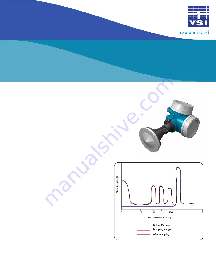
The Nile Radar has the ability to map or profile its path to the surface
of the water by suppressing interference echoes from obstructions
that may cause false echoes. When adding a map to the instrument,
you are creating a threshold that will tell the unit to ignore all false
signals before this threshold. The mapping feature is accessed
through the Nile’s optional display.
The signal from the Nile reflects off everything within its footprint,
which may include the water surface, the riverbank, and part of a
bridge pier. Mapping will eliminate the data points from the bank
and bridge pier so only the reflections from the water surface are
recorded in the data.
Note that mapping does not just blank out the data
above 48 ft; it maps the path of the signal and then
subtracts out those signals above the initial water
surface point. Thus, even if the water rises above the
48 ft point and overtops the banks, the Nile will still
return an accurate water level.
In our example, let’s say the riverbank returns signal
strength of 5 db. When the water rises above the
bank, the Nile will record the 5 db from the bank and
perhaps 30db from the water surface. The graph will
add the 5 db to the 30 db for a total of 35 db where
the water is overtopping the bank. The mapping then
subtracts out the 5db from the bank so it still shows
only the water surface level.
Note: Adding a map will not cause your device to
read incorrectly unless you initially map out the water
surface. Additionally, if a second map is needed after
the initial mapping is performed the initial map must
be deleted first. For instructions on deleting a map see
“Steps to Delete a Mapping” below (page 3).
1
©2016
YSI
+1.937.688.4255
ysi.com/nile
Figure 2
Figure 1


