background image

GPSMAP

®

 A12

Owner’s Manual

Summary of Contents for GPSMAP A12

Page 1: ...GPSMAP A12 Owner sManual...
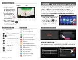
Page 2: ...elm Panoptix Reactor Shadow Drive SmartMode and SteadyCast are trademarks of Garmin Ltd or its subsidiaries These trademarks may not be used without the express permission of Garmin Apple is a tradema...

Page 3: ...8 Navigating to a Point on the Chart 8 Premium Charts 8 Fish Eye 3D Chart View 9 Viewing Tide Station Information 9 Animated Tide and Current Indicators 9 Showing Tides and Current Indicators 9 Showi...

Page 4: ...ilboat Autopilot Operation 22 Wind Hold 22 Setting the Wind Hold Type 22 Engaging Wind Hold 22 Engaging Wind Hold from Heading Hold 22 Adjusting the Wind Hold Angle with the Autopilot 22 Tack and Gybe...

Page 5: ...U Turn Pattern 37 Setting Up and Following the Circles Pattern 37 Setting Up and Following the Zigzag Pattern 38 Following the Williamson Turn Pattern 38 Following an Orbit Pattern 38 Setting Up and F...

Page 6: ...eather Data Broadcasts 46 Changing the Weather Chart 46 Viewing Precipitation Information 47 Storm Cell and Lightning Information 47 Hurricane Information 47 Weather Warnings and Weather Bulletins 47...

Page 7: ...Memory Card 56 Copying Built In Maps to a Memory Card 56 Updating Built In Maps with a Memory Card and Garmin Express 57 Backing Up Data to a Computer 57 Restoring Backup Data to a Chartplotter 57 Sav...

Page 8: ......

Page 9: ...and functions Some buttons are accessible only in a combination page or SmartMode layout or when accessories such as a radar are connected Button Function Clears the on screen icons and re centers th...

Page 10: ...le the device locates satellites It may take 30 to 60 seconds to acquire satellite signals When the device acquires satellite signals appears at the top of the Home screen If the device loses satellit...

Page 11: ...n the station 1 From the home screen select SmartMode Menu Add Layout 2 Select an option To change the name select Name Symbol Name enter a new name and select Done To change the SmartMode symbol sele...

Page 12: ...splash screen on your chartplotter 1 Insert a memory card that contains the image you want to use 2 Select Settings System Sounds and Display Startup Image Select Image 3 Select the memory card slot...

Page 13: ...our mobile device 7 If necessary adjust which notifications you receive in your mobile device settings Receiving Notifications WARNING Do not read or reply to notifications while operating the vessel...

Page 14: ...etwork 3 Enter a password You will need this password to access the wireless network from a wireless device The password is case sensitive Connecting a Wireless Device to the Chartplotter Before you c...

Page 15: ...Charts and 3D Chart Views The charts and 3D chart views that are available depend on the map data and accessories used You can access the charts and 3D chart views by selecting Charts Nav Chart Shows...

Page 16: ...rrected course may pass over land or shallow water Use visual sightings and steer to avoid land shallow water and other dangerous objects NOTE The Fishing chart is available with premium charts in som...

Page 17: ...nd animated current direction indicators on the chart select Animated To enables the tides and current slider which sets the time for which tides and currents are reported on the map select Slider Sho...

Page 18: ...ading information are provided by an activated AIS target but rate of turn information is not provided the projected course of the target is calculated based on the course over ground information Acti...

Page 19: ...nd hides tracks on the 3D chart view Range Rings Shows and configures the appearance of range rings on the 3D chart view Range Rings help you to visualize distances in some chart views Chart Layer Set...

Page 20: ...radient of the bottom with shading This feature is available only with some premium maps Sonar Imagery Shows sonar imagery to help show the density of the bottom This feature is available only with so...

Page 21: ...in Quickdraw Contours Map You can add labels to a Garmin Quickdraw Contours map to mark hazards or points of interest 1 From the Navigation chart select a location 2 Select Quickdraw Lbl 3 Enter text...

Page 22: ...your memory card TIP If you cannot find the file look in the Downloads folder The browser may have saved the file there 9 Remove the memory card from your computer 10Insert the memory card into the c...

Page 23: ...g Go To page 15 How do I make the device guide me along a straight line minimizing cross track to a location using the shortest distance from the present location Build a single leg route and navigate...

Page 24: ...User Data Waypoints 2 Select a waypoint 3 Select Review Edit 4 Select an option To add a name select Name and enter a name To change the symbol select Symbol To change the depth select Depth To chang...

Page 25: ...ou must create and save at least one route 1 Select Info User Data Routes Auto Guidance Paths 2 Select a route 3 Select Navigate To 4 Select an option To navigate the route from the starting point use...

Page 26: ...structions To delete the path select Cancel Auto Guidance To save the path select Done Adjusting a Saved Auto Guidance Path 1 Select Info User Data Routes Auto Guidance Paths 2 Select a path and selec...

Page 27: ...o Guidance line and determine whether the line safely avoids known obstacles and the turns enable efficient travel Auto Guidance maintains a wide clearance from obstacles in open water even if you set...

Page 28: ...oute to a Boundary Before you can convert a route to a boundary you must create and save at least one route Creating and Saving a Route page 17 1 Select Info User Data Routes Auto Guidance Paths 2 Sel...

Page 29: ...ault 1 From the Sail Racing combination screen select Start NOTE You can also access this from the Sailing SmartMode screen and the navigation chart 2 When necessary select Sync to synchronize with th...

Page 30: ...is engaged To adjust the wind hold angle in increments of 1 select or To adjust the wind hold angle in increments of 10 hold or Tack and Gybe You can set the autopilot to perform a tack or gybe while...

Page 31: ...ew you can separately adjust the gain for each frequency If you do not see an arrangement of sonar views to suit your needs you can create a custom combination screen Creating a New Combination Page p...

Page 32: ...rom the current location of the pin select Set Reference Panoptix Sonar Views NOTE Not all models support Panoptix transducers To receive Panoptix sonar you need a compatible chartplotter and a compat...

Page 33: ...h FrontV sonar decreases as your speed rises above 8 knots To see the FrontV sonar view you must install and connect a compatible transducer such as a PS21 transducer You may need to update the transd...

Page 34: ...by adjusting the Interference sonar setting Adjusting the Level of Detail You can control the level of detail and noise shown on the sonar screen either by adjusting the gain for traditional transduce...

Page 35: ...ect an option To adjust the scroll speed automatically using speed over ground or water speed data select Auto The Auto setting selects a scroll rate to match the boat speed so targets in the water ar...

Page 36: ...etting the FrontV Depth Alarm page 30 This alarm is available only with Panoptix FrontV transducers Water Temp Sets an alarm to sound when the transducer reports a temperature that is 2 F 1 1 C above...

Page 37: ...e of an orca whale pod It is your responsibility to use the device in compliance with all applicable laws and ordinances 1 From a sonar view select Menu Frequency 2 Select a frequency suited to your n...

Page 38: ...t a particular area of interest For example you might aim the transducer to follow a bait ball or focus on a tree as you pass it 1 From a LiveV or FrontV sonar view select Menu Transmit Angle 2 Select...

Page 39: ...location This allows you to view the forward distance from the bow instead of the transducer installation location This feature applies to Panoptix transducers in the FrontV LiveV Forward and RealV 3D...

Page 40: ...structions 2 Turn on the chartplotter If necessary the radar warms up and a countdown alerts you when the radar is ready 3 Select Radar 4 Select a radar mode A countdown message appears while the rada...

Page 41: ...the guard zone 5 Select Done MARPA Mini automatic radar plotting aid MARPA enables you to identify and track targets and is primarily used for collision avoidance To use MARPA you assign a MARPA tag...

Page 42: ...n Echo Trails The echo trails feature enables you to track the movement of vessels on the radar display As a vessel moves you can see a faint trail of the vessel s wake You can change the length of ti...

Page 43: ...tter and targets A higher sea clutter setting reduces the appearance of clutter caused by nearby waves but it can also reduce or eliminate the appearance of nearby targets NOTE Depending upon the rada...

Page 44: ...sates for the physical location of the radar scanner on a boat if the radar scanner does not align with the bow stern axis Measuring the Potential Front of Boat Offset The front of boat offset compens...

Page 45: ...not display any data Autopilot Overlay Bar Actual heading Intended heading heading the autopilot is steering toward Actual heading when in standby mode Intended heading when engaged Engaging the Autop...

Page 46: ...cancel a pattern using step steering mode Select Standby Enabling the Autopilot Controls on a Garmin Watch You can control the Garmin autopilot with a compatible Garmin watch Go to www garmin com for...

Page 47: ...r screen prompting you to activate navigation to the man overboard location disappears Man Overboard and SOS Distress Calls Initiated from the Chartplotter When your chartplotter is connected to a Gar...

Page 48: ...s how the gauges pages are displayed and the data in each gauge 1 Open a gauge page 2 Select Menu Edit Gauge Pages 3 Select an option To change the data shown in a gauge select the gauge To change the...

Page 49: ...top the engine when this alert is on If you do you may not be able to restart the engine Water in the fuel Water has collected in the fuel filter fuel separator Stop the engine immediately and consult...

Page 50: ...u can configure the sailing wind gauge to show true or apparent wind speed and angle 1 From the wind gauge select Menu Sailing Wind Gauge 2 Select an option To show true or apparent wind angle select...

Page 51: ...and for the present date and time Select Info Tides Currents Currents Celestial Information You can view information about sunrise sunset moonrise moonset moon phase and the approximate sky view loca...

Page 52: ...a screen select Source NOTE After few moments the compatible FUSION PartyBus stereos appear as sources 2 Select the FUSION PartyBus stereo 3 If necessary select Source and select a different source co...

Page 53: ...lable station in the next ensemble Selecting a DAB Station from a List 1 From the DAB media screen select Browse Stations 2 Select a station from the list Selecting a DAB Station from a Category 1 Fro...

Page 54: ...e on compatible connected stereos and accessories 1 Go to www fusionentertainment com marine and download the software update onto a USB flash drive Software updates and instructions are available on...

Page 55: ...ine forecasts warnings hurricane warnings METARS county warnings weather fronts and pressure centers surface pressure and weather buoys Viewing Forecast Information for Another Time Period 1 Select Ch...

Page 56: ...left of the screen Variations in the visibility shading show the forecast change in surface visibility NOTE This feature is not available on all devices and in all subscriptions Select Charts Visibil...

Page 57: ...ameras provide additional options to control the camera view NOTE Not all options are available on all camera models and chartplotter models Refer to the camera manual for a list of available features...

Page 58: ...mobile device go to the Wi Fi settings on your mobile device and connect to the camera access point using the name and password on the camera screen 5 On your mobile device start the GarminVIRB app T...

Page 59: ...Rotation Allows you to rotate the camera angle Adding the VIRB Action Camera Controls to Other Screens Before you can control a VIRB action camera with the chartplotter you must connect the devices u...

Page 60: ...Select System 3 Select Regulatory Information Preferences Settings Select Settings Preferences Units Sets units of measure Language Sets the on screen text language Navigation Sets navigation prefere...

Page 61: ...eposition the Auto Guidance line unless the destination selected requires navigation through a narrow waterway 8 Select an option If the placement of the Auto Guidance line is satisfactory select Menu...

Page 62: ...is available only with Panoptix FrontV transducers Water Temp Sets an alarm to sound when the transducer reports a temperature that is 2 F 1 1 C above or below the specified temperature Contour Sets...

Page 63: ...a positive number if the sensor connected to the chartplotter measures the water temperature as being colder than it actually is Enter this value in step 5 as a negative number if the sensor connected...

Page 64: ...s from HomePort to a Chartplotter Before you can copy data to the chartplotter you must have the latest version of the HomePort software program loaded on your computer and a memory card installed in...

Page 65: ...ter support you by completing our online registration today Keep the original sales receipt or a photocopy in a safe place 1 Insert a memory card into the card slot Inserting Memory Cards page 2 2 Wai...

Page 66: ...erent cables voids your warranty Through the HDMI OUT port you can duplicate the chartplotter screen on another device such as a television or monitor The Garmin GPSMAP HDMI accessory cable is 4 5 m 1...

Page 67: ...ed Refer to the label on the cable or the installation instructions for the exact fuse size needed Check the fuse to make sure there is still a connection inside of the fuse You can test the fuse usin...

Page 68: ...84 Alert Response 127497 Trip parameters Engine Receive PGN Description 065030 Generator average basic AC quantities GAAC 126983 Alert 126985 Alert text 126987 Alert threshold 126988 Alert value 12699...

Page 69: ...Association NMEA format and sentences from NMEA Seven Riggs Avenue Severna Park MD 21146 USA www nmea org J1939 PGN Information The chartplotter can receive J1939 PGN sentences The chartplotter cannot...

Page 70: ...all user data 20 depth log 43 depth shading 11 12 14 destinations navigation chart 15 selecting 15 detailed maps 56 57 device cleaning 58 registration 57 digital selective calling 38 39 channels 40 co...

Page 71: ...auges 42 sailingstarting line 21 SART 10 11 satellite imagery 9 satellite signals acquiring 2 screen brightness 4 locking 1 unlocking 1 screenshots 59 capturing 59 settings 14 51 52 radar display 36 s...

Page 72: ...2 46 fishing 48 forecast 47 48 overlay 48 precipitation 47 sea conditions 47 48 subscription 46 48 surface pressure 48 visibility 48 water temperature 48 wave information 48 winds 47 Wi Fi 5 Wi Fi tec...

Page 73: ......

Page 74: ...support garmin com December 2018 190 02262 00_0D...

Reviews: