


Reviews:
No comments
Related manuals for GPSMAP 546

AMERICAN STARPOWER X2
Brand: Nady Systems Pages: 2

SingStar 7013539
Brand: Namtai Electronic Pages: 2

PASSPORT P-80
Brand: Fender Pages: 51

Varixx UMS 4401 SPCD
Brand: Grundig Pages: 47

NC-8011
Brand: Daewoo Pages: 44
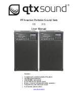
PPA72
Brand: Qtx Pages: 5

GTM 20
Brand: Garmin Pages: 2

DA-E660
Brand: Samsung Pages: 27

AH68-01018B
Brand: Samsung Pages: 23

AH68-02275X
Brand: Samsung Pages: 29

AH68-00935B
Brand: Samsung Pages: 28

AH68-01236A
Brand: Samsung Pages: 28

AH68-01145B
Brand: Samsung Pages: 29

AH68-00939B
Brand: Samsung Pages: 29

CM3430B
Brand: Samsung Pages: 38

DA-F760
Brand: Samsung Pages: 62

AH68-02272Y
Brand: Samsung Pages: 68

inTONE 2.1mini
Brand: Taga Harmony Pages: 6


