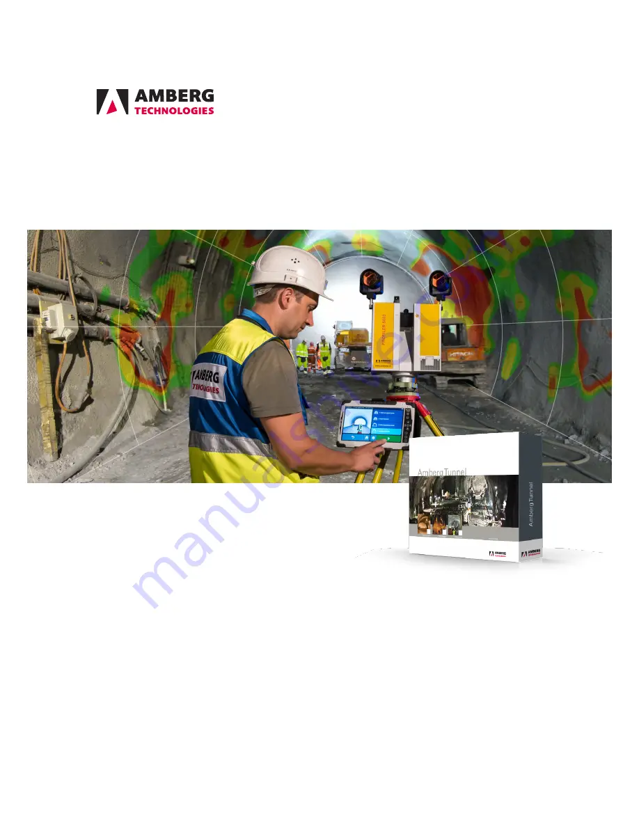
manualshive.com logo in svg
background image

Amberg Tunnelscan

Adding value to your scan data

User manual

30/04/2018 (Application version 2.13)

© Amberg Technologies, 2018

Art.No. 21789

Amberg Technologies AG

Trockenloosstrasse 21

8105 Regensdorf

Switzerland

Phone: +41 44 870 92 22

Mail: [email protected]

http://www.amberg.ch/at

Содержание Tunnel 2.0 - Tunnelscan

Страница 1: ...can data User manual 30 04 2018 Application version 2 13 Amberg Technologies 2018 Art No 21789 Amberg Technologies AG Trockenloosstrasse 21 8105 Regensdorf Switzerland Phone 41 44 870 92 22 Mail support tunnel amberg ch http www amberg ch at ...

Страница 2: ......

Страница 3: ...chronize measurement data with Amberg Navigator Tablet 15 3 3 Import measurement data 15 3 3 1 Import point cloud data 16 3 4 Export measurement data to PTS 16 3 5 Edit measured points 16 3 5 1 Select points with polygon 16 3 5 2 Delete point cloud selection 17 3 5 3 Copy point cloud selection 17 3 5 4 Increase Decrease point cloud density 17 3 5 5 Downsample point cloud 17 3 5 6 Point cloud filte...

Страница 4: ...nalysis settings 48 4 3 4 Reporting 52 4 3 5 Export data 52 4 4 Analysis type Undulation 52 4 4 1 Add analysis wizard 53 4 4 2 Analysis editor 53 4 4 3 Analysis settings 54 4 4 4 Graphical reports 56 4 5 Analyses type High resolution image 57 4 5 1 Add analysis wizard 57 4 5 2 Analysis editor 57 4 5 3 Analysis settings 58 4 5 4 Reporting 59 4 5 5 Export data 59 5 Additional project elements 61 5 1...

Страница 5: ...m a tunnel project Measurement data from various sources can be imported managed analyzed and converted to reports A tight integration with the field software Amberg Navigator Tablet allows an automated data synchronisation On top of the functionality of Amberg Tunnelscan Basic Amberg Tunnelscan Plus offers more analysis types and advanced export functionality 2 Scanner measurements in general Doi...

Страница 6: ...Page 6 of 68 ...

Страница 7: ...Fur ther basic concepts are explained in the chapter Concepts in the manual Amberg Tunnel 2 0 Base 1 2 1 Measurements and construction stages In an Amberg Tunnel project each heading has a Measurements node which handles vari ous types of measurement data Measured point clouds are managed per construction stage allowing comparison between construction stages and easy filtering to keep the overview...

Страница 8: ...ments of this construction stage will be calculated against the one of the original construction stage to derive deviation values 1 2 3 5 Undulation analysis The analysis type Undulation is made for a evenness control of the tunnel surface The user can select one or multiple construction stages to analyse the measured point clouds The mea sured point clouds will be used for evenness calculation of...

Страница 9: ...recommended to create analyses for a certain purpose customize them to your needs and reopen when new measurements need to be evaluated or reports need to be delivered Every time after new measurements have been imported to the project the analysis can be reopened This will automatically recalculate and update all diagrams to the new data All settings remain unchanged to make sure the generated re...

Страница 10: ...Page 10 of 68 ...

Страница 11: ...manual Amberg Tunnel 2 0 Base 2 2 Addresses It is possible to create and manage several sender and recipient addresses including the re spective logos Select them for printing on reports Please find more information about address es in the manual Amberg Tunnel 2 0 Base 2 3 Custom report templates Custom report templates allow to generate reports from the point cloud analysis that have a different ...

Страница 12: ...Page 12 of 68 ...

Страница 13: ...oint clouds editor The graphical area displays a overview of the selected point clouds from the table in top view The measured point clouds table holds all measured point clouds imported to a construction stage In the table each point cloud is listed with its attributes Heading stationing 3D Tun nelmeter Computed average Heading stationing 3D Tunnelmeter value of all points of the measured point c...

Страница 14: ...ject select one or multiple point clouds in the table and press the Delete button at the bottom of the table or in the toolbar 3 1 2 Detail editor The Detail editor is an 3D overview of all measured points of a point cloud Figure 2 Measured point clouds detail editor The graphical area displays the measured point cloud in 3D To remove or edit points from a point cloud select one or multiple points...

Страница 15: ... to Amberg Navigator Tablet or Synchro nise with Amberg Navigator Cloud Select a filename and a target directory to save the at2nav file for the file export to Navigator Tablet If the data transfer should be done via Navi gator Cloud connection please define the Cloud synchronisation settings for the data trans fer in the project tree For more information please see the Amberg Navigator or Amberg ...

Страница 16: ...ormats but is stored in an ASCII file use the flexible ASCII import This option allows to specify the format of the source files 3 4 Export measurement data to PTS Open the Point cloud editor of the construction stage and select the point clouds that should be exported Use the Export to PTS button from the menu the toolbar or the context menu to start the export 3 5 Edit measured points Open the P...

Страница 17: ...enter will have a higher absolute coordinate accuracy the points far away More than 80 percent of the scan points will be in overlapping areas e G Available in a other scans That points can be also filtered to increase the performance of the analyses significant To use the analyses later in a full automatic way it is recommenced to have only two different CS measurements in one scan E g excavation...

Страница 18: ... filter The filters used in the point cloud detail editor and the down sampling of data can be used in the point cloud editor Select one or multiple scans in the list and use the point cloud filter button to input the value for the filtering of all selected scans Input the values for the filter and press OK to start the filter function ...

Страница 19: ...d point cloud from the toolbar or from the context menu Profiles are copied relative to the stationing on the axis This means that you can paste point clouds to a different construction stage or site You can even copy point clouds to a different project if you have two instances of Amberg Tunnel 2 0 running at the same time 3 8 Reposition measured point clouds The point cloud measurement methods l...

Страница 20: ...point cloud type is possible Use the function Reposition button from the toolbar or from the context menu The Reposition point cloud data wizard will guide you through the process The selected point clouds must contain positioning information in order to enable the Reposition measured point cloud function Check the property Repositioning infor mation available in the property window to see if a pr...

Страница 21: ...ep 1 Height Height value of the control point used for resection calculation according to selected date and time in step 1 Date and time Date and time of the control point coordinate used from the Con trol points editors of this project dE Residual of Easting coordinate after resection calculation dN Residual of Northing coordinate after resection calculation dH Residual of Height coordinate after...

Страница 22: ...t wizard 1 Select the corresponding file format GSI ASCII or DBX which contains all positioning mea surements The ASCII file has to contain point id easting northing and height information per row and point Every column is separated by a space Figure 7 APM ASCII file example 2 The program now calculates the position of the rotation center of the first scan file and an orientation only based on the...

Страница 23: ...rgets The steps of the Reposition of the point cloud with checkerboard sphere targets for point cloud data wizard are described following 1 Select the state date and time at which the control point coordinates should be used 2 Mark the center of the targets with manually click to the target center Use the Insert point function in the menu If minimum 3 points with valid control point coordinates ar...

Страница 24: ...his control point for resection calculation Control point Id ID of the control point edit if the name from the positioning infor mation does not match the control points stored in this project Any control point defined in the project may be used Easting Easting value of the control point used for resection calculation according to selected date and time in step 1 Northing Northing value of the con...

Страница 25: ...ides information about the pa rameter If the accuracies are within the required tolerance the status is Ok The repositioning functionality recalculates the point cloud points and replaces the parameters of the point cloud position as displayed in the lower table of the wizard step 3 The workflow for reposition with sphere targets is mostly identical to the point cloud position with checkerboard ta...

Страница 26: ...Page 26 of 68 ...

Страница 27: ...d select Add point cloud analysis from the context menu The New analysis wizard will guide you through the steps described below Figure 11 New analysis wizard 1 On the first wizard page set Line scan as analysis type Enter a name for the analysis optionally add a comment and click Next 2 On the second wizard page select a Reference construction stage that will be used for all axis related calculat...

Страница 28: ...cted Data source construction stages are listed On the left side the status of calculation is visible in different colours grey measurements available red not processed yellow in progress and green for processed sections The processing overview process bar displays the progress of the pro cessing during calculation time 4 1 2 2 Processing Multiple ore single sections can be selected by mouse click...

Страница 29: ...oint cloud All measured points are dis played in the 3D view To navigate within the 3D view there are several methods available Turn Click with your mouse to the 3D graphics and drag Zoom Use the mouse wheel or right click and move the mouse Pan Press the mouse wheel and move the mouse Reset view Use the according buttons from the toolbar Default view Top view Front view Side view Lock rotation Pr...

Страница 30: ...nalysis are listed Figure 13 Settings dialog General settings Selection of construction stages The design data of the selected Reference construction stage is used for all computations in this analysis Option ally theoretical profiles of Additional construction stages can be displayed Select them in the list and change their line color if desired Deviation unit and format The calculated deviation ...

Страница 31: ...ting data typical setting is 0 02 m Filter Use filters to analyses only points within a defined distance range around the theoretical tunnel model Only points within this range will be considered There are two options which can be used separately or combined if this filter is ac tivated Points inside theoretical model with deviation distance bigger than Specify the distance Points between the theo...

Страница 32: ...he report header Addresses Select addresses to be printed on the report Recipient address The selected address is printed in the recipient address field of the report Sender address The selected address is printed in the sender address field of the report Find more information about address management in the manual Amberg Tunnel 2 0 Base Measurement info Input additional information to be printed ...

Страница 33: ... to be used in this analysis You may select from the standard report template and suitable customized templates loaded in the Custom report templates manager see manual Amberg Tunnel 2 0 Base Figure 19 Settings dialog Report Template Template Select the templates for the report types available in the analysis Graphical report template Template used to generate graphical reports from this analysis ...

Страница 34: ... activated the trim angle is applied to the eval uation of this analysis The trim angle section is defined by the center point coordinate relative to the axis and two angle values from angle to angle relative to zenith The geometrical data filters respect the transverse slope definition of the reference construction stage selected for this analysis 4 1 3 8 Visualisation Background Modify the appea...

Страница 35: ...of the displayed point cloud in the analyses Contrast Adjust the contrast of the displayed point cloud in the analyses 4 1 3 10 Visualisation Color maps The calculated deviation values of the measured point cloud to the reference tunnel model can be displayed in various colours Points in different distance ranges to the theoretical tunnel model can be displayed with different colours Use the follo...

Страница 36: ...orts are available Tabular reports and Graphical reports Select the report type that you want to include in your report 4 1 4 1 Tabular reports A tabular report of the analysed point cloud can be generated using the Tabular report button in the toolbar or from the context menu A dialog is shown to select the report to be generated Additional a stationing range or the block definition of the refere...

Страница 37: ...w for each selected section It contains the following data per section Start Heading stationing 3D Tunnelmeter End Heading stationing 3D Tunnelmeter Heading stationing range Reference volume Measured volume Underprofile Overprofile volume 4 1 5 2 Export point cloud to PTS or LAS Export the analysed point cloud to a PTS or LAS file with color or reflectivity values by using the Export to point clou...

Страница 38: ...st Activate this function for the export of profiles at a predefined stationing list Select an ASCII file containing the profile posi tions Each profile position must be listed on a new line Ex ample 512 000 513 000 514 000 515 000 516 000 Filter Use Filters to generate profiles with fixed point spacing There are two options Fixed number of points Select how many points you want have in each extra...

Страница 39: ...functions 4 1 6 1 Show profile view Turns the profile view on A selected cut of the point cloud in the 2D map view can be displayed in 2D The deviation interval in the 2D view is set automatically 4 1 6 2 3D view options Turn the option dialog for the 3D view on 4 1 6 3 Render to image Export an image of the 3D tab view to a PNG image file 4 2 Analysis type Layer thickness The analysis type Layer ...

Страница 40: ...ormat and Stationing mode that you want to use in this analysis If necessary you can change all these settings in the settings dialog later Click Next 3 On the third wizard page you must select two different construction stages as data source Point clouds from the Original construction stage are used to compare the point clouds from the Comparison construction stage against After the wizard has be...

Страница 41: ...view process bar displays the progress of the pro cessing during calculation time 4 2 2 2 Processing Multiple ore single sections can be selected by mouse click in the heading sections interval list Right click in the selected sections displays the processing context menu Following options are available Process all or selected Process all or selected sections with the point clouds to the theoretic...

Страница 42: ...ight click and move the mouse Pan Press the mouse wheel and move the mouse Reset view Use the according buttons from the toolbar Default view Top view Front view Side view Lock rotation Press the E N or H key on your keyboard to lock unlock the rotation around the respective axis If the rotation lock is active this is indicated at the coordinate axes bottom left of the 3D view Set rotation center ...

Страница 43: ...hat are compared against the original state Original construction stage Data source of the point cloud that are used as representation of the original state 4 2 4 Reporting Convert the enhanced measured point cloud data and the derived computations of the analy sis into reports Basically two types of reports are available Tabular reports and Graphical reports Select the report type that you want t...

Страница 44: ...the selected point cloud to a txt file by using the Export to file button in the toolbar or from the context menu Select a filename and a target directory to save the file The txt file can easily be opened in a spreadsheet software for example Microsoft Excel or in any text editor The generated file exists of a header row and following one row for each selected profile It contains the following da...

Страница 45: ...s where the profile should be exported Start stationing Input the start station for the range where the profiles should be exported End stationing Input the end station for the range where the profiles should be exported Interval Input the interval where the profiles should be cre ated Stationing list Activate this function for the export of profiles at a predefined stationing list Select an ASCII...

Страница 46: ...m different scans As an example you can merge different excavation scans from the top heading invert and base together It is also possible to merge different point cloud parts from different construction stages E g Shotcrete layer one and Shotcrete layer two in multiple scans together to create a complete picture of the shotcrete layer one Figure 29 Example Blast Round Scan Figure 30 Example Blast...

Страница 47: ...viation unit and format and Stationing mode that you want to use in this analysis If necessary you can change all these settings in the settings dialog later Click Next 3 On the third wizard page you can select one or multiple construction stages as data source The analysis will take into account all measured point clouds from the selected construction stages After the wizard has been completed a ...

Страница 48: ... from the context menu Analysis settings are saved for each analysis separately To preview your settings without leaving the settings dialogue use the Apply button at the bottom right Some settings offer suitable color options to change the display style Use the color picker to select text fill and stroke color The settings of this analysis type are mostly identical to the ones of the Line scan an...

Страница 49: ... theoretical model with deviation distance bigger than Specify the distance Points between the theoretical model outside and the defined distance will be used Figure 34 Distance to construction stage model filter Mask points Use mask points to analyses only points with maximum or minimum devia tion values to the theoretical model Only points within this range will be con sidered There are two opti...

Страница 50: ...be filled with design points from the reference construction stage model or with in terpolation from neighbour measurements in the grid From design Design points of the construction stage mod el are used From measurements The deviation values for the missing points are calculated from neighbour points based on linear interpolation Interpolation distance Define the maximum size of the missing areas...

Страница 51: ...le From measurements longitudinal Figure 39 Example From measurements lateral Figure 40 Example From measurements lateral Color settings The color for the interpolated areas can be set in the Color maps settings If the color setting for the interpolated areas is set to inactive the normal deviation area colours are used ...

Страница 52: ... can select one or multiple construction stages to analyse the measured point clouds The measured point clouds will be used for evenness calculation of the tunnel surface This analysis is used for quality cheeks of the shotcrete before the membrane system for waterproofing will be applied in the tunnel The surface of the shotcrete should be smooth and even Steel elements such as reinforce ment bar...

Страница 53: ...Deviation unit and format and Stationing mode that you want to use in this analysis If necessary you can change all these settings in the settings dialog later Click Next 3 On the third wizard page you can select one or multiple construction stages as data source The analysis will take into account all measured point clouds from the selected construction stages 4 On the next wizard page select a R...

Страница 54: ... from the context menu Analysis settings are saved for each analysis separately To preview your settings without leaving the settings dialogue use the Apply button at the bottom right Some settings offer suitable color options to change the display style Use the color picker to select text fill and stroke color The settings of this analysis type are mostly identical to the ones of the Line scan an...

Страница 55: ... theoretical model with deviation distance bigger than Specify the distance Points between the theoretical model outside and the defined distance will be used Figure 46 Distance to construction stage model filter Mask points Use mask points to analyses only points with maximum or minimum devia tion values to the theoretical model Only points within this range will be con sidered There are two opti...

Страница 56: ...alculation The undulation is then calculated with the following formula Undulation Distance to the surface Touch length L if touch length is larger than LMin value length L Otherwise LMin is taken instead of L 4 4 4 Graphical reports A graphical report of the analysed point cloud can be generated using the Graphical report button in the toolbar or from the context menu A dialog is shown to select ...

Страница 57: ...uction stage that will be used for all axis related calculations displayed in the diagrams Set Stationing mode that you want to use in this analysis If necessary you can change all these settings in the settings dialog later Click Next 3 On the third wizard page you can select one or multiple construction stages as a data source The analysis will take into account all measured point clouds from th...

Страница 58: ...gs The Analysis settings dialog can be opened by clicking on the Settings button in the toolbar or from the context menu Analysis settings are saved for each analysis separately To preview your settings without leaving the settings dialogue use the Apply button at the bottom right The settings of this analysis type are mostly identical to the ones of the Line scan anal ysis type Therefore this cha...

Страница 59: ...g functionality of this analysis type are mostly identical to the ones of the Line scan analysis type Please see Section 4 1 4 Reporting on page 36 for more information 4 5 5 Export data Export the enhanced point cloud images to use them for further analysis in third party software or in the Amberg Inspection modul 4 5 5 1 Export to image Export information about the selected image to a tiff file ...

Страница 60: ...art and end stationing off the tiff file that should be created Interval Input the interval for the files that should be created Derolement range Define the range along the theoretical model of the reference construc tion stage which should be used The zero point for the derolement is the highest point of the theoretical tunnel model ...

Страница 61: ...5 1 Scan settings During the import from Amberg Navigator Tablet the imported scans are converted to internal format To have also the original scan files in the original format for quality management avail able The scans are stored additionally in the original format to the selected folder ...

Страница 62: ...Page 62 of 68 ...

Страница 63: ...tional transverse slope definition Cross section based anal ysis Geotechnical analysis type for evaluation of measurements per cross section Each cross section is analysed separately Geotechnical cross sec tion Place in the tunnel defined by a heading stationing value where geotechnical measurement points are installed Erroneous measurement Measurement of a geotechnical measurement point that is k...

Страница 64: ...esign data measurements and analyses Con struction view Site Contains tube and shaft headings of a project Construction view Structure Top node for tubes and shafts with chainage axes of the finished structure Structure view Theoretical profile Polyline defining the shape of a tunnel as designed Theoretical section Defines the design of a construction stage by describing which theoretical profile ...

Страница 65: ...enith angle Angle between zenith vertical direction and measurement di rection downwards defined positive Zero measurement First measurement of a geotechnical measurement point after it has been placed or replaced Means that the difference to the previous measurement is not computed because it is not avail able first measurement or not meaningful replaced point Flag can be set ...

Страница 66: ...Page 66 of 68 ...

Страница 67: ......

Страница 68: ...Amberg Technologies AG Trockenloosstrasse 21 8105 Regensdorf Switzerland Phone 41 44 870 92 22 Mail support tunnel amberg ch http www amberg ch at ...

Отзывы: