


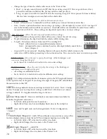


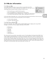


26
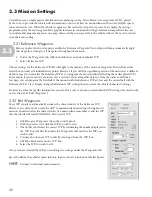
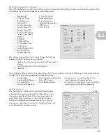
1. Move the overlay map to the top position.
2. Using the black directional arrows on the bottom of the panel, move the base map to the second (lower)
position in the map list directly below the overlay map.
3. Alter the transparency by entering a value 0-100 in the ‘Translucency’ box below the map list. This number
designates what percentage of the map will be transparent. You may also click the up and down arrows to
change the transparency of the map by one digit. When you lower the number, the map becomes more
transparent. (Hint: 50% allows for close to even viewing of both maps.)
3.52 Overlay Missions and Logs
VectorMap allows the user to overlay previous/other mission and logs provided they are in the same map range. You
may use this feature to compare missions side-by-side to decide which one may be best for the desired survey, or you
can overlay the logs in order to see the actual course taken and retrieve precise data from any point in the mission.
Once you import a georeferenced map, (either from file or TerraServer) you can proceed with mission planning,
which will be discussed in the following section. However, you can do some advanced mapping with the ‘Layers’
feature. ‘Layers’ can also be used to evaluate mission data by overlaying log files, which will be covered later in the data
collection section.
Overlay missions:
1. Click file.
2. Select ‘Open Existing Mission’
3. Browse to the desired mission.
4. Click on the file.
5. Click ‘Open.’
This step is very useful when creating an .srp (Safe Return Path) file, as it allows you to simultaneously
examine an origin mission and the Safe Return Path.
Overlay Sonar Files:
1. Open the desired map file(s).
2. Click file.
3. Select ‘Add sonar file…’
4. In the ‘Select Sonar File…’ window, browse through your files until you locate the sonar file(s) you wish to
overlay (.tif files).
5. Click on the file (Ctrl + click to select multiple files or, if you wish to display all sonar files, click the first file
and Shift + click the last file).
6. VectorMap will display the side-scan sonar image on the primary screen area.
Overlay Log Files:
Overlaying logs can be very useful as a diagnostic tool to determine how the vehicle behaved at certain points
throughout the mission. You can click at any point on the line to determine what the vehicle was doing and possibly
ascertain why.
1. Open the desired map file(s).
2. Click file.
3. Select ‘Overlay Log…’
4. In the ‘Overlay log…’ window, browse through your files until you locate the mission log file you wish to
overlay; VectorMap only displays log files in this browser.
5. Click on the file.
6. VectorMap will display a window asking ‘Would you like to load the multimedia directory for this log file?’
7. Click ‘no’ (This will be implemented with the future use of video cameras.)
8. The program may ask you if you still want to view the log although some of the headers do not have related
information. Click ‘yes’ in the window.
9. VectorMap will then display the actual course (log) of the AUV on the primary screen area.
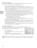
3.5
NOTE