Chapter 7
Using WCDMA/HSPA+ Signal Analyzer
JD700B Series User’s Guide
205
Measurement example
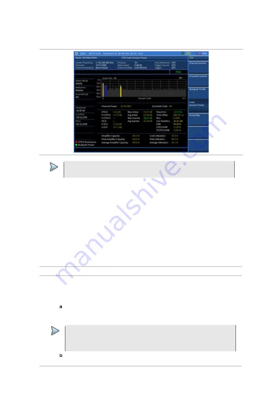
Figure 106 Code domain power measurement with WCDMA/HSPA+ OTA signal analyzer
NOTE
You can use the
LIMIT
hot key to analyze your measurements with the user-definable
limit and Pass/Fail indication.
Route map
The JD700B Series provides the Route Map function that allows you to collect data of points in an indoor or
outdoor environment and track the received signals and coverage of RF transmitters by plotting data real
time directly on top of a loaded floor plan or a map.
The JD700B Series also supports the RAN-IL (Interference Location) feature that enables you to overlay
user experience data obtained through VIAVI ariesoGEO on your base map to help you troubleshoot
problems easily and quickly using your instrument. You can generate raster data files on the ariesoGEO
application and load them on your instrument.
Setting measure setup
Procedure
1
If required, connect a GPS receiver to your JD700B series for outdoor mapping.
Indoor mapping does not necessarily need a GPS antenna.
2
Configure test parameters as described in the “Configuring test parameters” on page 173.
3
To load your map file, complete the following steps:
Plug in your USB drive that has a floor map or
.mcf
file type created in JDMapCreator. If
the JDMapCreator application on your computer is connected to the instrument via USB or
LAN, you can send a map file with a single layer to the instrument directly by using the
Send to EQP
menu in JDMapCreator.
NOTE
The JDMapCreator converts and resizes any scanned floor plan or layout to fit onto your
instrument’s display. JDMapCreator 1.2.0 or later can save a multiple-layered map,
providing
x1
,
x2
, and
x4
views,
as a sizable map file
so that you can zoom in and out
after loading it.
Press
SAVE/LOAD
hot key, and then select
Load > Load Map
. See “Using load” on page
37 for more information.