• Pressing the
[Waypoint]
button will place a waypoint at your vessel’s
current location.
• Pressing the
[Plus]
or
[Minus]
buttons will range in and range out
respectively, centered around your vessel .
Cursor mode
In cursor mode the cursor can be used to select objects onscreen.
Controls behavior:
• Pressing the
[OK]
button opens the context menu for the area or object
directly under the cursor’s position.
• Pressing any button on the
[Directional pad]
moves the cursor in the
respective direction.
• Pressing the
[Waypoint]
button will place a waypoint at your vessel’s
current location.
• Pressing the
[Plus]
or
[Minus]
buttons will range in and range out
respectively.
• Pressing the
[Back]
button will switch back to Motion mode.
Note:
Waypoints are not shown in the Radar app.
Radar app context menu
The Radar context menu provides context sensitive data and menu options.
• The Radar context menu is accessed by
highlighting a location or object onscreen
and pressing the
[OK]
button.
• The context menu provides Latitude,
longitude, range and bearing details for
the selected location or object in relation
to your vessel’s position.
• The context menu provides access to the
VRM/EBL marker control
10.4 Radar modes
The Radar app provides preset modes that can be used to quickly achieve
the best picture depending on your current situation. Only Radar modes
supported by your Radar scanner are shown.
To change radar mode select the required mode from the Radar app menu.
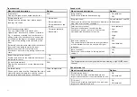
[HARBOR]
Harbor mode takes into account land clutter that is typically
encountered in a Harbor, so that smaller targets are still
visible. This mode is useful when navigating in a Harbor.
[COASTAL]
Coastal mode takes into account slightly higher levels of
Sea clutter that are encountered out of Harbor areas. This
mode is useful when in open water but keeping to coastal
areas.
[OFFSHORE]
Offshore mode takes into account high levels of Sea clutter
so that targets are still visible, useful when navigating in
open water away from the coast.
[WEATHER]
Weather mode optimizes the display to help identify
precipitation, useful for helping determine weather fronts.
10.5 Automatic Identification System (AIS)
support
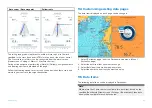
With compatible AIS hardware connected to your display, AIS targets can
be tracked.
AIS equipped vessels that are transmitting their position, and are within range
of your vessel, can be represented in the Radar app using AIS target icons.
Note:
A maximum of 100 AIS targets can be tracked simultaneously. If there
are more than 100 AIS targets within range of your vessel the closest 100
targets will be displayed.
122


