www.northstarnav.com
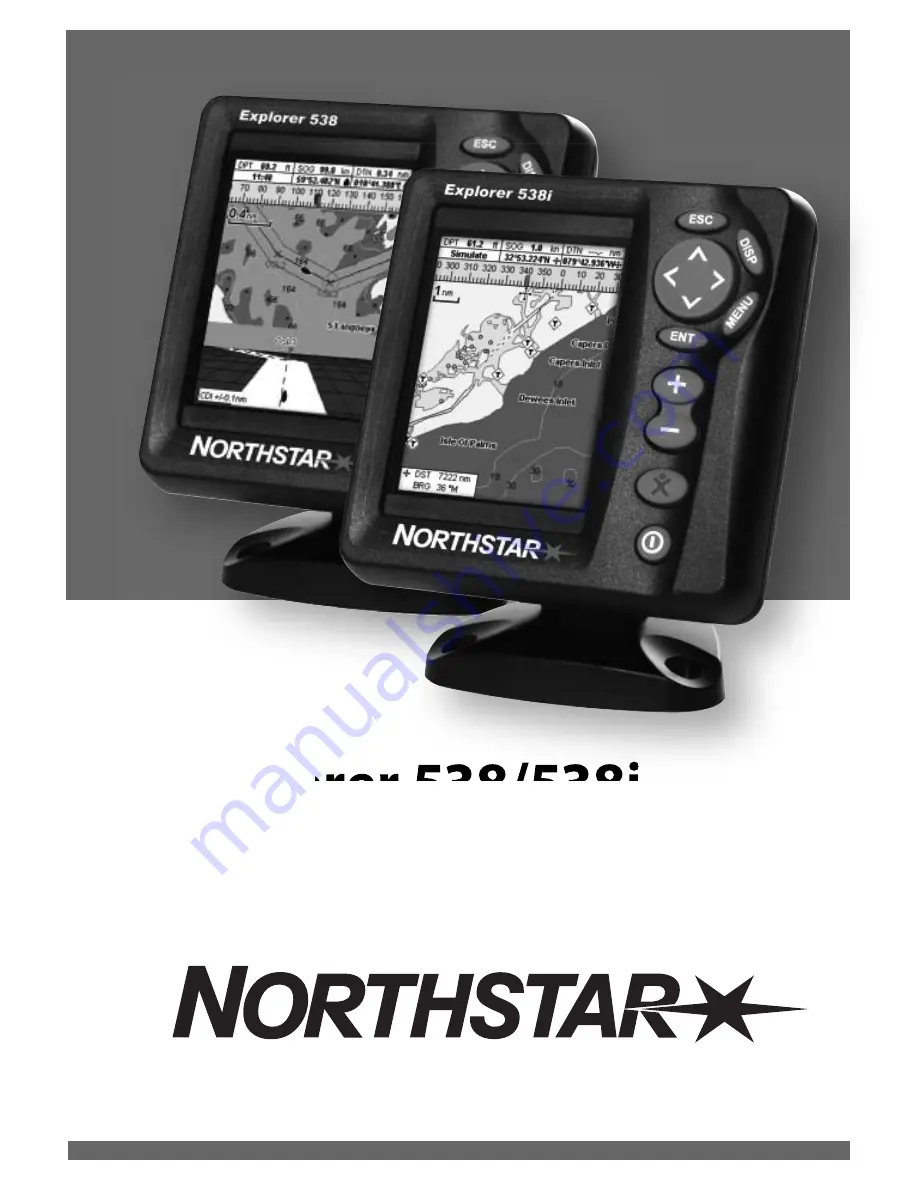
Explorer 538/538i
Chartplotter
Installation and Operation Manual
Page 1: ...www northstarnav com Explorer 538 538i Chartplotter Installation and Operation Manual ...
Page 2: ...d possible injury or death WARNING WARNING indicates a potentially hazardous situation which if not avoided could result in death or serious injury CAUTION CAUTION indicates a potentially hazardous situation which if not avoided could result in minor or moderate injury CAUTION CAUTION used without the safety alert symbol indicates a potentially hazardous situation which if not avoided may result i...
Page 3: ... official government charts supplemented by notices to mariners contain the information required for safe and prudent navigation Always supplement the electronic information provided by Explorer with other plotting sources such as observations depth soundings radar and hand compass bearings Should the information not agree the discrepancy must be resolved before proceeding any further Fuel Computer ...
Page 4: ...d off auto power 10 2 4 Backlight and night mode 11 2 5 Man overboard MOB 11 2 6 Alarms 11 2 7 Simulate mode 12 2 8 The main displays 12 3Navigation Chart 16 3 1 Overview of navigating 16 3 2 Chart display 18 3 3 Distance and bearing calculator 20 3 4 Projected course 21 3 5 Tracks and tracking 21 4Navigation Highwaydisplay 22 5Navigation Waypoints 22 5 1 Waypoints display 23 5 2 Managing waypoint...
Page 5: ...Fuel 44 14 5 Setup Track 45 14 6 Setup Logs 46 14 7 Setup Alarms 46 14 8 Setup Units 47 14 9 Setup Comms 47 14 10 Setup Calibrate 48 14 11 Setup Time 48 14 12 Setup Simulate 48 15Installation 49 15 1 Installation What comes with the Explorer 538 538i 49 15 2 Installation Options and Accessories 49 15 3 Installation The display unit 51 15 4 Installation Power Data cable 52 15 5 Installation GPS ant...
Page 6: ...4 Tracks records of where the boat has been 3 5 GPS receiver status 7 Saving and loading data with a user card 12 User card Chart data Chart features built in world chart 3 2 Chart details 3 2 4 5 C MAP chart Tides at a port 11 C MAP chart Alarms Built in alarms 2 5 SmartCraft engine alarms 1 1 SmartCraft Boat data Data at top of main displays 2 7 2 Compass at top of main displays 2 7 3 Dedicated ...
Page 7: ...line sensors to be installed 1 1Overview SmartCraft engine functions require a SmartCraft system to be installed For information on using SmartCraft see the SmartCraft Gateway Installation and Operation Manual The Explorer can send data to other instruments such as an autopilot and receive data from other instruments For information on installing options see section 15 2 This manual describes how ...
Page 8: ... unit in a dry clean place such as the optional Northstar carry bag Replacing the display unit 1 Remove the dust covers from the connectors Plug the connectors into the back of the display unit Match the connector s Color to the socket Color Knob Mounting bracket Changingtheplug incard Turn the Explorer 538 538i off see section 2 3 Pull the card holder out of the Explorer 538 538i and pull any car...
Page 9: ...tion highlight Show a menu of the options for the current display Press again to display the Setup menu see section 17 Start an action or accept a change Zoom in or out to display different areas and detail on the chart Man overboard MOB see section 2 5 Turn Explorer 538 538i on and off see section 2 3 adjust the backlighting see section 2 4 2 1Usingthekeys In this manual Press means to push the key...
Page 10: ...he menu of options 2 Press or to move the highlight to the option you want then press 2 3Turningonandoff autopower Turning on manually If the Explorer 538 538i is not wired for auto power press to turn the unit on If necessary adjust the display to be easy to read see section 2 4 Note If the Explorer 538 538i is not wired for auto power then the Explorer 538 538i does not record engine hours and m...
Page 11: ...ight mode off Night mode Night mode sets the palette for all displays Normal palette for daytime A palette optimised for night time To change mode select Night mode then press To change only the chart palette see section 17 2 2 5Manoverboard MOB If the NMEA output autopilot is on the Explorer asks if the autopilot is active Select No Use the Explorer 538 538i to manually navigate to the destinatio...
Page 12: ...ctions To start and stop Simulate mode and for more information see section 14 12 In simulate mode Simulate or Demo flashes at the bottom of the display Never have Simulate mode on when the Explorer 538 538i is navigating on the water SmartCraft menu and displays The SmartCraft displays require a SmartCraft system to be installed For information on using SmartCraft see the SmartCraft Gateway Insta...
Page 13: ...Northstar Explorer 538i 538 Installation and Operation Manual 13 Other menu and displays Note Press to go from an Other display back to your last chart display ...
Page 14: ...auges display is not active Yellow border Press Press Yellow border Chart display is not active Gauges display is active The chart and highway displays can show data at the top of the display The data header for each display can be different To change the data header for a display 1 Go to the display press and select Data header 2 To turn the data header off or on i Select Data ii Select or 3 To c...
Page 15: ... symbol in the middle When the boat is navigating to a point the compass also shows bearing to the destination BRG a black symbol In this example BRG is 300 and COG is 320 To turn the compass off or on 1 Press and select Data header 2 Set Compass to or 2 8 3Compass Tip If less than the maximum number of lines of data are used the data will take up less of the display area 5 Press to return to the ...
Page 16: ...e which indicate the maximum expected deviation from the plotted course For more information see appendix C If the Explorer 538 538i is connected to an autopilot the Explorer 538 538i will send data to the autopilot to steer the boat to the destination Start the autopilot before starting to navigate to the point If the Explorer 538 538i has no autopilot steer the boat manually a use the boat posit...
Page 17: ...n the route in turn as described in section 3 1 1 The Explorer 538 538i stops navigating to the waypoint at the end of the current leg and starts the next leg of the route a when the boat comes within 0 025 nm of the waypoint b or when the boat passes the waypoint c or if you skip the waypoint Skipping a waypoint To skip a waypoint go to a chart display press and select Skip The Explorer 538 538i ...
Page 18: ... section 2 8 2 B Compass see section 2 8 3 C Chart scale see section 3 2 3 D Boat position see section 3 2 1 E Boat track see section 3 5 F Boat course and CDI lines see Appendix C CDI The boat is going to the waypoint called FISH06 G Distance and bearing of cursor from boat H Land I Sea J The cursor see section 3 2 1 K A typical waypoint see section 5 Note To change the types of information displ...
Page 19: ...Cursor mode The distance DST and bearing BRG of the cursor from the boat are displayed at the bottom left corner of the display The chart does not scroll as the boat moves If the cursor reaches the edge of the display the chart will scroll For example hold down to move the cursor to the right side of the display and the chart will scroll to the left If the cursor has been moved in the last ten sec...
Page 20: ...ve the new course as a route press and select Save This also saves any new points on the course as new waypoints with default names If necessary edit the route later see section 6 2 2 and edit any new waypoints later see section 5 2 3 7 Finally press to return to the chart display 3 2 5Findingplaces To see places near the boat s position press to switch to centre on boat mode To see places near a ...
Page 21: ...comes full then recording continues and the oldest points in the track are deleted The maximum length of 3 5Tracksandtracking a track depends on the selected track interval a small interval will give a shorter more detailed track and a long interval will give a longer less detailed track as shown in these examples The track lengths are in the current distance units for example nm If Projected cour...
Page 22: ...538 538i can have up to 3000 waypoints A waypoint can be created changed or deleted A waypoint has A name up to eight characters An icon showing what kind of waypoint it is The available icons are A position A color for the waypoint symbol and name on the chart A type Normal A normal waypoint can be navigated to or included in a route Danger A danger waypoint is a point to avoid If the boat comes ...
Page 23: ...that point on the chart 2 Press 3 A new waypoint with the default name and data is created 4 Change the waypoint data if necessary see section 5 2 7 Select Save Creating a new waypoint from the waypoints display 1 In the waypoints display press and select Create 2 A new waypoint with a default name and data is created at the boat position 3 Change the waypoint data if necessary see section 5 2 7 S...
Page 24: ...t display with the selected waypoint at the centre of the chart 5 2 5Deletingawaypoint A waypoint can not be deleted if the boat is navigating to it or if the waypoint is used in more than one route A waypoint that is used in one route can be deleted Deleting a waypoint from the chart display 1 In the chart display move the cursor to the waypoint to delete 2 Press and select Delete 3 Select Yes to...
Page 25: ...es can be created changed and deleted The Explorer 538 538i can have up to 25 routes Each route can have up to 50 waypoints A route can Start and stop at the same waypoint Include waypoints more than once The Explorer 538 538i can navigate along a route in either direction Waypoints on the route can be skipped 6 1Routesdisplay The routes display is a list of the routes that have been entered each ...
Page 26: ... 6 2Managingroutes 6 2 1Creatinganewroute A Creating a new route from the chart display while creating the route Press or to change the range scroll the chart by moving the cursor to the edge of the chart A data box at the bottom left of the display shows the route name and total distance If the cursor is near a leg it shows the length and bearing of the leg as well The legs of a route must start ...
Page 27: ...from the chart 1 In the routes display select the route to edit Press and select Edit on chart 2 The selected route is displayed on the chart with a circle around the first waypoint 3 Edit the route as described in section 6 2 1 A starting at step 4 Editing a route from the routes display 1 In the routes display press or to highlight the route to edit Press and select Edit 2 The selected route is ...
Page 28: ... and are received by the Explorer s standard GPS antenna The accuracy of the corrected GPS position is typically better than 5 m 15 ft for 95 of the time 7 Satellites WAAS covers all of the USA and most of Canada EGNOS will cover most of Western Europe when it becomes operational Differential beacon DGPS Differential beacons are land based radio transmitters that broadcast correction signals that ...
Page 29: ...splays Simulate see section 2 7 B Time and date from GPS satellites Time is local time UTC GMT plus local offset see section 14 11 C HDOP The error in the GPS position caused by satellite geometry A low value indicates a more precise fix a high value a less precise fix D Signal strengths of up to twelve visible GPS satellites The higher the bar the stronger the signal E Boat position F Positions o...
Page 30: ...l flow see section 17 11 Chart Gauges ChangingtheGaugesdisplay 1 Go to the Gauges display and press 2 To select the gauge type i Select Gauge type ii Select Analog round or Digital numbers 3 To select the gauge size i Select Gauge size ii Select Small Medium or Large 4 To change the data displayed i Select Gauge setup ii Change a gauge a Press the cursor keys to highlight the gauge b Press to disp...
Page 31: ...rer otherwise REMAINING RANGE and the low fuel alarm will be meaningless A When you completely fill the tank 1 Fill the tank 2 Press one or more times until the Setup menu is displayed then select Fuel 3 Select Tank full Note Underfloor fuel tanks are often difficult to refill to the same level twice due to air pockets With underfloor fuel tanks Trim the boat to the same angle in the water each ti...
Page 32: ...which to use The choice affects the calculated Range and Economy see section 17 5 Speed source If the Explorer 538 538i uses a paddlewheel sensor to measure speed then the speed must be accurately calibrated Economy The the distance travelled per unit of fuel used The bigger this number the better the fuel economy Adjust the throttle and trim to achieve the best economy Range The estimated boat ra...
Page 33: ... speed for the conditions Fuel consumption curves require engine RPM which requires SmartCraft to be installed Making a fuel consumption curve requires running the boat in a straight line through the engine s full RPM range for about 15 minutes For your first curve choose a calm day with light wind and little current have a typical load and a freshly cleaned hull Then you can make fuel consumption...
Page 34: ...ss and select the name of the curve to display on the fuel display Using a curve Compare your boat s performance now at the current RPMs with the boat s performance when you made the curve You can compare your boat s performance now with a curve made under ideal conditions or with a curve made under similar conditions Information in a curve A RPM of the boat now For a twin engine boat the RPM is t...
Page 35: ...d Select the tide station to display The chart redraws with the tide station centred 4 Press and select Chart info 5 Select Tide height Choosing the date of the tide chart 1 Press 2 Select Today Next day or Prev day To choose a different date from these select Set date edit the date press A Tide station name and distance from boat B Current time and chosen date for display C Tide chart D Night E D...
Page 36: ...ata stored on the user card and shown on the file list is not available to be used by the Explorer 538 538i until loaded into the Explorer 538 538i with the LOAD command see below Saving data to the user card This saves all the Explorer 538 538i s waypoints all the Explorer s routes or one of the Explorer s tracks to one file on the user card 1 Press and select Save 2 Select Waypts Routes or Track...
Page 37: ...sks which route to keep A track file The new track will replace the existing track in the Explorer 538 538i To load a file to the Explorer 538 538i 1 Select the file to load 2 Press and select Load Deleting a file from the user card 1 Select the file to delete 2 Press and select Delete 3 Select Yes to confirm Reading the file information This reads the file names from the user card and displays th...
Page 38: ...the unit using the default settings before making any changes to the data in these menus To go to a setup option menu press one or more times to display the setup menu then select an option Note 1 The Setup menu options are explained in the following sections 2 Section 2 1 describes how to set or change data in the setup menus 3 The setup data available will depend on the optional sensors and inst...
Page 39: ...option menus Factory default settings are shown The setup data available will depend on the optional sensors and instruments installed System see 14 1 Chart see 14 2 Time see 14 11 Alarms see 14 7 Units see 14 8 Comms see 14 9 Logs see 14 6 Track see 14 5 Fuel see 14 4 GPS see 14 3 Calibrate see 14 10 Simulate see 14 12 Water 14 2 Others 14 2 ...
Page 40: ...a worldwide reference datum known as WGS 84 Most paper charts are based on WGS 84 However some paper charts are based on other datums In these cases the latitude and longitude coordinates of objects on the Explorer 538 538i chart display are different to the latitude and longitude coordinates of these objects on the paper chart This applies to all objects such as the boat waypoints tracks lines of...
Page 41: ...Some charts have consistent position errors To correct this apply a map shift After a map shift The positions of cartographic features such as land rocks buoys and depth contours move on the Explorer 538 538i chart display to where they should be The positions of the boat waypoints tracks and lines of latitude and longitude on the Explorer 538 538i chart display remain unchanged Applying a map shi...
Page 42: ...art coverage is available Auto shows the next four detail levels On shows all Text icon size Select the size of chart text and icons Water submenu Water features displays marine sediment labels for example M shows areas of mud and tide station icons Bathymetrics DisplaysunderwaterdepthcontoursbetweenBath sndgs min andmax Spot soundings DisplaysdepthsoundingsbetweenBath sndgs min andmax Bath dndgs ...
Page 43: ...ree minutes to restart The satellite display shows the status of the GPS receiver see section 7 Restart the GPS if the receiver has not been used for some time and is taking a long time to get a GPS fix 14 3Setup GPS StaticNavigation When the boat stops or moves very slowly the calculated GPS speed and course become erratic Static navigation is a number and the options are 0 01 to 99 9 If the boat...
Page 44: ...consumption This is best done using a small portable tank At least 4 gallons 15 litres of fuel should be used to ensure an accurate calibration It is often very difficult to fill underfloor tanks to the same level twice due to air pockets so the more fuel used the more accurate the calibration To calibrate the fuel transducer s perform the following steps 1 Record the level of the fuel in the tank...
Page 45: ...ck Press one or more times until the Setup menu is displayed then select Track Tracking records and displays the boat s course on the chart see section 3 5 Five different tracks can be recorded track 1 has up to 2000 points and tracks 2 3 4 and 5 have up to 500 points each Record Off The Explorer 538 538i tops recording a track 1 to 5 select a track number The Explorer 538 538i starts recording th...
Page 46: ... to the destination or to a waypoint radius than the alarm trigger value Anchor alarm boat moves by more than the alarm trigger value XTE boat moves off course by more than the CDI scale see section 14 2 Danger boat comes closer to a danger waypoint than the alarm trigger value Low fuel fuel remaining equals the alarm trigger value Loss of Explorer 538 538i can not receive the DGPS signal DGPS fix...
Page 47: ...r Northstar instruments through NavBus or any compatible NMEA instrument Press once or more until the Setup menu is displayed then select Comms NMEAout NMEA is generally used with third party instruments see section 15 9 Select this to transmit NMEA sentences for example to an autopilot NMEAdata Use this to specify which NMEA sentences will be transmitted see section 15 9 and Appendix A Lat londps...
Page 48: ...e on Mode There are two choices for Mode 1 Normal Simulates the boat moving from the selected start point at the given speed and heading The options required for Normal are Speed The simulated boat speed to use Course The simulated bearing for the boat to follow Press once or more until the Setup menu is displayed then select Time Localoffset The difference between local time and UTC GMT Change lo...
Page 49: ...moves vary Course to simulate the boat moving off course 2 Demo Simulates a boat moving along a route and automatically displays different Explorer 538 538i functions The options required for Demo are Speed The simulated boat speed to use Route The route to follow Explorer 538 or 538i display unit Dust cover for display unit Blanking caps for unused connectors Power cable Mounting bracket screws i...
Page 50: ... section 18 10 Other instruments The Explorer 538 538i can receive data from other instruments and send data to other instruments by NavBus or NMEA see sections 18 12 and 18 13 Please consult your Northstar dealer for more information Connections GPS antenna Explorer 538 15 5 Power 15 4 External alarms 15 4 NavBus instruments 15 8 NMEA out to instruments 15 9 Petrol gasoline sensors 15 6 NMEA in 1...
Page 51: ...h sea passages Easy to access the 12 V DC power source and convenient to route the transducer cables There are two mounting arrangements 1FlushMounting Requires a solid panel with access behind for wiring and mounting screws After flush mounting the display unit cannot be tilted or moved after installation to reduce any unwanted glare or reflections Carefully select the best viewing position befor...
Page 52: ...ine fuel sensors are installed or if SmartCraft is installed without fuel tank level sensors Otherwise wire for basic power for more information see section 2 2 Basic power Auto power During setup set up Auto power off see sections 2 3 and 17 1 Power data cable Yellow Red Black Ignition Ignition switch Main switch 12 V DC Fuses 2A Power data cable Red Green 2 Wire any external alarm beepers or ligh...
Page 53: ... Explorer 538 538i for different antenna options see section 14 3 For more information contact your Northstar dealer Installinganantenna If an external antenna is required install the antenna and fit the antenna cable back to the display unit Follow the instructions in the manual supplied with the antenna Fit an optional Northstar extension cable if required Connect the Explorer 538 external anten...
Page 54: ... other instruments in the same group If the backlight is changed in an instrument in group 0 then no other instruments are affected If an alarm sounds mute it by clearing the alarm on any instrument which can display that alarm NavBus and the Explorer 538 538i The Explorer 538 538i can Display wind speed and direction from an optional Northstar Wind instrument Receive and display depth from an opt...
Page 55: ...xplorer 538 538i can Receive and display wind speed and direction from an optional compatible wind instrument Receive and display depth paddlewheel boat speed and water temperature from an optional compatible instrument Receive data from an optional compatible GPS or GPS DGPS source Send GPS position and other navigation data to an autopilot or other instrument An autopilot requires APB APA and VT...
Page 56: ...our of 500 points Chart datums 121 Chart datums see next page One user defined map shift Chart scale 0 05 to 4096 nm for chart chart dependent down to 0 01 nm in plotter mode FUEL COMPUTER Optional fuel sensor s required Engine types Outboard carburetted two stroke and EFI petrol gasoline engines 50 to 300 hp Outboard four stroke petrol gasoline engines 90 to 300 hp Inboard petrol gasoline engines...
Page 57: ...sian 1974 Ireland 1965 ISTS 061 Astro 1968 ISTS 073 Astro 1969 Johnston Island 1961 Kandawala Kerguelen Island 1949 Kertau 1948 Kusaie Astro 1951 L C 5 Astro 1961 Leigon Liberia 1964 Luzon M Poraloko Mahe 1971 Massawa Merchich Midway Astro 1961 Minna Montserrat Island Astro 1958 Nahrwan Masirah Is Oman Nahrwan United Arab Emirates Nahrwan Saudi Arabia Naparima BWI North American 1927 North America...
Page 58: ... sections in this manual It is possible in many cases to solve difficulties without having to send the display unit back to the manufacturer for repair Please follow this troubleshooting section before contacting the nearest Northstar dealer There are no user serviceable parts Specialized methods and testing equipment are required to ensure that the display unit is reassembled correctly and is wat...
Page 59: ...lect the correct chart datum see section 14 2 c Map shift has been applied wrongly Clear map shift then reapply if necessary see section 14 2 2 4 Can not see boat on chart Press to switch to centre on boat mode see section 3 2 1 2 5 The time or date on satellite display is wrong or off a No GPS fix b In simulate mode Turn simulate mode off see section 14 12 c Local time offset is wrong see section...
Page 60: ...remove the transducer from the fuel line and gently blow through it in the opposite direction to the fuel flow A fuel filter between the fuel transducer and the fuel tank must be installed as per the fuel installation guide Failure to do so will void the warranty d Inspect the fuel cable from end to end for damage such as cuts breaks trapped or squashed sections e Check that the fuel filter is cle...
Page 61: ...n 7 Leg The straight segments of a route between waypoints A route with four waypoints has three legs MOB Man overboard MOB function Starts navigating back to the place where someone fell overboard see section 2 5 NavBus A way of connecting Northstar instruments together to share data see section 15 8 NMEA National Marine Electronics Association NMEA 0183 A standard for interfacing marine electron...
Page 62: ...on 14 7 an alarm will sound if the boat reaches a CDI line COG Course Over Ground Direction in which the boat is moving over the ground CTS Course To Steer Optimum course to steer to return to the plotted course DTG Distance To Go Distance from the boat to the destination ETA Expected Time of Arrival At the destination assuming that SOG and COG remain constant RNG Range to cursor Distance from boa...
Page 63: ......
Page 64: ...y Belvidere Rd Southampton SO14 5QY ENGLAND Ph 44 2380 339922 Fax 44 2380 330345 northstaruk northstarnav com AUSTRALIA PO Box 479 Gladesville NSW 2111 AUSTRALIA Ph 61 2 9879 9060 Fax 61 2 9879 9009 northstaraus northstarnav com NEW ZEALAND PO Box 68 155 Newton Auckland Auckland NEW ZEALAND Ph 64 9 481 0500 Fax 64 9 481 0590 northstarnz northstarnav com www northstarnav com ...