


GLOSSARY
xliv
NSK North
Stabilization
Kit
N-UP North
up
The north is always pointed to the top center of the radar display.
O
Own track
Display function of own ship’s track
Open Array Antenna
An antenna consisting of arrayed antenna elements, covered with a radome, and rotating
itself.
P
PI Parallel
Index
line
Past positions
Equally time-spaced past position marks of a tracked or AIS target and own ship.
POSN Position
PRF Pulse
Repetition
Frequency
The number of radar pulses transmitted each second.
PROC Process
Radar signal processing function
R
Radar
Acronym for RAdio Detection And Ranging
Radar beacon
A navigation aid which responds to the radar transmission by generating a radar signal to identify
its position and identity
Radar cross-section
Radar cross-section of a target determines the power density returned to the radar for a
particular power density incident on the target
Range Rings
A set of concentric circles labeled by distance from CCRP.
Reference target
A symbol indicating that the associated tracked stationary target is used as a speed
reference for the ground stabilization
Relative course
The direction of motion of a target relative to own ship motion
Relative speed
The speed of a target relative to own ship’s speed data
Relative vector
A predicted movement of a target relative to own ship’s motion
RM Relative
Motion
A display on which the position of own ship remains fixed, and all targets move relative to own
ship.
RM(R) Relative
Motion.
Relative
Trails.
RM(T) Relative
Motion.
True
Trails.
ROT Rate
of
Turn
Change of heading per time unit.
Route
A set of waypoints.
RR Range
Rings
S
SART
Search And Rescue Transponder
Radar transponder capable of operating in the 9GHz band
SBAS Satellite-Based
Augmentation
System
Generic technique for correcting the error of the GPS using the geostationary satellite
This is used for the positioning accuracy of GPS higher.
Sea stabilization
A display mode in which speed and course information are referred to the sea.
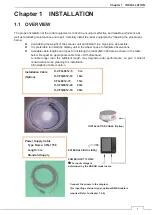
Summary of Contents for JMA-3400 Series
Page 2: ......
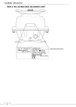
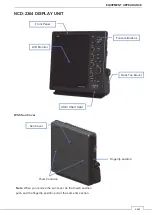
Page 23: ...WARNING LABEL MOUNTING POINT xxi NKE 2103 4 4HS 6 6HS SCANNER UNIT NCD 2364 DISPLAY UNIT ...
Page 31: ...EQUIPMENT APPEARANCE xxix NKE 2043 SCANNER UNIT NKE 2063A AHS SCANNER UNIT ...
Page 32: ...EQUIPMENT APPEARANCE xxx NKE 2103 4 4HS 6 6HS SCANNER UNIT ...
Page 34: ...EQUIPMENT APPEARANCE xxxii Fuse ...
Page 48: ......
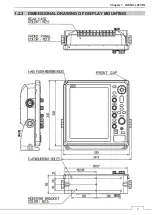
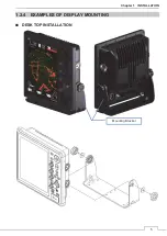
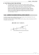
Page 51: ...Chapter 1 INSTALLATION 3 1 2 3 DIMENSIONAL DRAWING OF DISPLAY MOUNTING ...
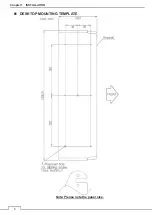
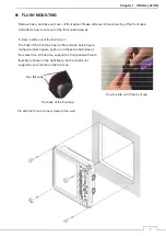
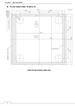
Page 56: ...Chapter 1 INSTALLATION 8 FLUSH MOUNTING TEMPLATE Note Please note the paper size ...
Page 85: ...Chapter 2 THE BASIC OPERATION 37 2 2 OPERATION UNIT ࢫࣆ ձ ղ ճ մ յ ն շ ո չ պ վ տ ւ ջ ռ ս ր ց ...
Page 266: ...Chapter 13 SPECIFICATIONS 218 13 1 SCANNER DIMENSION 13 1 1 NKE 2043 ...
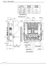
Page 270: ...Chapter 13 SPECIFICATIONS 222 13 2 DISPLAY DIMENSION 13 2 1 NCD 2364 ...
Page 283: ...235 Chapter 13 SPECIFICATIONS MEMO ...
Page 293: ...APPENDIX A 10 MEMO ...
Page 313: ......