background image

2. Introduction

LiPod 3D laser scanner is ground-station LiDAR 3D scanning system with the function of collecting high-precision point

cloud and panoramic images. It can automatically calculate and obtain high-precision true color point cloud data in real

time. It can also obtain highly-precise georeferenced point cloud data. It can be widely used in indoor and outdoor

integrated measurement, underground space information acquisition, tunnel engineering, factory digitalization, mine

digitalization, forestry resource surveying, BIM and other fields.

2.1 Product Name

LiPod Lite 3D Laser Scanner

2.2 Main Technical Parameters

Performance

Parameter

Laser Sensor

Velodyne VLP-16

Laser Safety Classification

Class 1 Eye-Safe

Range Accuracy

±3cm

Sys. Relative Accuracy

2cm

Sys. Absolute Accuracy

5cm

Weight

3.0kg

Dimensions

D150*H375mm

Max Range

100m

Wavelength

903nm

Scan Rate

300,000pts/s

Horizontal FOV

0°~360°

Vertical FOV

-135°~135°

Point Cloud Data format

.las

.laz

.ply

.LiData

.e57

Storage Space

128GB

Ports Available

USB, ethernet port

Battery Capacity

5700mAh

Operating Time

≥2h

Operating Temperature

-10

~40

Camera Type

Wide Field Camera

Pixel

18 mega

Control and Display

UI on mobile devices via WiFi(smartphones and tablets); data transmission over Ethernet cable (tablet)

5

Summary of Contents for LiPod

Page 1: ...User Guide Copyright 1 Safety Warning 2 Introduction 2 1 Product Name 2 2 Major Technical Parameters 3 Product Components 3 1 Laser Scanner 3 2 Camera 3 3 PC 3 4 Wifi Information 4 Workflow 4 1 Prepa...

Page 2: ...2...

Page 3: ...info greenvalleyintl com www greenvalleyintl com Valued Customers Thank you for using LiPod Lite 3D laser scanner We are very pleased to provide you with ground based mobile survey data collection an...

Page 4: ...avoid collision and strong vibration When transporting equipment ensure that all items are properly placed in the protective box Do not transport or move any equipment that is not in the protected sta...

Page 5: ...nd other fields 2 1 Product Name LiPod Lite 3D Laser Scanner 2 2 Main Technical Parameters Performance Parameter Laser Sensor Velodyne VLP 16 Laser Safety Classification Class 1 Eye Safe Range Accurac...

Page 6: ...transfer cable 3 1 Laser Scanner Laser Scanner Velodyne VLP 16 Maximum Range 100m Wavelength 903nm Scan Rate 300 000pts s Horizontal FOV 360 Vertical FOV 15 LiDAR Range Accuracy 3cm Operating Temperat...

Page 7: ...ncy Range 2 4 GHz Protocol IEEE 802 11n Security WPA2 Personal Gateway Address 192 168 12 1 8090 Coonection allowed 1 device Connection Range 5m Wifi SSID LiPod Lite SN default password greenvalley Li...

Page 8: ...of the legs Set up tripod 2 Set up equipment turn the bayonet lock on the tripod counterclockwise and place the main body of the sensor on the tripod base in a point to point manner After it is placed...

Page 9: ...ompartment and you should hear a click indicating that the battery is firmly inserted Insert the battery 5 When trying to connect the battery with the equipment the red dot on the connector of the cab...

Page 10: ...the scanner is 5 10 m for the best data quality It is recommended to set the target spheres in a zigzag row at different elevation the magnet at the bottom of the target sphere can be attached to stre...

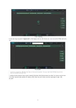
Page 11: ...nterface Note Please use the Google Chrometo connect the equipment other browsers may be abnormal The following figure shows the mobile terminal display interface after successful connection Lidar and...

Page 12: ...seconds When the button starts to flash it means that data collection is started The data collection status can be monitored in real time on the web Web control After checking the device acquisition...

Page 13: ...Start Pic ON Downing Img 13...

Page 14: ...ight will always stay on in web mode It is recommended to try it again if the light is not flashing If you want to stop data acquisition after clicking Start you must wait until the device enters the...

Page 15: ...le Explorer and enter 192 168 1 200 to see projects saved to the Lipod s internal storage Open the share folder s and find the corresponding true color point cloud data e57 file in accordance with the...

Page 16: ...g Wifi connections The first time you enter the share folder please input the username and password username share password 111111 USB transfer When the device is powered on insert the USB disk into t...

Page 17: ...drive before the device is powered on You must insert the USB flash drive after the device is powered on for data copy The following picture shows the true color point cloud data collected and automa...

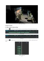
Page 18: ...r left corner of the main interface you can control the display of the status bar above the main interface Status bar display Status bar off Click the button on the upper right corner of the main inte...

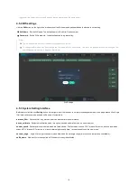
Page 19: ...terface Before data collection click Setting button on the right side of the interface to set pre processing parameters including distance filter Angle filter data collection mode and add suffix name...

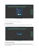
Page 20: ...ear on the right of the page to Clear data Note This operation will clear all the previously collected data please pay attention to backup Clear system memory 4 5 5 System Firmware Update You can cont...

Page 21: ...cation is incorrect or the update package name is changed the system will not recognize the update package 4 5 6 System Version Click the About button on the right side of the interface to view the cu...

Page 22: ...tate displays point clouds 2 if the mobile device has been connected to another device please clear browsing data Why can t the power be turned on after booting and the green button does not light up...

Page 23: ...4 hours with one fully charged battery What are the recommended operation environments and conditions for LiPod Operation of the system should be carried out when ambient temperatures are within the 1...

Page 24: ...and barges construction sites pipelines and powerlines etc All data is displayed in LiDAR360 GVI s all in one software that provides comprehensive LiDAR solutions LiDAR360 supports regular point cloud...

Page 25: ...Elevation View of Indoor Hallway True Color EDL Greyscale View of Buildings 25...

Page 26: ...Forestland Multi station stitched point data of buildings Top View Side View Multi station stitched point data of buildings Greyscale true color display 26...

Reviews: