
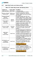
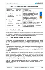
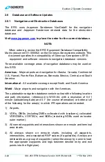
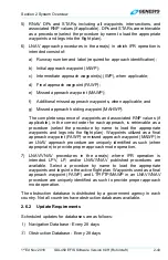


Section 3 Display Symbology
1
st
Ed Nov 2018
IDU-450 EFIS Software Version 8.0H (Rotorcraft)
3-7
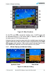
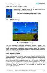
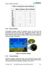
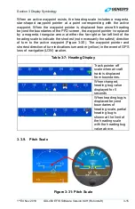
3.2.5. Altitude Display (Metric Units)
Pilot-selectable altitude values are in metric units with a
resolution of 10 meters as depicted.
Figure 3-13: Altitude Display (Metric Units)
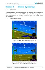
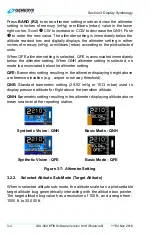
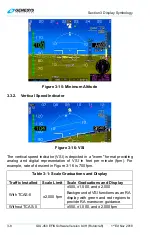
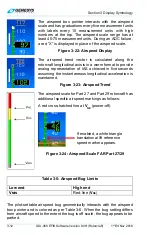
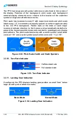
3.3. PFD
Symbology
Figure 3-14: PFD Symbology
The PFD combines pitot-static information, heading, attitude, 3-D
navigation data, and more overlaid on a virtual background of the outside
world. Other objects in the background, including terrain, obstructions,
traffic, and runways are presented conformally as if seen directly in front of
the aircraft while looking outside.
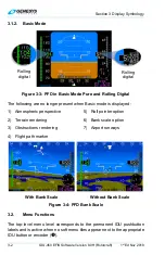
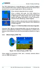
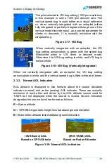
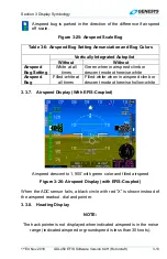
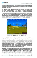
3.3.1. Minimum
Altitude
A user-settable minimum altitude bug consists of a bold yellow line on the
altitude scale and a yellow region on the altitude scale from the minimum
altitude down to ground level. The minimum altitude bug value is displayed
above the altitude scale with a resolution of 10 ft. The minimum altitude bug
can be used in conjunction with a selected altitude or VNAV bug. When a
minimum altitude is set, descending from above to below causes the
“Minimums, Minimums” audible alert and the minimum altitude to turn
amber (yellow) and flash.