
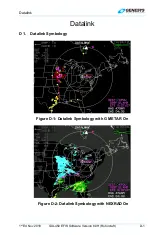


Datalink
D-8
IDU-450 EFIS Software Version 8.0H (Rotorcraft)
1
st
Ed Nov 2018
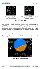
path definition requirements and matches the lateral navigation guidance
on the PFD (GPS/SBAS CDI in automatic OBS mode, skyway boxes, and
mini-map). Active flight plan path fly-over waypoints symbols are distinct
from fly-by waypoints and consist of the waypoint symbol within a circle.
When there is a parallel offset, the active flight plan path depicts the parallel
offset path, and the original flight plan path is shown with haloed gray
dashed lines.
When there is an active waypoint and manual GPS/SBAS OBS setting, the
course through the waypoint is shown as a pointer centered on the
waypoint and matches the lateral navigation guidance on the PFD
(GPS/SBAS CDI in manual OBS mode, skyway boxes, and mini-map).
The active flight plan path’s active leg/manual course and active waypoint
are magenta but turn amber (yellow) in the event of a GPS LON caution.
The datalink page displays airport runways in correct relationship and scale
to the ownship symbol.
D 2.9. Borders
National and United States state borders are drawn in white in correct
relationship to the ownship symbol.
D 2.10.
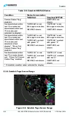
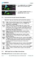
Pan Mode
Use the pan mode to change the location of the center of the page away
from current location and view weather conditions along the route of flight
and at the intended destination or alternate destination. When pan mode is
active, press
NORTH (L3)
,
SOUTH (L4)
,
EAST (R3)
, or
WEST (R4)
to pan
in indicated direction. When pan mode is active, a line is drawn from the
map center to the aircraft's current position, and bearing and distance to
the map center is always displayed above the ownship symbol when the
aircraft is more than 0.5 NM away. If referenced to magnetic north, (as
specified in Section 3 Display Symbology) when panning, the nearest
displayed graphical METAR symbol within the inner range ring is
highlighted with a flashing circle. When such a point is highlighted,
dedicated buttons are present to allow the pilot to view and hide the
waypoint information (including datalink weather information) associated
with that point.
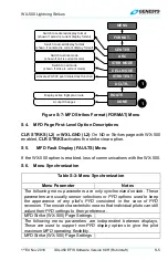
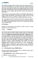
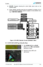
D 3. MFD Datalink Format (FORMAT) Menu
Upon selecting the MFD format menu when in the Datalink page, an option
list appears with the following options:
1)
PAN ON/PAN OFF
: Toggles Datalink page pan mode.
2)
DCLTR..
: Activates option list.