


Section 3 Display Symbology
3-68
IDU-450 EFIS Software Version 8.0H (Rotorcraft)
1
st
Ed Nov 2018
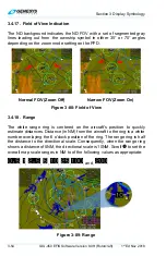
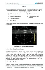
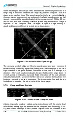
Figure 3-107: Hover Vector Active Flight Plan Path/Parallel Course
3.7.5. Navigation
Data
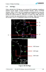
The hover page displays navigation data in correct relationship to the
ownship symbol. Navigation data symbols include airport symbols, VORs,
NDBs, fixes, and user waypoints. The user waypoint symbol on the hover
page includes an outlining box sized so it cannot be obscured by the
ownship symbol. The intent of this requirement is to allow the pilot to hover
by reference to a user waypoint. These symbols cannot be decluttered from
the hover vector page since there is no
FORMAT..
menu option.
The hover page displays airport runways and some heliports in correct
relationship and scale to the ownship symbol. Immediately upon a system
startup on the ground, the runways for the nearest airport are displayed.
Upon activation of a DP, VFR approach, IFR approach, or STAR
procedure, the runways for the airport associated with the procedure are
displayed. In addition, the runways associated with the three nearest
airports are also displayed. Runways are shown in dark gray according to
characteristics contained in the navigation database, including position,
orientation, length, and width. The landing portion of the selected runway,
taking into account displaced threshold data, are shown in light gray.
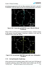
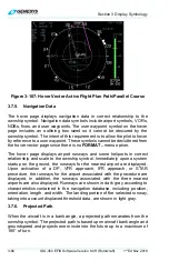
3.7.6. Projected Path
When the aircraft is in a bank angle, a projected path emanates from the
ownship symbol. The projected path is based upon aircraft bank angle and
groundspeed and projects one minute into the future up to a maximum of
180° of turn.