User Data Layer Settings
You can show user data, such as waypoints, boundaries,
and tracks, on the charts.
From a chart, select
Menu
>
Layers
>
User Data
.
Waypoints
: Shows waypoints on the chart and opens the
list of waypoints.
Boundaries
: Shows boundaries on the chart and opens
the list of boundaries.
Tracks
: Shows tracks on the chart.
Other Vessels Layer Settings
NOTE:
These options require connected accessories,
such as an AIS receiver, radar, or VHF radio.
From a chart, select
Menu
>
Layers
>
Other Vessels
.
DSC
: Sets how DSC vessels and trails appear on the
chart, and shows the DSC list.
AIS
: Sets how AIS vessels and trails appear on the chart,
and shows the AIS list.
MARPA
: Sets how MARPA vessels and trails appear on
the chart, and shows the MARPA list.
Details
: Shows other vessel details on the chart.
Proj. Heading
: Sets the projected heading time for AIS-
activated and MARPA-tagged vessels.
Collision Alarm
: Sets the safe-zone collision alarm
Setting the Safe-Zone Collision Alarm
).
Water Layer Settings
From a chart, select
Menu
>
Layers
>
Water
.
NOTE:
The menu may contain some settings that are not
supported by your installed charts or your present
location. If you make changes to those settings, the
changes will not impact the chart view.
NOTE:
Not all settings apply to all charts, views, and
chartplotter models. Some options require premium maps
or connected accessories.
Depth Shading
: Specifies an upper and lower depth to
shade between.
Shallow Shading
: Sets the shades from the shoreline to
the specified depth.
Spot Depths
: Turns on spot soundings and sets a
dangerous depth. Spot depths that are equal to or
more shallow than the dangerous depth are indicated
by red text.
Fishing Contours
: Sets the zoom level for a detailed
view of bottom contours and depth soundings and
simplifies map presentation for optimal use while
fishing.
Relief Shading
: Shows the gradient of the bottom with
shading. This feature is available only with some
premium maps.
Sonar Imagery
: Shows sonar imagery to help show the
density of the bottom. This feature is available only with
some premium maps.
Lake Level
: Sets the present water level of the lake. This
feature is available only with some premium maps.
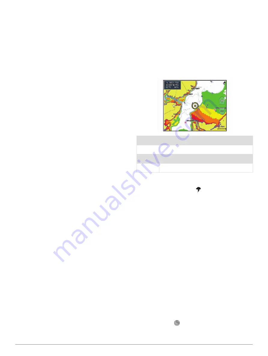
Depth Range Shading
You can set color ranges on your map to show the water
depths where your target fish are currently biting. You can
set deeper ranges to monitor how quickly the bottom
depth changes within a specific depth range. You can
create up to ten depth ranges. For inland fishing, a
maximum of five depth ranges can help reduce map
clutter. The depth ranges apply to all charts and all bodies
of water.
Some Garmin LakeVü
™
and premium supplemental
charts have multiple depth range shading by default.
Red
From 0 to 1.5 m (from 0 to 5 ft.)
Orange
From 1.5 to 3 m (from 5 to 10 ft.)
Yellow
From 3 to 4.5 m (from 10 to 15 ft.)
Green
From 4.5 to 7.6 m (from 15 to 25 ft.)
Weather Layer Settings
From the Navigation or Fishing chart, select
Menu
>
Layers
>
Chart
>
Weather
> .
From a weather chart, select
Menu
>
Layers
>
Chart
>
Weather
.
Observed Layers
: Sets which observed weather items
are shown. Observed weather is the present weather
condition that are visible now.
Forecast Layers
: Sets which forecasted weather items
are shown.
Layer Mode
: Shows forecasted or observed weather
information.
Loop
: Shows a loop of forecasted or observed weather
information.
Legend
: Shows the weather legend, with the severity of
the conditions increasing from left to right.
Weather Subscription
: Shows weather subscription
information.
Restore Defaults
: Resets the weather settings to factory
default values.
Edit Overlays
: Adjusts the data shown on the screen
).
Radar Overlay Settings
From the Navigation or Fishing chart, select
Menu
>
Layers
>
Radar
>
.
From a radar screen, select
Menu
.
Radar To Standby
: Stops radar transmission.
18
Charts and 3D Chart Views


