background image

About Exit Services

While you navigate a route, you can find gas, food, lodging, and 

restrooms near upcoming exits.
Services are listed under tabs by category.

Gas

Food

Lodging

Restrooms

Navigating to an Exit

1

From the map, select   > 

Exit Services

 >  .

2

Select 

Go!

.

Finding Upcoming Points of Interest

1

From the map, select   > 

Up Ahead

.

2

Select a tab.

3

Select a point of interest.

Avoiding Road Features

1

Select 

Settings

 > 

Navigation

 > 

Avoidances

.

2

Select the road features to avoid on your routes, and select 

Save

.

Avoiding Transit Types

NOTE: 

Transit types are available when cityXplorer™ maps are 

loaded.

1

Select 

Settings

 > 

Navigation

 > 

Public Transit

.

2

Select the transit type to avoid on your routes, and select 

Save

.

Navigating Off Road

If you are not following roadways as you navigate, you can use 

Off Road mode.

1

Select 

Settings

 > 

Navigation

.

2

Select 

Calculation Mode

 > 

Off Road

 > 

Save

.

The next route will be calculated as a straight line to the 

location.

Pedestrian Routes

Following a Pedestrian Route

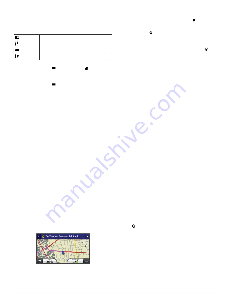
In Pedestrian mode, your route is displayed on a two-

dimensional map.

NOTE: 

cityXplorer maps are not included with the device. Go to 

http://my.garmin.com

 to purchase cityXplorer maps.

NOTE: 

You can change the types of public transit and limit the 

distance spent walking during a pedestrian route.

Using the Pedestrian Navigation Map

• Select 

À

 to switch between sections of the route.

• Select 

Á

 to view the route itinerary.

Pedestrian Map Icons

• When you are navigating in Pedestrian mode,   indicates 

your approximate position and your direction of travel on the 

map.

• The circle around   indicates the accuracy of your position 

on the map. A smaller circle means the displayed position is 

more accurate.

• The yellow icons indicate the navigation method used in 

each section of the route. For example, when you see  , 

you should board a bus at that point in the route.

• The black dots on the map indicate public transit stops along 

your route.

Map Pages

Customizing the Map Layers

You can customize which data appear on the map, such as 

icons for points of interest and road conditions.

1

Select 

Settings

 > 

Map & Vehicle

 > 

Map Layers

.

2

Select the layers to include on the map, and select 

Save

.

Viewing the Trip Log

Your device keeps a trip log, which is a record of the path you 

have traveled.

1

Select 

Settings

 > 

Map & Vehicle

 > 

Map Layers

.

2

Select the 

Trip Log

 check box.

Changing the Map Data Field

1

From the map, select a data field.

NOTE: 

You cannot customize 

Speed

.

2

Select a type of data to display.

3

Select 

Save

.

Changing the Map Perspective

1

Select 

Settings

 > 

Map & Vehicle

 > 

Driving Map View

.

2

Select an option:
• Select 

Track Up

 to display the map in two dimensions (2-

D), with your direction of travel at the top.

• Select 

North Up

 to display the map in 2-D with north at 

the top.

• Select 

3-D

 to display the map in three dimensions.

Customizing Map Buttons

You can include up to three icons on the right side of the main 

map.

1

Select 

Settings

 > 

Map & Vehicle

 > 

Map Buttons

.

2

Select an icon, and select 

OK

.

3

Select  .

4

Select a different icon.

Changing the Map Dashboard

The dashboard displays trip information at the bottom of the 

map. You can select different dashboards to change the style 

and the layout of the information.

1

Select 

Settings

 > 

Map & Vehicle

 > 

Dashboards

.

2

Use the arrows to select a dashboard.

3

Select 

Save

.

Viewing a List of Turns

While navigating a route, you can view all of the turns and 

maneuvers for your entire route and the distance between turns.

Map Pages

5

Summary of Contents for nuvi 140 series

Page 1: ...n vi 140 150 series Owner s Manual March 2014 190 01517 00_0D Printed in Taiwan...

Page 2: ...t Garmin n vi and the Garmin logo are trademarks of Garmin Ltd or its subsidiaries registered in the USA and other countries These trademarks may not be used without the express permission of Garmin B...

Page 3: ...Transit Types 5 Navigating Off Road 5 Pedestrian Routes 5 Following a Pedestrian Route 5 Using the Pedestrian Navigation Map 5 Pedestrian Map Icons 5 Map Pages 5 Customizing the Map Layers 5 Viewing t...

Page 4: ...g Theft 11 Erasing User Data 11 Extending the Battery Life 11 Changing the Fuse in the Vehicle Power Cable 11 Mounting on Your Dashboard 11 Removing the Device from the Mount 11 Removing the Suction C...

Page 5: ...ides quarterly map updates for the useful life of your device For terms and conditions go to www garmin com us maps numaps _ lifetime LMT This model includes a n Maps Lifetime subscription lifetime tr...

Page 6: ...To Remove Shortcut s 2 Select the shortcut to remove 3 Select the shortcut again to confirm Finding Locations Locations The detailed maps loaded in your device contain locations such as restaurants h...

Page 7: ...c category of places Location markers or a blue dot appear on the map 4 Select an option Select a location marker Select a point such as a street intersection or address location 5 If necessary select...

Page 8: ...location 3 Select Go Starting a Route to a Saved Location 1 Select Where To Saved 2 If necessary select a category or select All Saved Places 3 Select a location 4 Select Go Previewing Multiple Routes...

Page 9: ...smaller circle means the displayed position is more accurate The yellow icons indicate the navigation method used in each section of the route For example when you see you should board a bus at that...

Page 10: ...ervices You can use the Where Am I page to find nearby services such as fuel hospitals or police stations 1 From the map select the vehicle 2 Select a category Using the Apps Using Help Select Apps He...

Page 11: ...p leg select a leg and select Transportation Mode To view the trip on the map select Map Navigating to a Saved Trip 1 Select Apps Trip Planner 2 Select a saved trip 3 Select Go 4 Select your next dest...

Page 12: ...For information about traffic receivers and coverage areas go to www garmin com traffic A traffic receiver is included in some packages built into either the vehicle power cable or the device and is a...

Page 13: ...I files from Garmin POI Loader Installing POI Loader About Memory Cards You can purchase memory cards from an electronics supplier or purchase pre loaded Garmin mapping software www garmin com In addi...

Page 14: ...fuel than other routes Off Road Calculates a direct line from your location to your destination Display Settings To open the Display settings page from the main menu select Settings Display Color Mod...

Page 15: ...Yes to erase all user data All original settings are restored Extending the Battery Life Keep your device away from extreme temperatures Put the device in sleep mode Entering and Exiting Sleep Mode D...

Page 16: ...safety camera information For some devices and regions basic safety camera data may be included with your device Included data does not include updates or a subscription Custom Points of Interest Cust...

Page 17: ...device to fully discharge 2 Fully charge the device without interrupting the charge cycle My device does not appear as either a portable device or a removable drive or volume on my computer 1 Disconn...

Page 18: ...view 6 K keyboard 2 language 10 layout 10 L language 8 keyboard 10 voice 10 latitude and longitude 3 lifetime maps 1 locations 2 3 7 current 4 6 editing 2 recently found 3 saving 3 searching for 3 set...

Page 19: ...bscriptions 1 searching for delays 8 9 transportation modes 2 travel history 11 trip computer 6 trip information resetting 6 viewing 6 trip log viewing 5 trip planner 7 editing a trip 7 troubleshootin...

Page 20: ...02 36 699699 52 001 855 792 7671 0800 0233937 47 815 69 555 00800 4412 454 44 2380 662 915 35 1214 447 460 386 4 27 92 500 0861 GARMIN 427 646 27 0 11 251 9999 34 93 275 44 97 46 7744 52020 886 2 2642...

Reviews: