


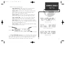

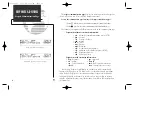


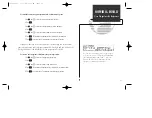


User Waypoint Information
In addition to the airport, VOR, NDB and intersection waypoints contained in your
NavData® card, the GPS 165 allows you to store up to 1,000 user-defined waypoints.
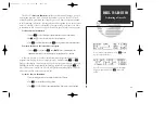
Once a user waypoint is created, two user waypoint pages will display the following
information:
• Waypoint identifier
• Position in latitude and longitude
• Identifier, range and bearing from a reference waypoint
• User comments
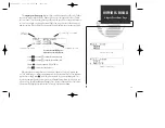
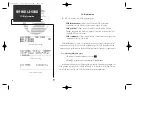
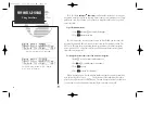
To scroll between the user waypoint position page and the user comments page,
rotate
O
. User waypoints may be created or modified using the
W
key. After select-
ing the waypoint identifier, as shown on page 25, you will be prompted to enter infor-
mation if the waypoint is new. There are three ways to create a user waypoint’s position
from the
W
key:
1. Enter the exact position of the new waypoint.
2. Reference a known waypoint.
3. Enter a range and bearing from your current position.
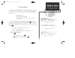
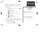
To create or edit a user waypoint:
1. Press
W
.
2. Use
O
to highlight the ‘user?’ field. Press
E
.
3. Use
K
and
O
to enter the waypoint identifier. Press
E
.
35
WAYPOINTS & DATABASE
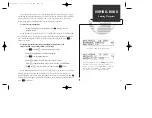
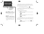
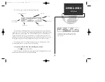
User Waypoint Overview
User Waypoint Comments Page.
User Waypoint Position Page.
Entering a user waypoint name.
165 manual 7/13/98 3:59 PM Page 35
Summary of Contents for GPS 165TSO
Page 2: ...165 manual 7 13 98 3 58 PM Page ii ...
Page 20: ......
Page 75: ......
Page 87: ......
Page 120: ...165 manual 7 13 98 4 00 PM Page 110 ...
Page 130: ...165 manual 7 13 98 4 00 PM Page 120 ...