3-6
Garmin G500H Pilot’s Guide
190-01150-02 Rev. J
For
ewor
d
Sec 1 System
Sec 2
PFD
Sec 3
MFD
Sec 4
Hazar
d
Avoidance
Sec 5
Additional Featur
es
Sec 6
Annun. & Alerts
Sec 7
Symbols
Sec 8
Glossary
Appendix A
Appendix B
Index
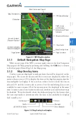
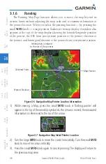
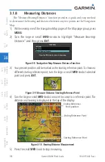
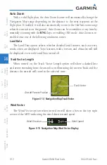
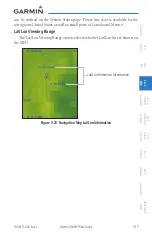
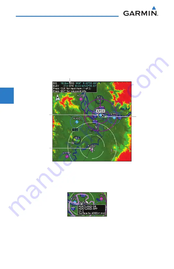
3.1.6 Panning
The Panning Map Page function allows you to move the map beyond its
current limits without adjusting the map scale and to examine information at
the pointer location. When you select the panning function — by pressing the
small
MFD
knob — a target pointer flashes on the map display. A window also
appears at the top of the map display showing the latitude/longitude position
of the pointer, the ETE from your present position to the pointer, elevation at
the pointer, and bearing and distance to the pointer from your present position.
Information is related
to the tip of the pointer
Selected Point
Map Pointer
Present Position
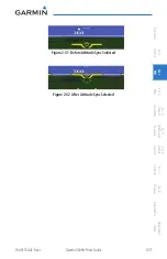
Figure 3-6 Navigation Map Pointer Location Information
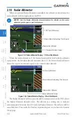
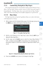
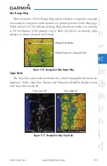
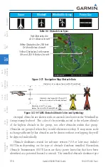
1) While viewing a Map, press the small
MFD
knob. A flashing pointer will
appear in the tip of the ownship symbol. As the arrow is moved, the measured
information is referenced to the tip of the arrow.
Figure 3-7 Navigation Map Initial Pointer Location
2) Turn the large
MFD
knob to move the cursor horizontally. Turn the small
MFD
knob to move the cursor vertically.
3)
Press
the small
MFD
knob again to cancel panning. The display will return to
the previous map view.
Summary of Contents for G500H
Page 1: ...G500H Pilot s Guide ...
Page 365: ......