7-6
Pilot’s Guide
190-01717-10 Rev. H
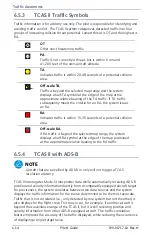
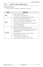
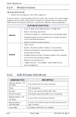
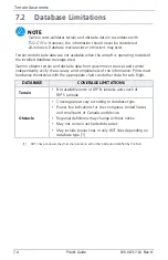
Terrain Awareness
AUTOMATIC ZOOM
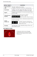
DISPLAY OBJECT
FUNCTION
Page Orientation
Label
Normally, Heading Up orientation.
Changes to Track Up in the event of a heading failure.
GSL Altitude
Displays current GPS height above mean sea level. Pilot
selectable units are available on the System Units page.
Legend
Displays color designations for terrain and obstacle relative
altitude ranges.
Terrain Function
Identifier
Indicates the active terrain function. Includes:
Terrain
Overlay Icon
Indicates when power lines or obstacles are present at the
current zoom scale.
Menu Key
Provides access to pilot selectable settings, self-test, and
alert inhibit functions.
TAWS-A, TAWS-B,
(H)Terrain-FLTA, Terrain Proximity
Automatic removal of obstacle and
power line data occurs at range scales
greater than 10 nm.
In the event an alert occurs, the page
automatically zooms to provide the best
depiction of that alerted terrain, obstacle,
or power line.
Summary of Contents for G500
Page 1: ...G500 H G600 G700 TXi Pilot s Guide ...
Page 12: ...x Pilot s Guide 190 01717 10 Rev H INTENTIONALLY LEFT BLANK ...
Page 110: ...1 82 Pilot s Guide 190 01717 10 Rev H INTENTIONALLY LEFT BLANK ...
Page 118: ...2 8 Pilot s Guide 190 01717 10 Rev H Primary Flight Display Reference Controls Menu Options ...
Page 244: ...4 48 Pilot s Guide 190 01717 10 Rev H INTENTIONALLY LEFT BLANK ...
Page 272: ...5 28 Pilot s Guide 190 01717 10 Rev H Weather Awareness 5 23 1 SiriusXM Weather Setup ...
Page 276: ...5 32 Pilot s Guide 190 01717 10 Rev H Weather Awareness 5 24 2 FIS B Weather Setup ...
Page 280: ...5 36 Pilot s Guide 190 01717 10 Rev H Weather Awareness 5 25 4 Connext Weather Setup ...
Page 354: ...7 34 Pilot s Guide 190 01717 10 Rev H INTENTIONALLY LEFT BLANK ...
Page 439: ......
Page 440: ...190 01717 10 Rev H ...


