Appendix A: Specifications
98-169085-B
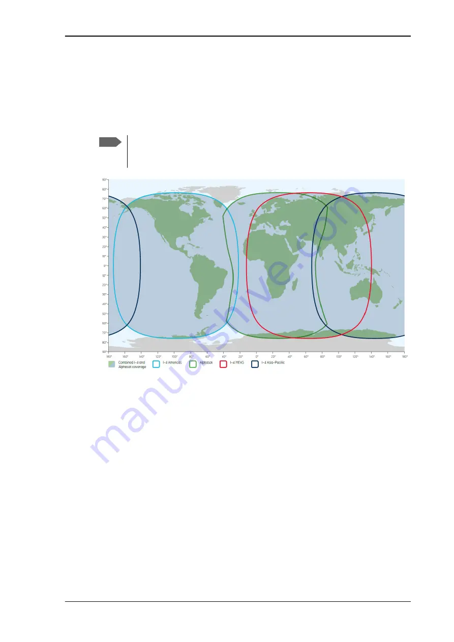
Satellite coverage
117
Satellite coverage
The Inmarsat
BGAN services are based on geostationary satellites situated above the equator.
Each satellite covers a certain area (footprint). The coverage map below shows the footprints
of the BGAN system. For updated information on coverage, see Inmarsat’s home page at
Note
In low elevations (below 20°), performance is limited. This means that 64 kbps is not
available and max. data rates for Standard data are lower, that is 270 kbps down/
158 kbps up instead of 284 kbps down/ 225 kbps up.


