


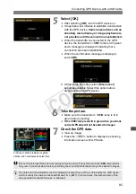


83
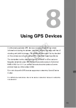
Using GPS Devices
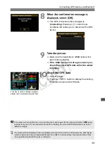
Commercially available GPS devices connected via USB can obtain
information including the latitude, longitude, altitude, and date and time of
shooting and add it to images. The additional information can be checked
on the camera as well as by using GPS-compatible mapping software.
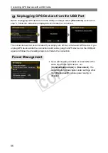
The transmitter can be used with Garmin GPSMAP or eTrex series or
Magellan eXplorist series GPS devices that produce data in the format
NMEA 0183 Ver. 3.0.1, as well as some devices that produce Garmin
protocol data (as of November 2009).
For a list of specific GPS devices supported, contact the Canon Service
Center.
For GPS device instructions, refer to the device’s instruction manual or contact the
manufacturer.
COP
Y
Summary of Contents for Wireless File Transmitter WFT-E2 II A
Page 14: ...14 COPY ...
Page 28: ...28 COPY ...
Page 42: ...42 COPY ...
Page 48: ...48 COPY ...
Page 60: ...60 COPY ...
Page 65: ...65 Managing Settings Information COPY ...
Page 91: ...91 Troubleshooting COPY ...
Page 108: ...108 COPY ...
Page 109: ...109 Reference COPY ...
Page 113: ...113 COPY ...
Page 114: ...114 COPY ...
Page 115: ...115 COPY ...


