


A-1
Appendix A. CSAT3B Orientation
A.1 Determining True North and Sensor Orientation
The orientation of the CSAT3B negative x-axis is found by reading a magnetic
compass and applying the site-specific correction for magnetic declination;
where the magnetic declination is the number of degrees between True North
and Magnetic North. Magnetic declination for a specific site can be obtained
from a USGS map, local airport, or through a NOAA web calculator
Online Magnetic Declination Calculator
(p. A-3)
). A general
map in FIGURE
taken from
www.ngdc.noaa.gov/geomag/img/DeclinationMap_US.png
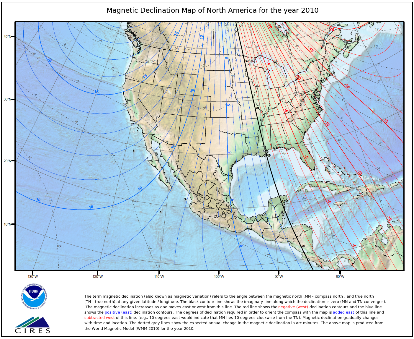
declination for the conterminous United States in 2010.
FIGURE A-1. Magnetic declination for the conterminous United States
(2010)