Field tested by
Teton County Search and Rescue.
Page 1
The indispensable link between
map, compass and GPS.
SIMPLE
!
ACCURATE
!
COMPACT
!
FIELD EFFECTIVE
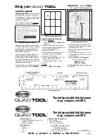
Map Datum Designation (Figure 1)
Latitude/Longitude Scale
Using your
QUAD
TOOL
The indispensable link between
map, compass and GPS.
Find positions in:
"
Universal Transverse Mercator (UTM)
"
Latitude & Longitude
"
Range & Township
Plot distance in:
"
Meters
"
Kilometers
"
Feet
"
Miles
Compute slope steepness for:
"
Route Finding
"
Avalanche Prediction
"
20, 40 or 80-foot Contours
For USGS 7.5 minute series,
1:24,000 scale only.
Printed on flexible, sturdy plastic with
protective no-glare finish. 7.6” x 1.7”
BRUNTON
QUAD
TOOL
For use with 1:24,000 scale maps.
QUAD
TOOL
©
©
QUAD
TOOL
©
USGS Topographic Map (Figure 2)
UNITED STATES
DEPARTMENT OF THE INTERIOR
GEOLOGICAL SURVEY
SWEETWATER GAP QUADRANGLE
WYOMING
7.5 MINUTE SERIES (TOPOGRAPHIC)
42'30"
40'
42˚37'30"
42˚45'
42'30"
40'
42˚37'30"
109˚07'30"
5'
2'30"
109˚07'30"
5'
2'30"
42˚45'
109˚00'
109˚00'
N
Distance Scale - Feet
Range and Township Grid Tool
Distance Scale - Mile
Slope Angle
UTM Tool / Metric Scale
Latitude-Longitude
Latitude-Longitude
(lat./long.) is a spherical
coordinate system. A position on Earth is mea-
sured in degrees (
o
), minutes ( ‘ ) and seconds
( “ ), and starts from 0
o
latitude (Equator) and 0
o
longitude (Prime Meridian).
For GPS receiver use, identify the map datum at
the lower-left corner on the map, (Figure 1).
Map datums were created because the Earth is
not a perfect sphere and corrections for mapping
are needed. When using a map with no map
datum identified use World Geodetic System
1984 (WGS-84) map datum.
All USGS topographic maps are bound by 7.5
minutes of latitude and longitude, and each cor-
ner is identified in lat./long. Latitude-longitude
tick marks are positioned every 2’30” around the
map (Figure 2). The crosses in the center of the
map indicate intersection points.
All of the examples use a 1:24,000 scale, USGS,
topographic map and the
QUAD
TOOL
.
Latitude-Longitude Positioning
1. Document map datum.
·
1927 North American Datum (
NAD-27us
)
(Figure 1)
2. Identify the black lat./long. tick marks, and
draw lines connecting equal value ticks to pro-
duce 9 small rectangles (Figure 2).
3. Mark position with an “
X
”.
4. Place the lat./long. scale vertically so its “0” is
at the bottom of one of the rectangles
and next to the “
X
” (Figure 3)
5. At the “
X
”, add the scale value (1’ 23”) to the
line at the latitude line (42
°
42’ 30”).
·
Add values similar to time on a clock.
42
°
42’ 30”
+ 01’ 23”
42
°
43’ 53” =
42
°°
43’ 53” N. Latitude
42
°
42’30”
42
°
45’00”
1’23”
Latitude Measurement (Figure 3)
6. Tilt lat./long. scale to the left until its “0” is at
the right, and its 2’30” touches the left side of
the rectangle (Figure 4, pg. 2).
7. Slide scale up or down until it lies next to the
“
X
” (Figure 4).
8. At the “
X
”, add the scale value (1’ 01”) to the
lowest longitude value (109
°
05’ 00”), same as
step # 5 above.
9. Longitude =
109
°°
06’ 01” W. Longitude
Final Lat. / Long. Coordinate is:
42
°°
43’ 53” N. Lat..
109
°°
06’ 01” W. Long.
Set GPS to
NAD-27us
map datum before enter-
ing coordinate.


