IFD400 Series Pilot Guide
Map Subsystem
3-5
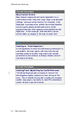
NOTE
Map Orientation Without GPS
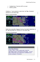
The map orientation will auto-switch from track-up
orientation to north-up orientation when GPS is lost.
Pilots who leave the map orientation in track-up during
shutdown may notice the map will start up in north-up
until a GPS position fix is available, at which time the
map will auto-switch to track-up.
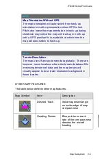
NOTE
Terrain Resolution
The map uses 9 arc-sec terrain data globally. There are
however, some locations where the terrain database fills
in missing terrain cell data and the map terrain will
visually appear to be a lower resolution background in
those locales.
OTHER MAP FEATURES
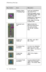
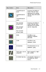
The table below defines other map features.
Map Symbol
Item
Description
Desired Track
Solid magenta triangle
on inside edge of map
compass rose
Heading Pointer
Blue pointer on each
side of the compass rose
denotes the aircraft
heading
Summary of Contents for IFD410 FMS/GPS
Page 1: ......
Page 8: ......
Page 56: ......
Page 100: ...IFD400 Series Pilot Guide 2 44 FMS Subsystem Info Tab Nearby Navaids ...
Page 160: ......
Page 250: ...IFD400 Series Pilot Guide 4 90 Aux Subsystem ADS B Unavailable Products Page ...
Page 252: ......
Page 378: ......

